
GIS Industry
Articles about trends and advancements in the geospatial industry.

Putting the Trees Back on the Map: How GIS is Helping Reforest South America
GIS is being used in creative ways – including covert spy tracking of illegal logging deep in the Amazon – to help put and keep trees back on South America’s map. The simplification of tools and availability of web systems has empowered technicians, NGOs, and governments alike to address corruption and illegal logging with transparent map-based monitoring.

GIS in Urban Planning
Frank Stafford, a graduate of Cambridge University with a background in Civil Engineering writes about why GIS is being used in Urban Planning.
Is the GIS Industry Splitting?
Matt Sheehan, from WebMapSolutions, shares some of the results from a survey asking, "is GIS splitting?"

Views From the 2014 Esri International User Conference: GIS In Imagery
Photographer Kristina Jacob shares moments she captured from the 2014 Esri International User Conference that was held in July in San Diego, California.
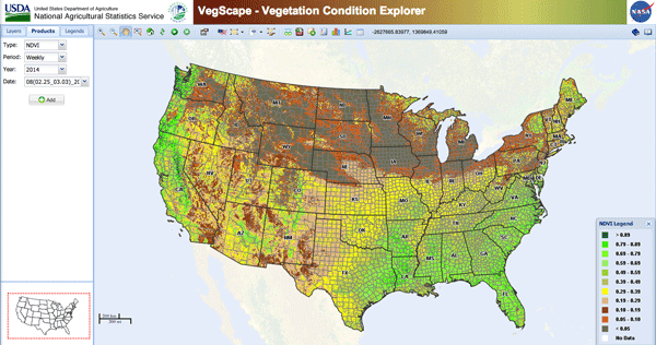
Use of GIS in Agriculture
By using GIS to map current (and potential) farmland scientists and farmers can work together to create more effective and efficient farming techniques.
Using Near-Infrared Aerial Imagery to Map Oak Trees
The GIS group for the City of Santa Clarita used 4-inch near-infrared aerial imagery to map specific oak tree species across the city.

Paleontology and GIS
Often, GIS is used to look at current trends and to predict future ones. GIS also has a use in ...
Geospatial Communities Back Court Decision in MAPPS Lawsuit
Last week, the U.S. District Court in Alexandria, Virginia, ruled against special interest groups that aimed to impose strict limitations ...

The World in a Box
This is an excellent video to show people who want to understand what GIS can do and how it affects them.

Dr. David M. Theobald Talks About His Career in GIS, Issues in GIS Education, and the Use of GIS for Conservation
Dr. David M. Theobald is a Scientist at the Natural Resource Ecology Laboratory at Colorado State University in Fort Collins, Colorado who has been working with GIS since the middle 1980s in the areas of planning, conservation GIS, and landscape ecology.