
Long before GIS, numerous maps of key events, infrastructure, and moments were critical to planners, historians, and others.
During World War II, the United Kingdom kept detailed accounts of nearly every bomb that landed on the city of London during the Blitz (1940-1941).[i]
While GIS offers a way to digitize these detailed historical records, it can also provide a new way to understand these old data. For instance, WebGIS of historical maps makes it easier to view other historical and archival data, including photographs, of places bombed so that not only does the map provide information about areas bombed but one can link the data with historical pictures.
Statistical calculations are also much easier to assess, including area damaged and concentration of where bombs fell, potentially providing insight into German war planning.
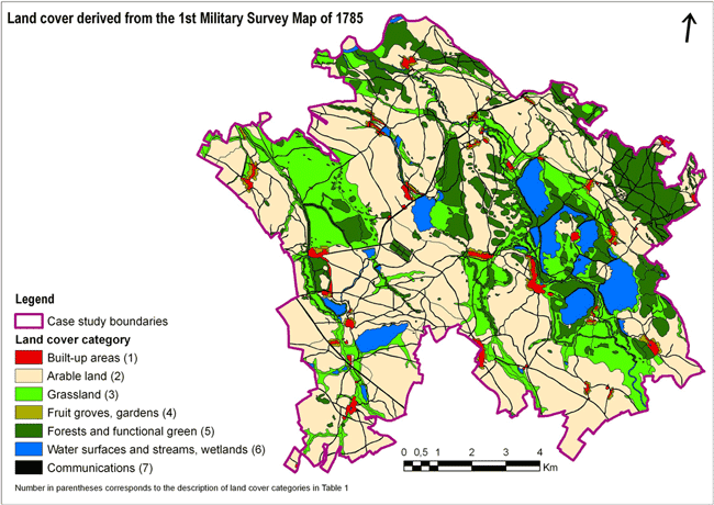
Applications of old map data include recreating how landscapes have changed and how areas have been used.[ii]
Not only does digitization and use of GIS aid historical understanding, but recreating and analyzing historical maps could play an important role for future planning as well. For instance, mapping of old infrastructure can be critical for planning where future infrastructure might be built, as there could be a need to know where old gas lines or even abandoned sewers might be located.
Conservationists and urban planners, in particular, have found such maps useful for development and making arguments on why certain development should be restricted by historical urban growth patterns.[iii]
Projects such as Open Historical Maps,[iv] the Historical GIS Research Network, [v] and Old Maps[vi] are trying to both archive and provide data useful for understanding the past but also planning and knowing about the present and future. These data provide valuable resources that, despite their age, will be of great value for future generations.
References
[i] For more on the Blitz and mapping, see: http://bombsight.org
[ii] For more on this project and understating historical change, see: Šantrůčková, M., Dostálek, J. & Demková, K. (2015) Assessing long-term spatial changes of natural habitats using old maps and archival sources: a case study from Central Europe. Biodiversity and Conservation. [Online] 24 (8), 1899–1916. Available from: doi:10.1007/s10531-015-0912-x.
[iii] As an example of the use of historical maps to understand development, see: Skaloš, J., Weber, M., Lipský, Z., Trpáková, I., et al. (2011) Using old military survey maps and orthophotograph maps to analyse long-term land cover changes – Case study (Czech Republic). Applied Geography. [Online] 31 (2), 426–438.
[iv] For more on Open Historical Maps, see: http://wiki.openstreetmap.org/wiki/Open_Historical_Map/Projects
[v] For more on the Historical GIS Research Network, see: http://www.hgis.org.uk/resources.htm
[vi] For more on Old Maps, see: https://www.old-maps.co.uk/