
Maps have played a central role in territorial disputes for centuries. In recent periods, the rise of digital mapmaking and GIS specifically have at times complicated conflicts or gave alternative forms of settlement for disputes.
Using GIS to Map Territories
One aspect of mapping using digital tools and GIS is that content now can be more easily varied or serve the interests of different actors using GIS layers, giving rise to many different voices in a conflict.
This can serve to even complicate territorial disputes, as many voices might have to be present in any resolution. A recent study of the use of GIS in different land use planning disputes has shown that GIS has increased the frequency of disputes between groups and has required more complex dispute resolution approaches in resolving these issues because there are now more stakeholders to consider and different perspectives.[1]
GIS and digital tools have also played a positive role in major recent disputes. Disputes over territory could be resolved more virtually using a variety of such tools.
In the Daytona Accords negotiations that helped to end conflict in the former Yugoslavia, a 3D visualization tool that combined satellite and other imagery, called PowerScene, was used by the US delegation to indicate that a corridor should be given to Gorazde, a largely Muslim town, so as to avoid future disputes in that area.[2]
Removing bias from GIS analysis of border disputes
The perception has been that the use of GIS might be a relatively unbiased way at looking at disputes. However, GIS likely makes it easier for multiple sides to alter reality in conflict and may make it more difficult to determine exact circumstances.

Selection bias and measurement validity become important issues to measure in the creation of maps that best represent disputes. For measurement validity, this can be overcome by only providing datasets that are easily measurable or can be empirically observed.
For selection bias, analytical solutions could be used in place of empirical or spatial locations of borders. In this case, the analysis can be done or assessed without certain knowledge of where borders are.
If bias is found, then that data are removed irrespective of the border locations that could be represented by an analytical set. This can be done using raster representation of borders, for instance.[3]
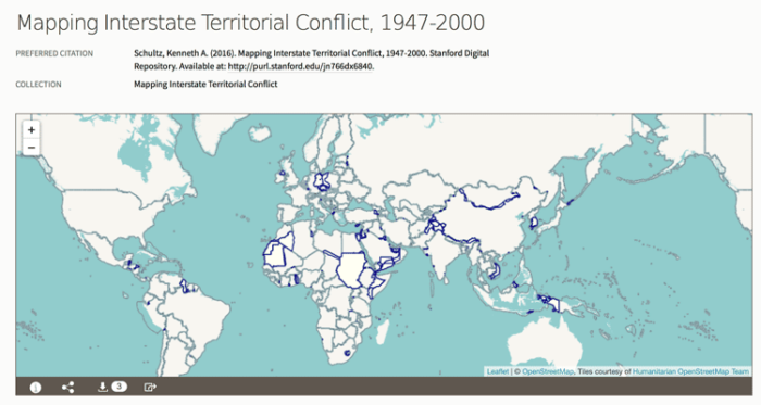
While biases in data are apparent with the use of GIS, one benefit of GIS is that it can also dispel longstanding myths about disputes. In an analysis of territorial disputes between states from 1947-2000, it was shown that areas where there are oil deposits often do not have oil as the main reason for creating disputes.
Rather, GIS and fine-scale analysis made it possible to indicate that territorial changes and disputes generally occurred in areas outside of such major resources. In effect, territorial disputes often has other underlying reasons, including historical factors.[4]

Mapping Tools for Tracking Disputes
Tools have also been developed to track disputes across time and space.
One such tool is GeoEPR, or a geocoded version of the Ethnic Power Relations. The tool provides different coding for conflicts spanning 1946 and later.
The focus is on groups of people involved in these disputes, rather than trying to be representational of all possible groups. This makes the wide possibilities of data represented in the tool more minimized, helping to address the sometimes confusing nature of dispute mapping, where too many actors might be included.
Major changes are also recorded as data are encoded through time, where group values and map data change. [5]
Territorial disputes and mapping have had a close relationship long before GIS emerged. However, what is different now is that we see GIS also affecting outcomes and dispute resolution.
Understanding space and the fact GIS gives voice to many parties has reshaped territorial disputes and potentially how they can be resolved.
References
[1] For more on issues that GIS may create in territorial conflicts, see: Dawwas, E. (2014). The evolution of GIS as a land use planning conflict resolution tool: A chronological approach. American Journal of Geographic Information Systems, 3(1), 38-44.
[2] For more on the use of spatial and digital tools for conflicts and conflict resolution, see: Branch, J. (2017). Territorial Conflict in the Digital Age: Mapping Technologies and Negotiation. International Studies Quarterly, 61(3), 557–569.
[3] For more on ways to resolve problems in using GIS and spatial tools in territorial conflict, see: Branch, J. (2016). Geographic Information Systems (GIS) in International Relations. International Organization, 70(4), 845–869.
[4] For more on how GIS can be used to assess the role of natural resources in conflict, see: Schultz, K. A. (2017). Mapping Interstate Territorial Conflict: A New Data Set and Applications. Journal of Conflict Resolution, 61(7), 1565–1590. https://doi.org/10.1177/0022002715620470
[5] For more on territorial conflicts and GIS using GeoEPR, see: Wucherpfennig, J., Weidmann, N. B., Girardin, L., Cederman, L.-E., & Wimmer, A. (2011). Politically Relevant Ethnic Groups across Space and Time: Introducing the GeoEPR Dataset. Conflict Management and Peace Science, 28(5), 423–437.
See Also
- The Politics of Google’s Mapping
- Rivers as borders