
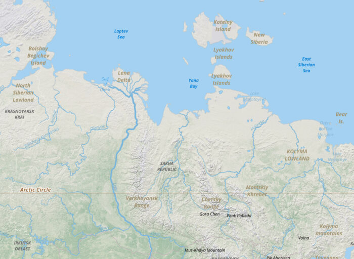
One of the longest rivers in the world, the Lena River originates in the Baikal Mountains of south-central Russia. From there, the Lena River winds 2,800 miles (4,400 kilometers) through northeastern Siberia before emptying in the Laptev Sea.
Formation of the Lena Delta
The Lena Delta is formed by sediment from the Lena River and the roughly 500 tributaries that meet the river along the way. The Lena Delta is the largest delta in the Arctic.
The Lena River Delta stretches out 60 miles (100 kilometers) into the Laptev Sea and is 250 miles (400 kilometers) wide. More than 20 million metric tons of suspended silt and roughly 550 cubic kilometers (130 cubic miles) of freshwater are discharged into the Laptev Sea annually by the river [1].
Shaded Relief Mapping of the Lena Delta

Summer thaw in the Lena Delta
For seven months of the year, the Lena Delta is frozen due to its far northern location. During the short summer season, the delta thaws and becomes a wetland.
Formation of Lakes and Ponds
The thawing produces hundreds of ponds and lakes that dot the delta. These waters are shallow as the depth of the ground thaw is limited to about 8-16 inches (20-40 centimeters) deep. The underlying permfrost helps to keep the lakes and ponds from draining during the summer.

Ecological Importance: The Lena Delta Reserve
The Lena Delta Reserve is Russia’s largest designated wilderness area. Many Siberian wildlife use it as a nesting place and refuge. This reserve plays a crucial role in conserving the region’s biodiversity, providing habitat for numerous bird species, including endangered ones. The delta is also home to various mammals, fish, and plant species adapted to the harsh Arctic environment.
The Vital Role of the Lena River and Delta
The Lena River and its expansive delta are vital components of the Arctic ecosystem. The river’s journey from the Baikal Mountains to the Laptev Sea supports a diverse range of wildlife and plays a significant role in the region’s hydrology. Understanding and preserving this unique environment is crucial for maintaining the ecological balance in the Arctic.
References
[1] Pratt, S. E. (2022, July 13). Lena river sedimentation. NASA Earth Observatory. https://earthobservatory.nasa.gov/images/150076/lena-river-sedimentation
[2] Lena river delta, Russia. (2007, January 25). NASA Earth Observatory. https://earthobservatory.nasa.gov/images/7343/lena-river-delta-russia