
conservation biology

Wildlife Conservation in the Face of Climate Change: The Importance of Protected Areas
Protected areas are important for providing refuge to amphibians and reptiles impacted by climate change.

Introduction to Wildlife Corridors
Wildlife corridors are overpasses and underpasses that connect natural regions and provide safe transit for migratory animals through human infrastructure.

Are Safaris the Best Answer for Elephant Conservation?
Tourism can be a great conservation tool as long as it is monitored closely.

Mapping the Last Wilderness
An international group of scientists led by James E. M. Watson and James R. Allan mapped the world’s remaining terrestrial wilderness in 2016.

UAVs, GIS, and Ecology
With the relatively cheap price and increasing effectiveness of unmanned aerial vehicles (UAVs), often called drones, we are seeing much more accurate estimates and understanding of ecological change.

Using GIS to Conserve the Greater Sage-Grouse
GIS has emerged as an essential analysis and communication tool for the Oregon BLM in general, and its sage-grouse conservation efforts.

Restoring a Salt Marsh
The San Francisco Bay was once connected to a large salt marsh that contained many different and rare species of plants and animals. Conservationists are now restoring the salt marsh.
Researchers: Satellite Imagery Could Boost Wildlife Conservation
An increased number of scientists, conservationists and technology scions are banding together to use their various strengths to benefit conservation efforts to track global biodiversity.

Are Ecosystems That are Rich in Biodiversity More Resilient to Diseases?
An ecosystem that is rich in biodiversity is stronger and more resilient to diseases, a recent series of studies has shown.
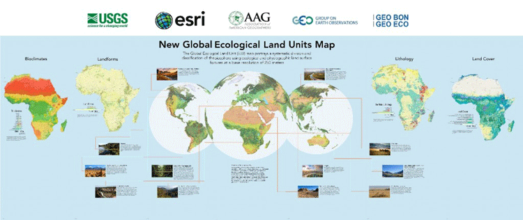
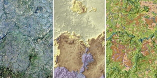
Global Ecological Land Units Map
Esri and the United States Geological Survey (USGS) have developed the highest spatial resolution ecological land units (ELUs) map of the world commissioned by the intergovernmental Group on Earth Observations (GEO).

How GIS is Being Used in Conservation Biology
GIS has a central role in analyzing the geographic distribution of endangered species, in measuring and monitoring biodiversity, and in identifying priorities for conservation management.

Saving Leatherback Turtles through Maps
Finding a balance between the needs of humans with those of the natural environment has always been a challenge. There ...

GIS and Natural Resource Management
Peter Rodericks Oisebe, a Natural Resource Management Consultant in Kenya writes about the applications of GIS in mapping and managing natural areas.
Conservation Biology and GIS
Conservation biologists have come to recognize the importance of GIS in their discipline. Geographic Information Systems (GIS) have become a ...

Monitoring Conservation Easements and Preserve Lands with GPS and GIS Technology
Trimble discusses how they use GPS and GIS technologies to effectively manage and map over 8,000 acres of conservation land.

How Space and Time Affect Conservation Biology
Time and space are two extremely important concepts that are central to formulating theories and models in biotic conservation.