

- GNSS has developed as the global standard for navigation
- GNSS is evolving to use multiple signals and constellations of satellites
- GNSS promises in the near future to improve location accuracy, enabling new consumer and industry possibilities
The Global Navigation Satellite System (GNSS) is what has emerged as the standard navigation system that provides global positioning for devices we use every day, such as smartphones and other location receivers (e.g., GPS devices). The system incorporates GPS, GLONASS, Galileo, Beidou, and other regional systems as part of the standard and, in fact, allows interchangeable use of these location services, providing multi-signal potential for receivers.
Not only for location, but GNSS provides positioning, navigation and timing (PNT) that helps keep a precise timestamp, which is used to help synchronize networks such as in telecommunications, energy, and financial services.
In a recent Geospatial podcast, how the system has evolved and its future are discussed.
Currently, there are more than 100 satellites that make up the GNSS system, which incudes the varied systems created by different countries such as GPS in the United States. In the past GPS was the main system, but that had limitations in that few satellites provided location data, minimizing accuracy for users.
Current systems have now become interchangeable with navigation signals as most use the same signal standards, thanks in large part to the GNSS which has facilitated this process benefiting all global users. In a standard location service, you generally need three satellites and a fourth to synchronize the receiver. The receiver calculates the location looking at distance and time from the satellites based on the signal received.
In the early days, when GPS was the main system, location data also meant that places such as dense urban environments did not allow good location signals, minimizing navigation tools in such places. Now, even as users go to zones where previously signals were hard to receive, such areas now are likely to get better signal coverage to enable location because of the interchangeability of satellite systems and greater number of multi-constellation satellites orbiting the Earth.
Receivers are able to use multiple frequencies and this enables the multi-system interoperation using the GNSS standard. Without noticing, one can be using the US GPS system, but then change to the GLONASS system, for instance.
With more systems and signals, error has now reduced even for basic navigation receivers. Today, even smartphones are within a few meters of the true location in most places.[1]
One limitation is that satellites are pre-programmed for frequency broadcast, meaning that we cannot change the frequencies once the systems are launched into orbit. However, by creating location receivers that better operate with multiple frequencies we can then take advantage of what currently exists, even older satellites.

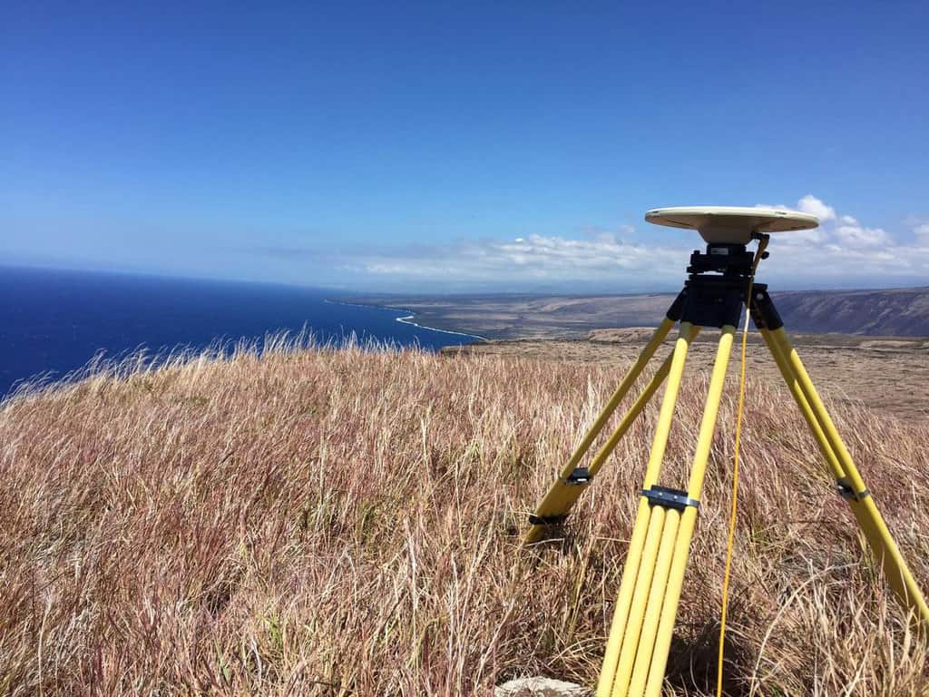
One task for the European GNSS Agency is to monitor use and assess the market and operation of GNSS. There are three main categories of users, which can be characterized as high volume, that is the mass market such as smartphone users, safety critical devices, that is devices that constantly need location data and are important for public safety, and high accuracy users who generally use signals for detailed mapping, requiring accuracy down to centimetre or millimetre scale.
For the mass market, they have already benefited from the switch to using multiple constellations and signals. For the safety critical devices, the change has been slower, as these devices have more regulation that needs to approve changes, but even here we are seeing adoption of multi-constellation and multi-frequency devices. What is apparent is the mass market devices are catching up to even the high accuracy devices that are generally far more expensive.[2]
Improving GPS Accuracy for Smartphone Users
In the coming years, we can expect centimetres-scale accuracy even for the mass market devices such as smartphones. Projects such as Galileo will enable this to be possible for many users.[3]
For some specialized users, it might be not necessary to use the high accuracy devices which are usually far more expensive. Effectively, having a smartphone could enable even some very accurate mapping, while devices such as UAVs and autonomous vehicles also begin to adopt improved GNSS signals from multiple frequencies.
Safety is still a critical focus, particularly maintaining a secured signal that is not hacked or disrupted in anyway. Opensignal navigation services are already providing authentication services to prevent spoofing or jamming, which can send false signals or interfere the location GNSS signal. This is critical for safety and financial services that use GPS, as they need to maintain authentic signals at all times.
While receivers have been now increasingly adapted to deal with the multiple signals used by the satellite constellations, design of future satellites is now evolving as multi-signal location services become more common. In fact, it is not just satellite-based systems but ground-based networks are also increasingly used to improve systems and work with navigation devices.
This helps when going through difficult locations such as tunnels. While some have stated cameras, particularly as they use sophisticated computer vision techniques to derive accurate location data, and other sensors could replace GNSS, the reality is that GNSS is a safe standard that provides accurate absolute location. In fact, even other satellites depend on GNSS to maintain accurate location. Nevertheless, we can expect that GNSS may begin to work more with relative systems in a type of hybridization approach.
For high accuracy systems, improved GNSS services could mean devices become much cheaper, as smaller devices begin to be able to provide accuracy at levels that detailed mapping can be done. Even new markets become possible, as mass produced high accuracy GNSS becomes a reality, then industries such as autonomous vehicles, financial services, and others we have yet to envision could dramatically benefit and begin to use cheap GNSS receivers.
In the near future, GNSS and other location services will not only be working together but positioning will be even more accurate than current capabilities. This will enable better mapping and navigation capabilities on devices that require high accuracy. With greater accuracy and more signals, mass market navigation receivers will even be nearly or as accurate as current high accuracy devices such as Differential GPS (DGPS). This could open up industries and consumer possibilities we have not even envisioned.
References
[1] For more on GNSS, see: Grewal, M.S., Andrews, A.P., Bartone, C., 2020. Global navigation satellite systems, inertial navigation, and integration, Fourth Edition. ed. Wiley, Hoboken.
Disclaimer: GIS Lounge is a participant in the Amazon Services LLC Associates Program, an affiliate advertising program designed to provide a means for sites to earn advertising fees by advertising and linking to amazon.com.
[2] For more on devices that use GNSS, see: Advanced GNSS Tropospheric Products for Monitoring Severe Weather Events and Climate COST Action ES1206 Final Action Dissemination Report, 2020. (Buy: Amazon affiliate link)
[3] For more on Galileo, see: https://www.esa.int/Applications/Navigation/Galileo/What_is_Galileo.