
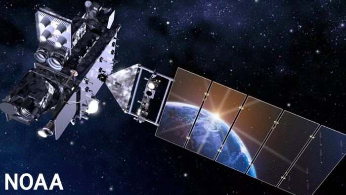
The most recent Geostationary Operational Environmental Satellite (GOES) satellite was launched on March 1, 2022 on an Atlas V rocket. Launched as GOES-T, the satellite was renamed GOES-18 on March 14 once it reached full orbit.
The GOES program has been operational since 1975 and the latest satellite represents a continued collaboration between NASA and National Oceanic and Atmospheric Administration (NOAA) to monitor weather, particularly in the United States and the rest of North America.
The latest GOES satellites can be applied in areas that go well beyond weather monitoring.
The GOES satellite program is perhaps the most recognizable satellite program in the US, given that GOES-16 and GOES-17 satellites provide most of the weather forecasts used by news and other media outlets today. The GOES-16 operates on the East Coast, while the GOES-17 is a West Coast satellite, where the two combined systems collect weather data across the US.

Monitoring Weather Systems Over the Pacific Ocean
The new GOES-18 (GOES-T) satellite is now placed to the west in the Pacific to monitor weather systems as they develop over the Pacific. The satellite is equipped with a new magnetometer that the current satellites do not have, giving it more accurate measurement of weather systems that will also aid in weather predictions.
The plan is the new GOES-T satellite will also replace GOES-17 on the West Coast in 2023 as the GOES-17 is shifted to the central US and will serve as a backup on-orbit satellite.[1]
Advanced Imagery and Magnetometer Measurements
The current versions of the GOES satellites are called the GOES-R series, which include GOES-16-18, which have advanced imagery and magnetometer measurements. The data provide real-time mapping of lightning and monitoring of space weather as well as weather across the US.
Filters within the satellite allow solar glare to be removed, which allows the observation of atomic oxygen even during daytime conditions.
The GOES-T satellite orbits at 22,300 miles (35,900 kilometers) above the Earth’s surface.
For the next few months, until about May, the satellite will undergo testing. The first images from GOES-T are expected in May.
Once fully operational, key data to be transmitted will include not only weather systems as they develop across the Pacific but also wildfires from Alaska to Hawaii and the western US.
With increasing wildfires and the recognition that many powerful storms develop in the Pacific, the GOES-T (18) satellite is seen as a crucial next step in improving forecasts and monitoring of rapidly changing climate conditions in much of the US. A new feature will also be the ability to monitor smoke drifts, which affects health and pollution levels in regions not directly affected by wildfires.
While the focus will be weather across the western US, the GOES-T also can be used to monitor solar storms that can affect other satellites and even power grids.
Improved Imaging of the Earth and Space
The Advanced Baseline Imager (ABI) instrument, which monitors visible to infrared wavelengths, is capable of providing four times the spatial resolution and five times faster coverage than previous imagers. The entire disc spanning the Earth can be imaged every 10 minutes. Improvements from previous GOES-R satellites include a radiator that improves thermal control and new electronics that improve the lightning mapper and propulsion.[2]
The GOES-R satellites are among NASA’s most sophisticated Earth observing satellites with dual capabilities in monitoring parts of space and Earth, including weather.
In addition to the ABI, the Geostationary Lightning Mapper (GLM) provides a near-infrared optical transient detector used to detect lighting and even tornadoes.
The Sun Pointing Platform (SPP) is a platform that provides seasonal and daily tracking of the Sun in relation to the spacecraft. Instruments include Extreme Ultraviolet and X-ray Irradiance Sensors (EXIS) that monitor solar irradiance and the Sun’s electromagentic raditiation.
The Solar Ultraviolet Imager (SUVI) is a type of telescope that monitors the Sun using the extreme ultraviolet wavelength range, providing a full Sun disc imaging capability at any time. Additionally, the Space Environment In-Situ Suite (SEISS) provides four sensors monitoring proton, electron, and heavy ion fluxes in the magnetosphere. This is important in mitigating damage to radio communication from high fluxes in these subatomic particles.[3]
Improving Earth Observation Data
The benefits of the GOES-T satellite will be felt not only by scientists but also the wider public. Weather forecasts, particularly dangerous storm systems and wildfires, could be better monitored and predicted. Important telecommunications equipment will also be protected from solar radiation. People should be able to have more advanced warning as weather systems develop, including even before wildfires fully form or produce dangerous smoke conditions.
Such satellites reflect NASA’s increasing focus on not only expanding exploration beyond Earth but improving our lives on an increasingly changing planet that will face greater challenges in keeping people safe.[4]
Read next: Remote Sensing of Lightning
References
[1] For more information and background to the GOES program, see: https://www.inverse.com/science/goes-t.
[2] A summary of key improvements and specifics on the GOES-T satellite can be found here: https://www.space.com/goes-t-noaa-weather-satellite-launch.
[3] Information on the GOES-R series instrumentation can be found here: https://www.goes-r.gov/spacesegment/instruments.html.
[4] For more on the benefits of GOES-T, see: Prescod-Weinstein, C. Do Look Down. New Scientist 2022, 253, 28, doi:10.1016/S0262-4079(22)00287-1.