
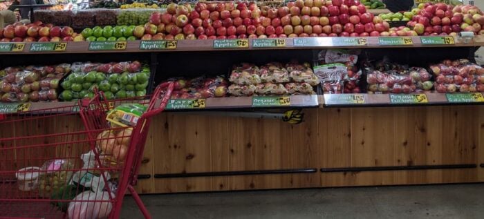
The recent COVID-19 pandemic has highlighted that global food supply chains are vulnerable to disruption, potentially causing food shortages in many regions. Food supply chains depend on a large web that connects producers and distributors at a global scale.
A variety of geospatial data and ‘Big Data’ approaches are now being used to help anticipate possible problems to supply chains before it is too late.
Supply chains are affected by worker sickness, slower deliveries, and delays caused at borders. Geospatial and Big Data firms such as Orbital Insight are using and combining satellite data, cellphone geolocation data, and UAV data to track total shipments to ports and distribution.
The idea is to see if significant bottlenecks, closures, or lack of distribution are affecting critical movement of food to stores and anticipate where problems might be occurring before disruptions have very negative consequences in the entire supply chain.[1]

Even before the COVID-19 pandemic spread, there were calls to further adopt digital and geospatial tools to assist with better monitoring of global supply chains, including in food.
For instance, advancements in the internet of things (IoT), blockchain, and big data applications are seen as assisting in real-time or near real-time monitoring of supply chains, where rapid data capture and analysis through artificial intelligence could help identify where supply chain disruptions may cause large-scale problems without having to depend on information being sent by any one company or individual. In effect, a digital supply chain has been one area that researchers have increasingly called for to help prevent major disruption or even food shortages from happening.
The idea with these new technologies is that supply chains become more descriptive, predictive, and prescriptive. In other words, more useful information can be obtained from automated data capture, which helps predict or forecast what may happen next as the data are sent to analytical tools, and information on how to address shortcomings in the supply chains can be made quickly in analyses. Whether hand-held scanners or cameras are used, these data should be sent in an automated fashion and be combined with other information as needed to make assessments of the overall supply chain.[2]
Integrating IoT into Assessing Food Supply Chains
One area that is particularly likely to aid further disruptions in global supply chains is the automated integration of IoT into small-scale and large-scale assessments of when food items and supplies reach given area. The potential of IoT is that as supplies are handled by distributors or dispatched, information is automatically sent over the network and real-time analytics can determine if the level of supply is likely to cause problems or may need changing to meet demand.

Devices that use IoT can range to many different items, which is why many see this as a great potential for better data capture. Satellite data can help track shipments from more macro-level views, such as monitoring ports and ships coming into harbors, but the total volume of supply may be under- or over-estimated simply relying on satellite data. Forecast models are potentially better updated using real-time IoT updates, although shipping information from satellite monitoring could potentially act as a type of early warning that shipping is either lower or higher than normal, baseline levels.[3]
Using Geospatial Technologies to Protect Global Food Supplies
Recently, the FAO has outlined guidelines in protecting global food supplies under the current COVID-19 crisis. One of the key areas they highlighted is the need to monitor and be aware of potential bottlenecks that could be created in supply chains, including when workers are sick or other disruptions happening that have macro-effects on the food supply network.
This is precisely where forecasting tools that use real-time data tracking information, including from IoT and other geospatial sources, could help address, where bottlenecks that record speed of supply transfer and volume at different distribution points could be critical in identifying where disruptions could be most severe.
The current crisis may help now to highlight the need for more rapid adoption of better monitoring tools.[4]
Recent events have highlighted the potential vulnerability of global food supply chains. So far, most supply chains have held up and are responsive, although disruptions have been apparent and short-term shortages became evident in places.
These events highlight the need to improve food supply tracking. Satellite and aerial data are valuable in this process, but other technologies may need to be combined, including IoT and blockchain, which are technologies that are more responsive to real-time events and can be used to measure volume and timing of supplies passing ports and distribution points. Such data can be transmitted to forecasting tools that identify weaknesses in the supply chain before they potentially become major problems.
For now, most food supply chains have not taken advantage of these new technologies but the current crisis may highlight the need for more rapid adoption.
References
[1] For a recent story on how geospatial data are being used to track food supply chains, see: https://www.bloomberg.com/news/articles/2020-04-12/satellites-are-helping-to-track-food-supplies-in-era-of-virus.
[2] For more on how supply chains could become more sustainable and able to respond to disruptions using new digital tools, see: Kamble, S.S., Gunasekaran, A., Gawankar, S.A., 2020. Achieving sustainable performance in a data-driven agriculture supply chain: A review for research and applications. International Journal of Production Economics 219, 179–194. https://doi.org/10.1016/j.ijpe.2019.05.022.
[3] For more on the use of IoT in forecasting and modeling food supply chains, see: Kamble, S.S., Gunasekaran, A., Parekh, H., Joshi, S., 2019. Modeling the internet of things adoption barriers in food retail supply chains. Journal of Retailing and Consumer Services 48, 154–168. https://doi.org/10.1016/j.jretconser.2019.02.020.
[4] For more on the FAO report on food supply chains, see: COVID-19 and the risk to food supply chains: how to respond, 2020. FAO. https://doi.org/10.4060/ca8388en.
Related
- Spatial Analysis of Inflation and the Impact of the Pandemic
- Mapping Outreach Services for Those in Need
- FAO Uses GIS to Protect Agricultural Economy of Vulnerable Countries
- Geospatial Data and Sustainable Development Goals