
For decades, scientists have been attempting to map the ocean’s floor, particularly since World War II with the advent of sonar and electronics that facilitate deep oceanic mapping. While early efforts to map the oceans did produce some coarse maps that are still used today, recent advancements make it possible to now map the ocean floor in far more detail. (Related: Marie Tharp and Mapping the Ocean)
In 2017, the United Nations launched the United Nations Ocean Conference that challenged countries to map the ocean floor. At that time, only about 6% of the oceanic floor was mapped globally. Today, that number has increased to about 20%, which shows great progress but still far from what is needed for many scientists.[1] In 2015, the First World Ocean Assessment revealed how the ocean not only plays an important role for the entire planet, including its climate and its support for life, but those systems that are critical are also under great threat.[2] Mapping the ocean has become a key environmental goal because of the fragility of the ocean, such as how acidification and biodiversity loss are affecting our ocean, and that extent and effect of the damage may be unknown unless we can create more detailed ocean floor maps.

Ocean Floor Mapping Technologies
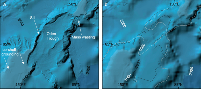
Today, technologies used to create detailed ocean floor, or seabed, maps include multi-beam echosounder. This is a type of sonar that can be attached to a ship’s hulls and it returns sound waves that bounce from the seabed. The information that bounces from the seabed also provides directional details, which can be reconstructed to produce layered levels of depth, enabling more detail with each scan at different levels. The three-dimensional data also allow one to collect information about salinity and temperature, giving some environmental detail to different depth levels of the ocean and seabed.[3] Such data allow us to also know more about the health of the ocean as planetary change is occurring. However, because data are collected through attachments made to ocean-going vessels, the work is very slow. In fact, outside of coastlines and well-traveled shipping lanes, the seabed is still largely unknown outside of small areas.
The Nippon Foundation, in Japan, Seabed 2030 is funding a large part of this effort, as Japan has great interest in producing detailed seafloor maps due to the island nation’s dependence on the ocean for its prosperity.[4] The country could better prepare for disasters, such as a tsunami or a typhoon, while improving its fishing practices by having more detailed knowledge of the seafloor. Key institutions taking part have so far been the Alfred Wegener Institute in Germany, which has focused on southern ocean regions, while Stockholm University and the University of New Hampshire having been focusing on the North Pacific and Arctic. New Zealand’s National Institute of Water and Atmospheric Research having been investigating areas that include the South and West Pacific. Much of the Atlantic and Indian Oceans have been a focus by the Lamont-Doherty Earth Observatory at Columbia University. Mapping data are being compiled and produced at the British Oceanographic Data Centre in Southampton. The data are released to the public for free under the General Bathymetric Chart of the Oceans (Gebco).[5]

The mapping project has gained attention not only from scientists but also companies interested in the data, such as fiber optic cable companies planning to put cables across the ocean to facilitate global data transfers and connections. Scientists have been using the data to look at how oceanic change due to global warming is also causing changes to the seabed and how that influences sea level change. Mining companies that want to search for minerals have also shown interest, although some may find it counter-productive for mining companies to use data from a project seeking to improve the environmental health of the ocean. The challenge is now to map as much as possible by 2030, when the challenge is set to expire.
Mapping the oceans at the level of the seabed is a grand challenge that may turn out to be critical for our efforts in improving our planet’s environmental health. So far, efforts have made a dent, as now about 20% is known, but large areas are still unmapped and the next decade will be critical if we are to produce detailed maps that can potentially be used to improve our environmental efforts and limit damage created to the seabed and our planet.
References
[1] For more on a recent story about this challenge, see: https://www.theguardian.com/environment/2020/jun/30/earths-final-frontier-the-global-race-to-map-the-entire-ocean-floor?CMP=share_btn_tw.
[2] For more on the findings of the First World Ocean Assessment, see: https://www.un.org/regularprocess/content/first-world-ocean-assessment.
[3] For more on how multi-bean echosounder’s data are used to map the seabed, see: Simons, D. G., & Snellen, M. (2009). A Bayesian approach to seafloor classification using multi-beam echo-sounder backscatter data. Applied Acoustics, 70(10), 1258–1268. https://doi.org/10.1016/j.apacoust.2008.07.013.
[4] For more on the Nippon Foundation Seabed 2030 and its efforts, see: https://seabed2030.gebco.net/.
[5] For information on Gebco data, see: https://www.gebco.net/data_and_products/gridded_bathymetry_data/gebco_2019/gebco_2019_info.html.