
With the discovery of sonar and its expanded use in World War II, mapping the ocean floors became feasible. Acoustic and imaging techniques have also become multifaceted and more sophisticated in recent decades. Today, seafloor mapping is essentially a form of remote sensing that uses similar concepts and applications to satellite-based systems, albeit adapted to the complex environment of the oceans.
Mapping seafloor habitats has particularly benefited from seafloor mapping techniques, as habitats could become sensitive to threats or change due to natural or human-induced factors. Techniques related to segmenting, classifying and different acoustic data with biological groundtruthing or surveys of the seafloor. Supervised and unsupervised classification is also typically used. Data can be obtained from multi-beam echo sounders, sonar, and acoustic ground discrimination systems applied in order to create high resolution maps of changing seabed environments.[1]
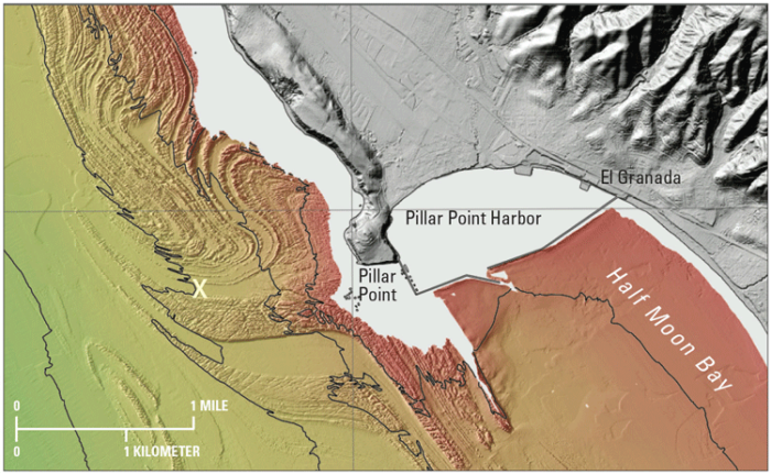
California Seafloor and Costal Mapping Program
One large project currently underway that is producing highly detailed seafloor maps is the California Seafloor and Costal Mapping Program and has led to the creation one of the largest seafloor datasets. Data include bathymetric, geologic, and habitat maps.[2] Even new satellites such as WorldView 2 are able to be used to map coastal bathymetry, as new channels available mean that seafloor features are visible. However, these are still limited as to the parts of the ocean floors that can be adequately mapped.[3]

New Sonar Techniques
The Scripps Institution of Oceanography, in general, has been developing new sonar techniques, such as down-looking and side-looking sonar, that gives broader and deeper coverage; the high frequency also gives much more detail than traditional sonar. Such new techniques have helped to reveal new details such as along the Mid-Atlantic Ridge, showing how North America and Europe continue to further pull apart.[4] Resolution for new sonar instruments is now able to go down to a few centimeters (3-5 cm). New technologies have also included autonomous robot submarines that can capture and even process data. Rather than use only sonar or other related forms of data gathering, hyperspectral imagery, at resolutions up to 30 cm in cases, is also gathered from such vehicles that can go to depths that are typically dangerous for manned missions.[5]

Mapping the Complex Seafloor
In addition to marine studies, other applications are evident. The disappearance of flight MH370 in the Indian Ocean caused global headlines. In the search for the plane a large area of the Indian Ocean was mapped using high-resolution multibeam echosounder that provided high detailed data of the ocean floor. Although the aircrafts final resting place have yet to be located, the results of this effort showed a much more rugged ocean and seamount numbers are far greater than previously believed. What such data show is that the seafloor is very complex, often hiding very tall mountains that suggest a complex geology.[6]
Mapping Ice Gouges
One application of GIS techniques with seafloor mapping is in mapping ice gouges. In this case, using high-resolution multibeam echo sounder, continuous field maps can be created using interpolation that allow depth and continuity of gouges to be visualized and analyzed more easily. This could be crucial for underwater exploration or understanding how such gouges may change or be affected by various phenomena.[7]
What new technologies demonstrate is improvement in sonar-based methods along with the use of imagery and unmanned submarines that can acquire data in some of the deepest parts of the oceans. High resolution results are beginning to transform our understanding of the oceans and, for the first time, we have a detailed understanding of the complex geology and marine life in arguably Earth’s last frontier.
References
[1] For more on seafloor mapping in monitoring habitats using acoustic techniques and remote sensing methods, see: Brown, C.J., Smith, S.J., Lawton, P. & Anderson, J.T. (2011) Benthic habitat mapping: A review of progress towards improved understanding of the spatial ecology of the seafloor using acoustic techniques. Estuarine, Coastal and Shelf Science. [Online] 92 (3), 502–520.
[2] For more on the California mapping project, see: Johnson, S.Y., Cochrane, G.R., Golden, N.E., Dartnell, P., et al. (2017) The California Seafloor and Coastal Mapping Program – Providing science and geospatial data for California’s State Waters. Ocean & Coastal Management. [Online] 140, 88–104.
[3] For more on seafloor mapping using WorldView 2, see: Eugenio, F., Marcello, J. & Martin, J. (2015) High-Resolution Maps of Bathymetry and Benthic Habitats in Shallow-Water Environments Using Multispectral Remote Sensing Imagery. IEEE Transactions on Geoscience and Remote Sensing. [Online] 53 (7), 3539–3549.
[4] For more on technologies used to map the ocean floor, see: Karson, J.A. (2015) Discovering the deep: a photographic atlas of the seafloor and ocean crust. Cambridge, Cambridge University Press.
[5] For more on unmanned submarines used for seafloor mapping, see: Bongiorno, D.L., Bryson, M., Bridge, T.C.L., Dansereau, D.G., et al. (2017) Coregistered Hyperspectral and Stereo Image Seafloor Mapping from an Autonomous Underwater Vehicle: Coregistered Hyperspectral and Stereo Image Seafloor Mapping. Journal of Field Robotics. [Online] Available from: doi:10.1002/rob.21713.
[6] For more on mapping results in the search for MH370, see: Picard, K., Brooke, B.P., Harris, P.T., Siwabessy, P.J.W., et al. (2018) Malaysia Airlines flight MH370 search data reveal geomorphology and seafloor processes in the remote southeast Indian Ocean. Marine Geology. [Online] 395, 301–319.
[7] For more on ice gouge mapping, see: Haneberg, W.C., Brumley, K. & Kucera, M.S. (2016) A GIS Approach to Quantitative Ice Gouge Depth Mapping, Analysis, and Prediction. In: [Online]. 2016 Offshore Technology Conference.