
ArcGIS Online
Articles about ArcGIS Online. ArcGIS Online is Esri’s online GIS and web mapping solution where users can create, and share maps, scenes, apps, layers, analytics, and data.
How to Find the URL to an ArcGIS Online Web Map and Add it to QGIS
Learn how to find URLs for older feature and map servers hosted on ArcGIS Online so they can be added to QGIS.

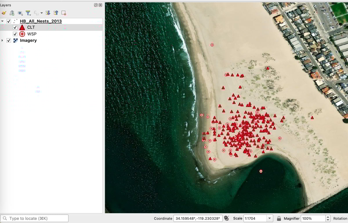
How to Add Data from ArcGIS Online to QGIS
Adding data from an ArGIS Online Map Service or Feature Service into a QGIS map project is fairly easy and quick in most instances.

Using ArcGIS Online to Manage Content
With the Item Report Dashboard from GEOACE, you can use out-of-the-box tools in ArcGIS Online to manage content within an organization.

Latest Release of ArcGIS Online Introduces New Features and Enhanced Capabilities
Bernard Szukalski, Esri tech evangelist and product strategist, introduces new features and enhancements to the latest release of ArcGIS Online.

A Story Map Journalism Experience
Eudel Cepero shares his experience developing a popular story map for Diario de Cuba using ArcGIS Online.

Adding “Early Voting Wait Time” Information to a Layer in ArcGIS.com
Tracy Garrison outlines an example of how a “County” might provide current early voting wait times to the public with ArcGIS.com and coding.

Streamline GIS Project Workflow with Online Recordkeeping
For efficient collaboration on a GIS project, document and catalog all work in an easily accessible location to overcome common challenges with diverse skill sets.

Keys to Successfully Managing GIS Data Health and Quality
Jennifer Kennedy, a GIS Analyst at Timmons Group discusses the importance of managing GIS data quality and some GIS solutions for managing GIS data and ensuring its integrity.
ArcGIS Explorer vs. ArcGIS Online: A Side by Side Comparison
Two of Esri’s principal GIS viewing products, ArcGIS Explorer Desktop and ArcGIS Online, offer a variety of tools for both business and personal use. Tracey Dash takes a look at some of the key differences between the two programs.

Add ArcGIS Online Maps to Your Wordpress Blog
A new plugin has just been released that gives those using Wordpress the ability to embed maps from ArcGIS Online ...
Excel Mapping with ArcGIS Online
Esri recently debuted the availability of Esri Maps for Office, a new component of its ArcGIS Online service that allows ...
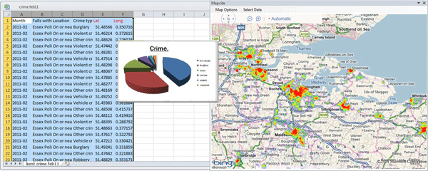
Making Maps With Excel
There is a huge amount of untapped geographic information stored within Microsoft Excel spreadsheets. With over one billion users of the popular spreadsheet software, that is a lot of data waiting to be mapped out. That said, the capability of mapping out that geographic data doesn't necessarily need to be done through an external desktop GIS software application. There are a few solutions on the market that provide both free and cost-based mapping solutions that operate directly within Excel.
Basemaps Defined
What is a basemap? The term basemap is see often in GIS and refers to a collection of GIS data ...