
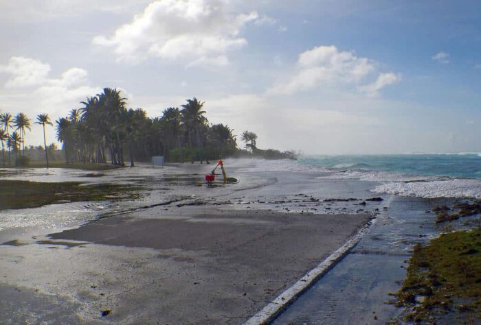
One result of climate change is increased flooding risks, including flash floods that can devastate communities. In fact, in the summer of 2021, devastating floods in Europe affected several countries with little advance warning, leading to many deaths and wide-scale property damage.
Now flooding risk mapping has taken increased importance with the rise in risks from flooding. The threats of flooding are even more severe for countries with poor records. New tools attempt to mitigate these risks and help communities better prepare for future flooding.
The Importance of Historical Flood Data
One of the problems with flooding is understanding its historical severity.
Having historical data allows one to better prepare for future events while estimating how extensive flooding, especially for those living in a floodplain, could be in any given region. Often, records to how high water levels reach, and the subsequent flood hazard, are not complete or up-to-date in some regions.
Few lessons are learned from singular events. If such data exist, often they are not digitized, making them of little value for modern analytical tools.
Globally, about 20% of countries have no flood maps of any record.

New Flood Mapping Tool
To address the need for flood maps, a new tool called World Flood Mapping Tool, created by the Institute of Water, Environment and Health at the United Nations University, promises to aid this data shortage and create flood maps even for countries without much data.[1]
The World Flood Mapping Tool is a collaboration with Google and Mapbox, where part of the outputs enable flood mapping data to be more easily downloaded.

Maps are built using Landsat satellite data, where data from different missions are used to recreate floods from 1985 to the present at 30 meters resolution.
Users simply find the location they are interested in and they can then search for significant flooding events for defined regions. The outputs then show where flood waters reached using past data.
Such data are estimated using image analytical techniques that use machine learning to classify water and flooding events. Users can also overlay data, including infrastructure or population density, to get a sense of how floods would potentially impact current communities.
Accurate Flood Mapping With Limited Data
Given the ability now to create flood maps in regions that have limited data, aid agencies have been rushing to use the tool, including those who work in vulnerable countries with poor data such as South Sudan and Afghanistan.
Stakeholders have also assisted with the model validation of the tool, that is the flood event estimates, where records and local knowledge have been used to validate estimates derived from the satellite data.

For example, in a 2017 flood in Bangladesh, the tool demonstrated it had about 83% accuracy, with overall mean accuracy estimated to be around 82% using other scenario examples from different regions.
While these accuracy results may not seem very high, they are a significant improvement relative to what was present previously in some countries. That is, results were better in some countries relative to the data availability.
The initial results show that researchers can improve results through incorporating machine learning techniques by adding more and better data to current models.[2]
Improved Methods and Technologies to Aid with Flood Preparedness
The Flood Mapping Tool is part of a trend in improving methods and technologies used to aid with flood preparedness.
For instance, tools now are using images taken of flood regions, including photographs, that can then estimate the depth in which past floods reached. These tools use deep neural network algorithms to determine potential depths that waters reach from photographs that have given reference points such as signs.
Such tools can then be used to potentially geolocate photographs and provide flood estimates across wider geographies, creating useful information such as estimated flood depths for regions that are also potentially data poor with regards to flood records.[3]
Other tools are also being created to not only estimate flood risk using old data, but the idea is to project future risk as well using estimated models under different climate scenarios. One such tool is Gestion et Analyse du Risque d’Inondation (GARI), which is being developed to enable flood potential risk under different climate scenarios for communities.[4]
What is clear is many tools are being developed as a response to the climate challenges we face in the near future. The recent 2021 United Nations Climate Change Conference, (COP26) climate conference has highlighted not only our threats but the enormous tasks that will be required to mitigate climate impacts.
Key to this mitigation strategy will be tools that enable communities to better adapt and understand the types of threats they face. Flooding is one of the greatest threats faced by communities, particularly as the majority of the global population lives near major water bodies.
Tools will increasingly need to utilize historical data but also data that can better estimate how flooding will likely become more severe or frequent in regions. These tools will also need to be closely developed and applied with communities to maximize their potential benefit.
References
[1] For more on the flood mapping tool created and background information about this tool, see: https://eos.org/articles/new-tool-crafts-fast-free-flood-maps-for-the-global-south.
[2] For more on the World Flood Mapping Tool, see: https://floodmapping.inweh.unu.edu/.
[3] For more information on using deep neural networks for estimating flooding, see: Alizadeh Kharazi, B.; Behzadan, A.H. Flood Depth Mapping in Street Photos with Image Processing and Deep Neural Networks. Computers, Environment and Urban Systems 2021, 88, 101628, doi:10.1016/j.compenvurbsys.2021.101628.
[4] For more on GARI, see: Oubennaceur, K.; Chokmani, K.; Gauthier, Y.; Ratte-Fortin, C.; Homayouni, S.; Toussaint, J.-P. Flood Risk Assessment under Climate Change: The Petite Nation River Watershed. Climate 2021, 9, 125. https://doi.org/10.3390/cli9080125.