
Maptitude
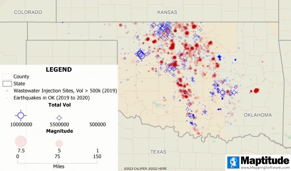
How Mapping Software Helps Us Analyze Earthquakes
Mapping software can help us observe trends in earthquakes, identify areas of high earthquake prevalence, and explore relationships between earthquakes and other phenomena.
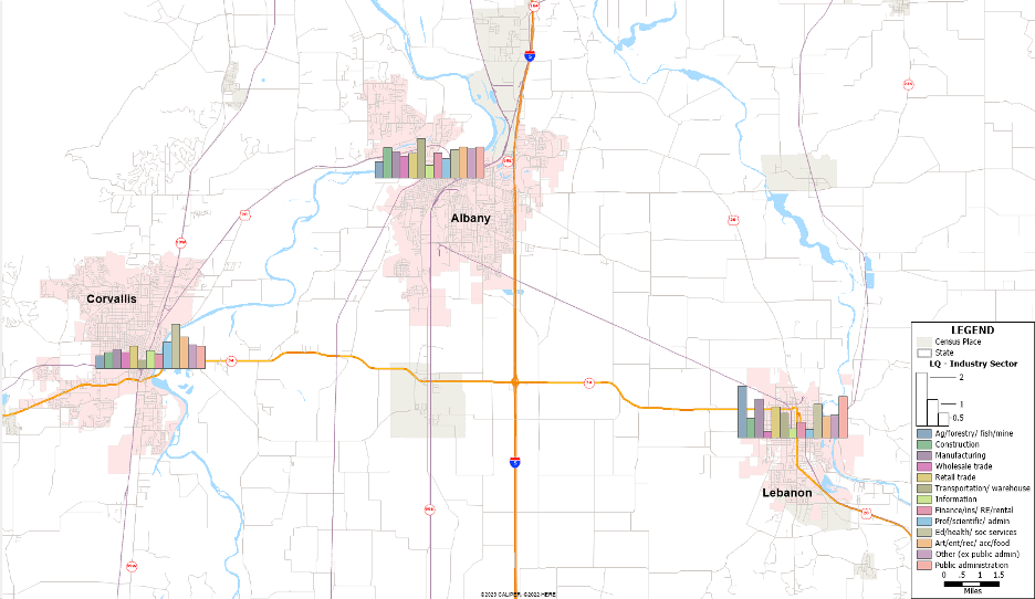
Using GIS to Map Trends in Employment
This tutorials shows users how to analyze ACS data from the US Census Bureau to calculate employment shift-share and location quotient using Maptitude.
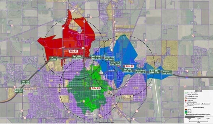
GIS for Local Government: Economic Development and Site Selection
This GIS tutorials shows how to use Maptitude in the municipal government sector for economic development and site selection.

GIS for Local Government: Public Works
This article by Stewart Barry and Brett Lucas describes an application of Maptitude in the municipal government sector for public works.

GIS for Local Government: Public Safety
This GIS tutorial from Maptitude shows users how to map out crime and demographics.

GIS for Local Government With Maptitude: Planning and Zoning
This article explores how to use GIS in local or Municipal Government using Maptitude.

How to Measure “Land Use Mix” using Entropy in Maptitude
This article discusses Maptitude's "Land Use Mix" add-in. Municipalities utilize land use mix calculations to measure service access.

How to Measure Hotel Market Share using the Huff Model in Maptitude
Learn how to map hotel market share to measure a city's tourism attractiveness using Maptitude.

Using Map Projections with Maptitude
Stewart Berry discusses how Maptitude works with different map projections.