
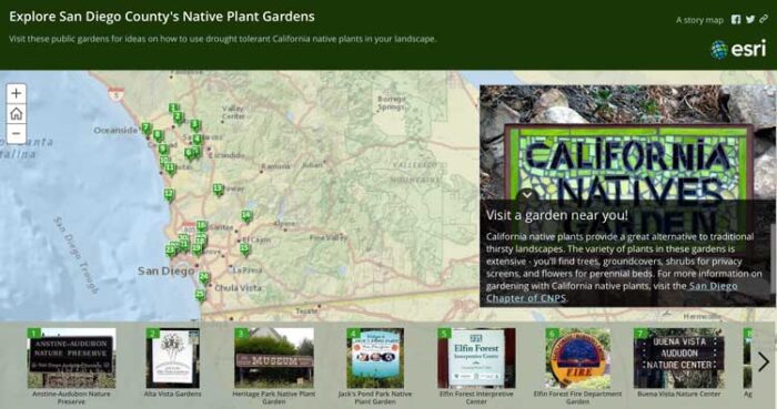
Gardening is largely about understanding spatial layout of plants. Given this reality, from research and public gardens to home and backyard plants one can find GIS being employed in the management and understanding of gardening.
Highly visible groups such as the Alliance for Public Gardens GIS provide a way for GIS professionals and gardening experts to collaborate and find GIS-based solutions for the care of public gardens.[1]
Dedicated GIS for public gardens
Major public gardens, including those used for research and as plant references, such as Kew Gardens in the UK, have dedicated GIS departments.[2] These are used to both manage the garden itself, but they are also applied to other regions being studied, including for efforts focus on conservation and using GIS as a database for a geographic-based taxonomy.
Using GIS and geospatial technologies to manage gardens
In most cases, ArcGIS is the tool of choice for these larger enterprises.
At smaller scales, local urban gardens have been employing GIS. In fact, plans for urban sustainability by cities such as Chicago involve using empty space for food production that have employed GIS and satellite imagery, including Google Earth data, to find spaces that are suitable for planting.[3]

Data integration of types of plants grown, spatial layout, and types of soils allows these datasets to be utilized and to assess important variables such as how much to irrigate or water for given gardens and their conditions.[4]
This could also include how to conserve water consumption based on layout or structural planning, where GIS can provide estimates of water requirements based on different scenarios of where plants or structures might be located.
In fact, water conservation and planning on efficient irrigation structures and systems seems to be a major area where GIS provides significant benefit to gardening either at large, urban or small, house or neighborhood scales.[5]
Given the needs for future sustainability, gardening seems to be a major potential area for GIS to be further employed.
References
[1] For more on the Alliance for Public Gardens GIS, see: http://publicgardensgis.ucdavis.edu/
[2] For more on Kew Gardens GIS department, see: http://www.kew.org/gis/
[3] For more on the urban sustainability initiative using gardens planned through using GIS, see: Taylor, John R., and Sarah Taylor Lovell. 2012. “Mapping Public and Private Spaces of Urban Agriculture in Chicago through the Analysis of High-Resolution Aerial Images in Google Earth.” Landscape and Urban Planning 108 (1): 57–70.
[4] For more information on garden water requirements and estimating using GIS, see: Hof, Angela, and Nils Wolf. 2014. “Estimating Potential Outdoor Water Consumption in Private Urban Landscapes by Coupling High-Resolution Image Analysis, Irrigation Water Needs and Evaporation Estimation in Spain.” Landscape and Urban Planning 123 (March): 61–72.
[5] For more examples of GIS used for urban gardening, see: International Conference on Ecosystems and Sustainable Development, J. L Miralles i Garcia, and C. A Brebbia. 2015. Ecosystems and Sustainable Development X, pg. 114.
Related Articles
- Geospatial Technologies in Precision Agriculture
- Mapping Soil Moisture from Space
- Use of GIS Techniques in the Study of Land Stability
