
Water management in agriculture is an increasingly important area evident in places such as the Western United States where diminishing water resources has required improved ways in which water is managed.
A key part of this emerging importance is the use of geospatial technologies that can help mitigate inefficient use of water and help improve how this precious resource is used in crop production.
For researchers, many applications involve the use of satellite imagery, including multi-spectral, synthetic-aperture radar (SAR), and microwave data. Much of this research involves analytical approaches to estimate crop growth and development relative to water allocation, often incorporating weather data.[1]
Open Source Geospatial tools for Estimating Agricultural Water Use
There are also now free and open source tools used to better estimate water use for agricultural purposes.
AquaCrop-OpenSource
One such tool is AquaCrop-OpenSource, which provides a crop water productivity model developed by the Food and Agriculture Organization (FAO). The tool estimates yield for multiple crop types, including in areas with limited water availability.
What is also useful about the modeling approach is it can be linked with satellite and other field observations, enabling model validation to be completed. This allows users to also calibrate models and better assess performance in cases where the tool can be used as a way to forecast future crop yield based on water availability or practitioners could also estimate ways in which they can make improvements to irrigation or water provision to see how it affects yield.
The tools is also made for researchers but also those who directly manage water and agriculture, making it practically relevant for farmers in particular.[2]

Dynamic Water Resources Assessment Tool (DWAT)
Another key tool, particularly focused on the water use side, is the Dynamic Water Resources Assessment Tool (DWAT). The tool assesses quality, dependability, and overall quantity of water availability.
DWAT looks at a variety of water sources, both above and below ground, while allowing for the identification of current and future water management challenges. Users can then compare to previous data or run scenarios to forecast different water use needs or scenarios based on the best available data.
At its core, the tool looks at catchment-level water behavior to allow for model-based assessment of regions. The tool is also made to make it easier for practitioners to use and estimate given water needs and scenarios.
What is useful about such as tool is that it is directly supported by the World Meteorological Organization (WMO). This can help the tool to be sustained over time, whereas other tools may suffer from a lack of long-term, institutional support, making them obsolete as technologies change.[5]
OpenET
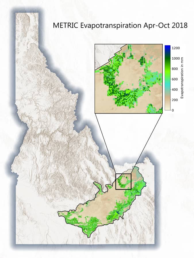
Water has become an increasingly precious resource in the US West. With record droughts and wildfires, it is clear that this resource will be crucial in shaping the future of the West in the years to come. Trying to help manage this resource, NASA has recently developed a platform, called OpenET, to aid farmers and water managers using satellite data on evapotranspiration.
The new OpenET tool is intended to put satellite-based view data on evapotranspiration (ET) in the hands of farmers, particularly those who find it increasingly harder to manage water resources in the face of climate change and diminishing rains.

Typically, ET can be detrimental to farmers and water resources because it is a measure of water lost during the cropping cycle.
At the spatial scale of individual farm fields, farmers can view how irrigation practices are resulting in crop production, allowing an estimate of how much water is being spent on crop yield. The tool uses the data to create a water budget so that farmers can manage how much water to use.
Additionally, groundwater data can be monitored and viewed to look at consumption and use patterns. The data helps farmers to also participate in water trading by determining water budgets and estimating needs for particular seasons based on current availability.[6]
The key data provided by the tool is information on ET, which has been previously difficult to monitor in real- or near real-time. Now, 17 states in the US West will have access to the public data, allow monitoring of ET to take place as fields are being watered. This will allow farmers to determine if their water use practices are efficient, could be improved, or are likely to cost too much relative the amount of water being used.

The imagery data used include Landsat data, with the tool supported and created by the Environmental Defense Fund (EDF), the Desert Research Institute (DRI), HabitatSeven, with funding from the Water Funder Initiative and in-kind support from Google Earth Engine. The overall team was led by NASA.
For water managers, the tool is transformative since monitoring water use and ET will now be possible using satellite data rather than water meters and estimates, which could save millions of dollars in monitoring costs as well as enable more efficient water use.[7]
How much water is lost can be estimated as ET, which also includes how much water is transpired by the types of plants growing. Satellite data can be used to estimate ET based on the types of crops growing, how they are spaced, and then look at the crops’ development to determine water use and needs in given fields.
Satellite-based tools allow the combination of years of research on plant water needs and how they take-up water in different environmental conditions with active monitoring that is now based on routinely updated satellite data rather than intensive fieldwork.[8] OpenET will aid in these estimates and provide updated web-based data that is more accessible to farmers.
For states such as California, OpenET could become crucial in enforcing legislation passed in 2014 that requires limitations to underground water use and pumping. In effect, OpenET could be used to enforce this law while also enabling farmers to better manage their water needs and use.
ETWatch
While OpenET is one such tool that is now providing farmers and water managers with a better understanding of ET using Landsat data, other tools such as ETWatch are also providing cloud-based solutions in delivering stakeholders with ET data.
Rather than limiting this to mainly the Western US, the tool allows managers and farmers to also benefit in other regions.[9] More tools such as this are being developed and expanded globally. Such tools come at an important time of increasing demands on water while many regions are experiencing increased drought.
Water Management Projects
The European Union (EU) also has recently sponsored efforts to create better water management tools.
FATIMA project
This includes the FATIMA project, which is used to aid in assessing geospatial strategies for the use of inputs, such as fertilizer and water, and determine their effects on crop yields, including estimating potential costs and profits.
The objective of the effort is to provide tools and services that can also estimate crop capabilities in a sustainable way. The applications also use wireless sensors and remote sensing to provide input, calibrate, and measure models deployed.
What is different from AquaCrop-OpenSource is this represents project-specific and customized ways in which different agricultural cases are addressed and managed.[3]
Smart Water Management Platform (SWAMP)
Another EU project is the Smart Water Management Platform (SWAMP), which integrates internet of things (IoT) devices, with UAV monitoring, and software approaches to monitor and estimate water requirements and needs for crops. The platform also allows the testing and application of different business models to crops to test how effective they will be in advance of implementation.[4]
Managing a diminishing resource such as water will increasingly be a challenge in the years to come. Ultimately, planners and managers may question why certain crops are grown and if such crops are necessary given the water needs they take. For now, OpenET will help farmers and water managers better monitor ET, while important decisions such as growing given crops could be better made through active monitoring of water use from tools such as OpenET and others that are being developed.
More tools are becoming available to us as water management, particularly as it relates to food and crop production, becomes a major concern for a variety of businesses and individuals. Open source tools make such tools and forecasting capabilities available to a greater number of users. Furthermore, these tools are made to be easier to operate, not requiring coding or extensive software experience, while also being able to integrate the latest in sensors, including satellite-based and IoT-derived data. There certainly needs to be improved macro-level national policies when it comes to water management; however, at smaller scales we have improved our abilities to provide options for water users in the agricultural cycle.
References
[1] For more on the use of satellite imagery for water management and agriculture, see: Geospatial Technology: Application in Water Resources Management; Oulidi, H.J., Fadil, A., Semane, N.E., Eds.; Advances in science, technology & innovation (ASTI) IEREK Interdisciplinary series for sustainable development; Springer: Cham, Switzerland, 2020; ISBN 978-3-030-24973-1.
[2] For more on AquaCrop-OpenSource, see https://www.aquacropos.com/about.html.
[3] For more on FATIMA, see: http://fatima-h2020.eu/.
[4] For more on SWAMP and its application, including a test case, see: Zyrianoff, I.; Heideker, A.; Silva, D.; Kleinschmidt, J.; Soininen, J.-P.; Salmon Cinotti, T.; Kamienski, C. Architecting and Deploying IoT Smart Applications: A Performance–Oriented Approach. Sensors 2019, 20, 84, doi:10.3390/s20010084.
[5] More on DWAT can be found here: https://wmo.int/activities/dynamic-water-resources-assessment-tool-dwat.
[6] More on OpenET can be found here: https://openetdata.org/.
[7] The NASA article on OpenET can be found here: https://landsat.gsfc.nasa.gov/article/transforming-water-management-in-the-u-s-west-with-satellite-data/.
[8] A recent NPR story on the use of satellite tools to monitor plants and better estimate water use can be found here: https://www.npr.org/2021/10/18/1037371060/satellites-reveal-the-secrets-of-water-guzzling-farms-in-california?t=1635068839149.
[9] For more on ETWatch, see: Wu, F.; Wu, B.; Zhu, W.; Yan, N.; Ma, Z.; Wang, L.; Lu, Y.; Xu, J. ETWatch Cloud: APIs for Regional Actual Evapotranspiration Data Generation. Environmental Modelling & Software 2021, 145, 105174, doi:10.1016/j.envsoft.2021.105174.