Google has just released the beta for its Google Maps Engine Lite which allows users to easily create their own maps on top of a Google Maps basemap. This lighter version of Google Maps Engine is designed for users that want to create simple maps which can then be easily shared.
Creating GIS data in Google Maps Engine Lite
Creating geographic data can be done through two main methods: either directly drawing on top of the basemap or through importing tabular data which contains a geographic field (address or lat/long values).
Users can annotate directly onto their maps, opting to place markers and lines by clicking and drawing on top of the chosen base map.
Data that is imported in tabular format is then geocoded after the user selects which fields contain location or address information.
Important GIS data
Geographic data can be imported using three methods.
The first is to drag and drop a CSV or XLSX file, import an existing My Maps, or pull in tabular data from Google Drive.
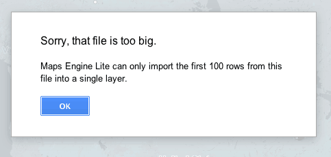
Google Maps Engine Lite is definitely designed for very small map projects, selecting the option to pull in tabular data from Google Drive resulted in a message box alerting me to a 100 record limit.
When I tried to pull in a table containing heavy metal bands per capita from around the world I got this message:

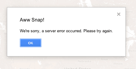
Unfortunately, geographic data (KML format) from a Google Fusion tables does not seem to be one of the file import options.
When I tried to pull in a Google Fusions table, I got this error message:

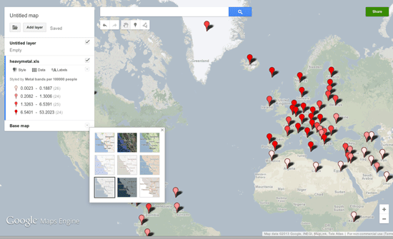
Once data has been added, either by using the manual method or by importing a table, the layers can then be easily symbolized. Where the real value of Google Maps Engine Lite comes in over users creating maps using Google Fusion Tables is the easy symbolization and labeling options.
Unlike mapping in Google Fusion Tables, there is an option to label data by selecting the column with the label values.
Data symbolization
Data symbolization is easily changed under the style tab. Data can be symbolized en masse or categorized based on a category. Individual marker styles are easily changed by selecting the value to be changed.
Selecting the data tab allows for users to inspect and individually edit data values, delete or add columns of information.
Multiple tables can be added for additional layers. Layers can be turned on and off by checking the box next to them.
There are multiple options for the underlying base map, ranging from the standard colored Google base map to various neutral and grayscale basemaps.

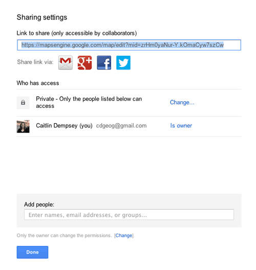
Once a map has been stylized, sharing and embedding options are pretty simply. The upper right corner contains a green share button where the user can set the privacy options (the map has to be set to public in order to set up embedding). Private maps can be share directly with authorized users who will need to sign in to Google to view them.

For a tutorial on how to make maps using Google Maps Engine Lite, visit this Google Earth Outreach page: Visualize your data on a custom map using Google Maps Engine Lite.
Related
- How to Use GIS to Make a Lego Map
- Make Maps for Print and Online with Lokaler Editor Beta
- Notable Cartographers and Their Maps

Great post. Thanks for that. Do you know if one can upload polygon data on the Lite Beta version? I can’t get my head around it.
Cheers!
Great Post. I had drawn a map around 2 months back using maps engine but it is not yet reflected on maps.google.com . How to I make it replace the public map that is crawled otherwise by google itself?
For example, I wanted something like this for our school to be shown publically on google:-
https://www.google.com/maps/preview#!q=The+Lawrence+School%2C+MDR+10%2C+Himachal+Pradesh%2C+India&data=!4m10!1m9!4m8!1m3!1d22651600!2d-95.677068!3d37.0625!3m2!1i1366!2i667!4f13.1
Don’t know how did they do that!
Kindly guide me how to save my edited map in .kml format. I tried a lot, but unable to save my data.
PLZZZZ HELP.