
web mapping

Finding Pleasant Routes Using GIS
GIS is being to used to plan pedestrian routes not based on the fastest way but centered on finding the quietest, shadiest, or most pleasant paths.

OpenRouteService’s ‘Quiet Routing’ Creates a Less Stressful Route for Pedestrians
Prof. Dr. Alexander Zipf introduces OpenRouteService's experimental routing option 'Quiet Routing' which guides pedestrian travel around noisy urban areas.

WMS Map Viewer
WMS Map Viewer, developed by Pantelis Rodis, is a http/JavaScript application for visualizing, combining and indexing web maps.

Using an Interactive Web and Desktop Based Spatial Technology to Monitor Performance of Public Health Outcome in Developing Countries
FGIS (FHI Geographical Information System) is browser-based interactive data visualization and mapping application that runs on the FHI360 Nigeria intranet, an online resource that serves as a common framework for sharing geographic resources about FHI360 programs in Nigeria.

A Web Mapping Tutorial for Beginners
This tutorial by Ardit Sulce guides users through how to create a web map using QGIS.

South Dakota’s Custom Enterprise System to Increase Wildlife Management
The Wildlife Inventory and Land Management Application (WILMA) is a web-based application allowing habitat managers to map, track, and report various land management activities on Game Production and Water Access Areas in South Dakota.

Disconnected Editing with ArcGIS in the Browser
Matt Sheehan discusses disconnected editing for ArcGIS and the libraries that Web Map Solutions has developed to provide users with disconnected capabilities to any ArcGIS web app in the browser.

The Usability of a Web Mapping Application with a Million Rows of Data
Manuel Timita write about Illustreets, a web mapping application built with Open Source software, open data, and emerging GIS technologies (i.e. CartoDB).
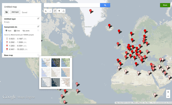
Make Your Own Maps with Google Maps Engine Lite
Google Maps Engine Lite is a simpler version of the Google Maps Engine that allows users to create and share their own maps.

Mapping Social Vulnerability
Oxfam America has released new maps about the geography and the people of the US Southeast, specifically Louisiana and Mississippi. This project ...

Making Maps with D3
D3 is a JavaScript data visualization library using HTML, SVG and CSS. D3 stands for Data Driven Documents and was developed by Mike Bostock, ...
GeoSocial Interactive Map for Transportation Project Planning
This week a spectacular conference aimed towards transportation professionals is being held in Los Angeles called Rail~Volution. The aim of ...

Mapping Emancipation Events during the Civil War
"Visualizing Emancipation," the first interactive map showing the end of American slavery during the U.S. Civil War, has been launched by the University of Richmond’s Digital Scholarship Lab in partnership with geospatial analysis (GIS) software development company Azavea.
Titanic Mapping
April 15th marks the 100th anniversary of the sinking of the Titanic in the North Atlantic Ocean. Esri has created ...

TileMill: Open Source Mapping Now for Windows
TileMill can now be used natively in Windows with the latest release. The release of TileMill 0.9.0 also includes a new plugin system: “TileMill ...

WorldMap: An Open Source Software Platform
Harvard’s Center for Geographic Analysis recently released WorldMap, an open source mapping application designed to make it easier for researchers to upload ...
Every Tree Counts: Using PhillyTreeMap for Collaborative Urban Forestry
Philadelphia, like many American cities, has a wealth of urban trees. Collectively known as the “urban forest,” these are the ...

The National Map: Using the National Geospatial Program
The National Map Viewer is a browser-based utility that allows map makers to create and download their own maps based on data layers that they apply to a base map of the United States.
Crime Mapping and the Los Angeles Police
The Los Angeles Police Department’s attempts at providing public mapping has not been without its issues and embarrassments. Chronicled here ...

How to Get Rid of that Pesky “missing (jsForm.htm)” Message in ArcIMS
Here's a quick solution to remove the "missing (jsForm.htm" message from ArcIMS.
Basic Guide to ArcXML
With the release of ArcIMS, ESRI’s map server software, GIS users were also introduced to ArcXML. ArcXML is ESRI’s flavor ...

Vector GIS Product Categories
This article categorizes GIS software by use, into four categories: desktop mapping, data viewers, components, and internet mapping.