
Landsat
Advances in Landsat Sensors
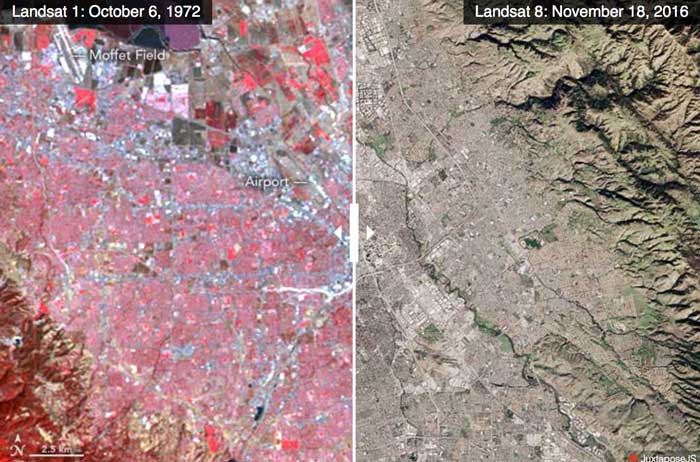
Since those first images in 1972, multiple Landsat satellites have been launched with the ability to take increasingly detailed pictures of our world.

Landsat 9 Will Launch in 2020
The Landsat series of satellites has been imaging the Earth’s surface for nearly 50 years, providing vital imagery for a range of purposes from the natural sciences to civil administration and conflict monitoring. NASA and the USGS recently announced that the next iteration of the program, Landsat 9, is due to launch in 2020.

Use of Earth Observation Data for Oil and Gas
Andrew Cutts, owner of ACGeospatial, discusses the role of GIS and earth observation data in the oil and gas industry in this guest article.

Karakoram Anomaly
Landsat satellite data helped researchers analyze advancing glaciers in the Karakoram mountains, which is uncommon compared to most glaciers worldwide.

Using Landsat Imagery to Find Shipwrecks
Satellite imagery from Landsat 8 has been used by a Belgian marine research institute to detect shallow water shipwrecks. Satellite imagery from Landsat 8 can detect the concentration of sand and silt particles in the ocean, which can then be used to pinpoint a potential shipwreck location.

Cloud Computing Used to Analyze Landsat Imagery and Detect Deforestation
Landsat, NASA’s longest running initiative for the acquisition of Earth imagery, has generated nearly 50 trillion pixels of data by capturing one image per season, of every place on Earth, for the past 43 years, providing a treasure trove of data for researchers.

River Width GIS Data Created from 1,756 Landsat Images
Researchers used 1,756 Landsat images to develop a GIS database of river widths for the entire North American continent.

Landsat 8 Data Users Handbook
Launched in 2013 by NASA, Landsat 8 is the latest satellite in the series. The mission of the orbiting satellite is ...

Ensuring the Future of GIS with Geospatial Education
The U.S. government is helping to guarantee the future of GIS by investing billions of dollars in geospatial education. The ...

Mapping Forest Disturbance with Landsat
The Landsat Ecosystem Disturbance Adaptive Processing System (LEDAPS) takes advantage of the 30 year Landsat archive to inventory recent disturbances and forest-cover change.

New Detailed Maps Show Changes in Earth’s Forests
Deforestation, the clearing and removal of the Earth’s forests, has been one of the major environmental threats to the globe ...

Timelapse Satellite Imagery – View Changes on Earth over Time
The series of Landsat satellites has been collecting global imagery continuously since 1972. A total of eight satellites and millions ...