
Python
Learning GIS Programming
Having some competence in programming has become a critical requirement for many geospatial positions. So which languages should you learn for GIS programming?

Python and Geospatial Analysis
Two recent podcasts from MapScaping take a look at the use of Python in geospatial analysis.

EarthPy: Python Package for Plotting and Working with Spatial Data
A Python language spatial package, called EarthPy, has been released for free download for working with GIS data.

Portable GIS
Portable GIS is a collection of open source GIS software applications and tools that can be run from a portable drive.
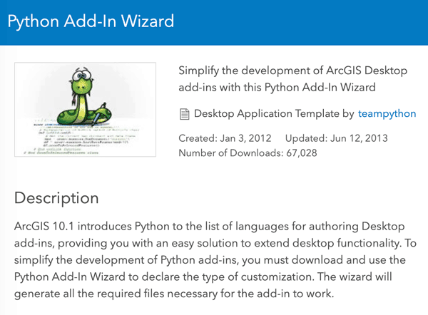
Customize ArcMap with Python Add-Ins
Daniel Fourquet walks users through the process of using Python to create Add-Ins for ArcMap.

Working with GIS Data using Python
Explore how Python, a scripting and programming language, enhances problem-solving across spatial sciences, from GIS data handling to visualization.
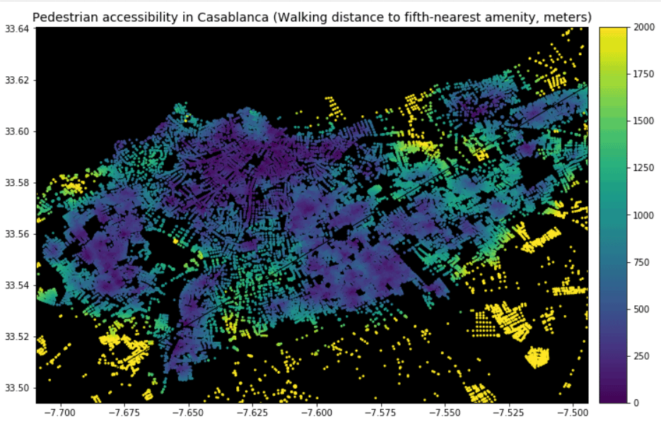
Using GIS to Analyze Pedestrian Accessibility
GIS tools to compute pedestrian accessibility are not just available to governments, academics, or companies, but are also free and open source.

The Use of Python in GIS
Python today is by far the most widely used language by GIS users and programmers.

Creating Dynamic Maps in QGIS Using Python: QGIS Python Programming CookBook
Learn how to use Python to create dynamic maps in QGIS with this free preview chapter of QGIS Python Programming CookBook. With ...

Tools: QGIS Python Programming CookBook
Learn how to work with map tools in QGIS using Python from this section as part of this preview chapter, Creating Dynamic Maps from QGIS Python Programming CookBook.
Labeling and Map Transparency: QGIS Python Programming CookBook
Learn how to label features and set map transparency in QGIS using Python from this section as part of this preview chapter, Creating Dynamic Maps from QGIS Python Programming CookBook.

Adding Real-Time Weather Data from OpenWeatherMap: QGIS Python Programming CookBook
Learn how to add real-time weather data from OpenWeatherMap in QGIS using Python from this section as part of this preview chapter, Creating Dynamic Maps from QGIS Python Programming CookBook.
Using the OpenStreetMap Service: QGIS Python Programming CookBook
Learn how to use the OpenStreetMap Service in QGIS using Python from this section as part of this preview chapter, Creating Dynamic Maps from QGIS Python Programming CookBook.

Layer Symbols: QGIS Python Programming CookBook
Learn how to symbolize layers using SVG and pie charts in QGIS using Python from this section as part of this preview chapter, Creating Dynamic Maps from QGIS Python Programming CookBook.
Scale and Layer Visibility: QGIS Python Programming Cookbook
Learn how to set up scale-dependent layer visibility in QGIS using programming from this section as part of this preview chapter, Creating Dynamic Maps from QGIS Python Programming CookBook.
Map Bookmarks: QGIS Python Programming CookBook
Learn how to create and navigate to map bookmarks using python in QGIS as part of this preview chapter, Creating Dynamic Maps from QGIS Python Programming CookBook.

Symbolizing Vector and Raster Layers: QGIS Python Programming CookBook
Learn how to symbolize vector and raster layers in QGIS using programming from this section of the preview chapter, Creating Dynamic Maps from QGIS Python Programming CookBook.
Accessing the Map Canvas, Changing Map Units, and Iterating over Layers
Learn how how to control an object through the Map Canvas, change map units, and how to loop through map layers in QGIS using Python. From: Creating Dynamic Maps from QGIS Python Programming CookBook takes a look at

GIS Tutorial for Python Scripting
GIS Tutorial for Python Scripting is a new release from Esri Press. This workbook contains hands-on programming exercises to familiarize GIS users ...

Mapping Out Geotagged Photos
These cartographers have mapped out geotagged photos to show areas where the most pictures by tourists have been taken.