
United States
Articles and information related to the geography of the United States

Review | The Longest Line on the Map
This book tells the story of how and why the Pan-American Highway was conceived and, poignantly, the why of a stubborn gap that remains unconnected.

2018 National Climate Assessment Warns of a Future with More Extreme Weather
The 2018 National Climate Assessment presents stark news for climate change and our environment.

Analysis of U.S. Climate in August 2018
For the summer of 2018, the contiguous United States lived through its 4th warmest summer on record, tying with the summer of 1934.

Can Painting City Streets Reduce the Urban Heat Island Effect?
The City of Los Angeles is experimenting with lowering the urban heat island effect by painting its streets a lighter color.

This Map Lets You Find the Best Cloud-Free Location to View the 2017 Solar Eclipse in the United States
This year a total solar eclipse will occur on August 21st, and will be visible from many states in the United States. The total solar eclipse will be visible in a path from Oregon to South Carolina.

Model Predicts Economic Damage from Climate Change to be Greatest in the South in the US
A new model maps out the agriculture, crime, coastal storms, energy, human mortality, and labor costs of climate change in the United States.
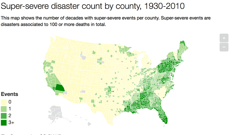
A Look at 90 Years of Natural Disasters by County in the United States
Researchers have mapped out ninety years of natural disasters data by county in the United States.
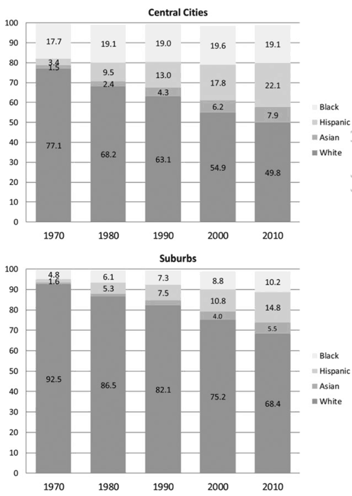
Racial Diversity Still Lacking in US Suburbs Per Study
A study out of Princeton University has found that United States suburbs are still mostly dominated by white residents.

These US Towns Each Have Less Than 15 Residents
Here are a few smaller than small towns in the United States.
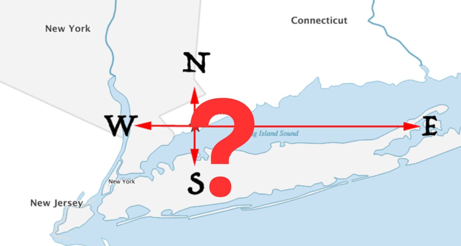
From Which U.S. City Can You Travel North, South, East, or West and End up in the Same State?
Can you answer this geography riddle? From which United States city can you travel due north, south, east, or west and still enter the same bordering state?

United States of Syllables
A syllable is a unit of blended sounds considered to be the phonological building blocks of words. Listed here are the number of states by syllable.

EPA Issues Report on Fracking and Earthquakes
According to EPA scientists in North Texas, earthquakes there are likely related to fracking and drilling. Although it is not a new discovery that this link is possible or even likely, an acknowledgement from the EPA is significant.

Geography of Lawns
Lawns now comprise the biggest use of land in the United States. Corn comes right behind grass as the second most grown ‘crop’ in the country.

Mapping the U.S. by Property Value and Land Area
How Urban Property Values are Adversely Affecting the U.S. Economy

Tracking Populations Using Sewage
Scientists and researchers have recently begun tracking the populations of cities in the United States using the amount of sewage produced.


What is the Geographic Center of the United States?
What's the geographic center of the contiguous United States? What's the center if Alaska and Hawaii were included?

New Study Discovers the Worst Drought of the Millennium Occurred in 1934
According to the National Aeronautics and Space Administration (NASA), the worst drought of the last thousand years occurred in 1934 ...

Geography of Car Thefts in the United States
The National Insurance Crime Bureau (NICB) each year takes a look at the national picture in terms of car thefts.

Hot Cities Getting Hotter in the US
Climate Central has published a new report that took at look at the increases in temperature in sixty of the largest U.S. cities.

Geography of Industry in the US
Mapping the geographical distribution of industries in the US can provide valuable insights into the economy, opportunities for growth, and potential investment areas for scientists, economists, and the general public.