
Maps and Cartography
Maps and cartography are essential tools in geography that enable us to visualize and understand the Earth’s surface and its features.
Cartography is the art and science of creating maps, which involves the use of sophisticated technology and techniques to accurately represent the Earth’s physical and cultural features.
Maps provide a visual representation of the world, allowing us to identify patterns, explore spatial relationships, and navigate through unfamiliar terrain.

Mapping the World’s Islands
A new USGS and Esri project has mapped 340,691 of Earth's islands, creating a publicly available GIS dataset.

Artist Creates Tapestry of the World
An artist from Portugal named Vanessa Barragão has created a unique map tapestry of the world inspired by nature.
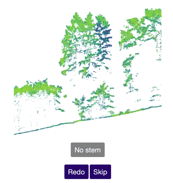
Help Identify Tree Stems from Drone Data
The Tree Mapping project uses crowd sourcing to accurate identify tree stems from laser scanning point cloud data acquired via UAV.

How Advances in Computer Mapping Shaped the Early Days of GIS
Greg Bunce, from the State of Utah’s Automated Geographic Reference Center, presents a walk through the history of mapping and geospatial advances that led to the early days of GIS.
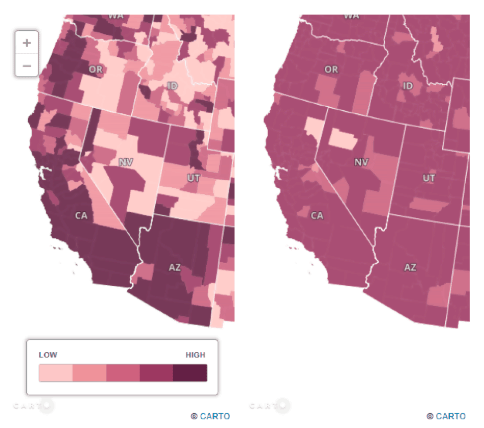
Thematic Mapping With CARTO
CARTO, which is an open-source software built on PostGIS and PostgreSQL, is an online mapping platform which allows end-users to produce a variety of Web GIS end products, including thematic maps.

Maps that put a Twist on Global Population
Cartographers have created maps that showcase the diversity of the world’s population in unique ways.

Voronoi Diagrams and GIS
Voronoi diagrams can be created by many GIS packages today for understanding spatial patterns.

Mapping the Human Footprint
The world settlement footprint, created in a online application called Urban Thematic Exploration Platform (TEP) sponsored by the European Space Agency (ESA), is the first map that combines optical and radar satellites to create a human urban footprint map of the world.

How Refugees are Using GIS to Map Their Geographies and Experiences
Story maps are a powerful tool that visualize events and what has happened to those who are displaced.

Analyzing the Benefits of Green Space on Mental Health Using GIS
A study in Denmark combined historical Landsat satellite data and a survey to analyze the relationship between green space and mental health.

Review | Sprawlball: A Visual Tour of the New Era of the NBA
Sprawlball demonstrates how basketball – that is, its professional incarnation in the NBA – has become a game of analytics.

Teaching Geography Through Map Samplers
These map samplers, made by schoolgirls over 200 years ago, demonstrated how such craftwork was utilized to aid in the teaching of geography.

Maps on Manhole Covers
Cities like Seattle, Chandigarh (India), and Oldenburg (Germany) have designed manhole covers with maps of their respective cities.

Lessons From a Viral Map
As public engagement becomes more and more important to society, it’s useful for scientists to know what makes maps and other geospatial content go viral.

Scotland: Defending the Nation, Mapping the Military Landscape | Book Review
'Scotland: Defending the Nation, Mapping the Military Landscape' is a comprehensive history of modern Scotland illustrated through such maps.

With Only Numbers and No Street Names, This Norwegian Town is Confusing Tourists
A Norwegian municipality decided to only give the chalets in a development numbers with no corresponding street names.
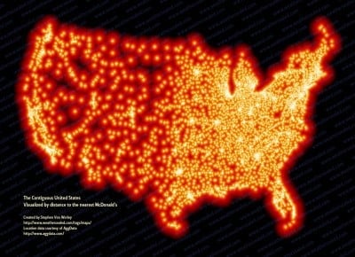
McFarthest in the Lower 48 – Map of McDonald Locations
Stephen Von Worley has mapped 13,000+ locations covering every McDonalds in the continental United States.

Automatic Raster Reclassification with ArcMap Model Builder Based on Raster Statistics
Alexandros Voukenas writes about the problem of automatic raster reclassification based on its statistics, using ArcMap’s Model Builder with this step-by-step guide with relevant screenshots and explanations

The Equal Earth Physical Map is Free
Both the physical and political Equal Earth maps are in the public domain which means users can use them however they want to.

Sunday Maptinee: Time-lapse Animation Shows How the World’s Second Largest Atlas Was Digitized
Watch this time-lapse video of the world's second largest atlas being digitized.

Review | Maps (Poetry)
This slim book reminds us that maps are not just lines and images on a surface – on paper or a globe – they are also emotional passages into the remembering and the meaning of our lives.

ICESat-2: Highest Resolution Laser Altimeter
ICESat-2's purpose is to collect detailed measurements of the Earth's surface using its Advanced Topographic Laser Altimeter System (ATLAS).

This 1835 Map Shows Incredible Detail About the Longest Cave System in the World
In 1835, Cincinnati-based surveyor Edmund F. Lee created this elaborately detailed map of Mammoth Cave.
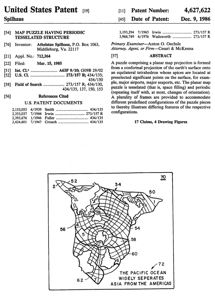
The Spilhaus Endless Ocean Map Projection
However, in 1942, a South African meteorologist, oceanographer, and inventor Athelstan Spilhaus created the world’s first fully ocean-centered map projection.

Over 600 Maps Added to South Dakota Digital Archives
The South Dakota State Historical Society has made over 600 maps available online with the South Dakota Digital Archives.
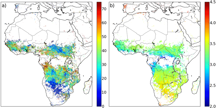
Geospatial Climate Models Show How Fire Seasons Are Changing
Changing technologies, including new satellite systems, and better climate and fire modeling, including the integration of these tools and data capture methods, will likely mean improved fire modeling in the future.