
Maps and Cartography
Maps and cartography are essential tools in geography that enable us to visualize and understand the Earth’s surface and its features.
Cartography is the art and science of creating maps, which involves the use of sophisticated technology and techniques to accurately represent the Earth’s physical and cultural features.
Maps provide a visual representation of the world, allowing us to identify patterns, explore spatial relationships, and navigate through unfamiliar terrain.
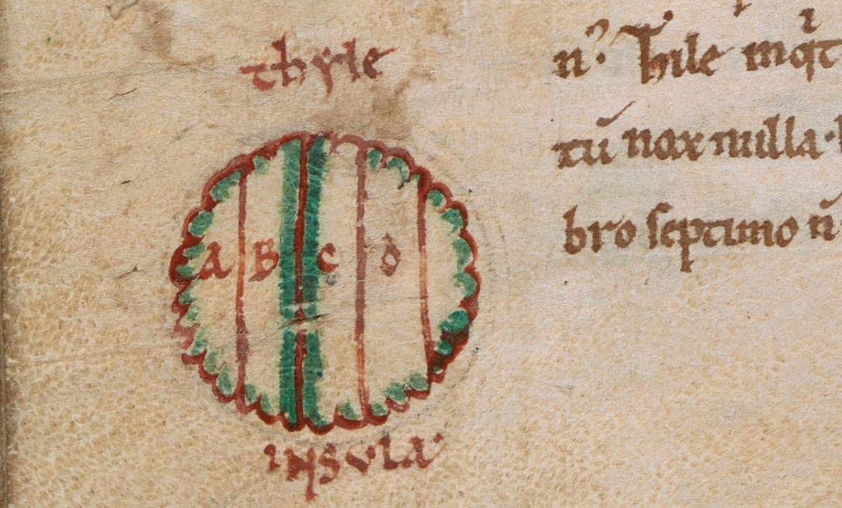
What Does Ultima Thule Mean?
Ultima thule is Latin and has been used over to the centuries to refer to an area of the world that is the most distant and inaccessible.

Hand Cut Paper Map of Amsterdam in the Shape of a Leaf
Street artist Nils Westergard created this intricate map of the streets of Amsterdam in the form of a leaf cut out from paper with an X-Acto knife.
The End of the Rainbow: Picking Color Schemes in GIS
The color symbology in displaying a GIS data on a map is an important decision to make in communicating geographic data.

When AI Goes Wrong in Spatial Reasoning
Machines can learn ‘wrong’ or biased information, creating large problems and poor conclusions when it comes to spatial data.

How to Make Map Ornaments and Geography Themed Christmas Decorations
If you want to lend a geographic touch to your Christmas celebrations, check out these ingenious geography crafting ideas.
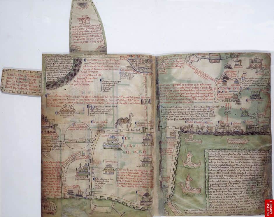
A Brief Look at Medieval Maps and Travel Guides
For many medieval maps created by European cartographers, locations were represented not by their geographic size but sized based on their importance to Christianity.

Review | Oxford Atlas of the World, 25th Edition
The Oxford Atlas of the World, 25th edition, has a new feature on Tourism and Travel and new maps on armed conflicts around the world, as well as a new map on Antarctica using the latest data from the British Antarctic Survey.

How Does GPS Technology Affect Our Understanding of Place?
How is an over reliance on GPS technology affecting our understanding and experience of place?

The Equal Earth Map Projection
Researchers recently announced the development of the Equal Earth map projection, which has quickly gained influence due to its ability in maintaining accurate area without distortion.

Mapping Native Lands
Canadian developer Victor Temprano- founder of Mapster - has created “Native Land,” a map that helps individuals find the original inhabitants of the land they live on.
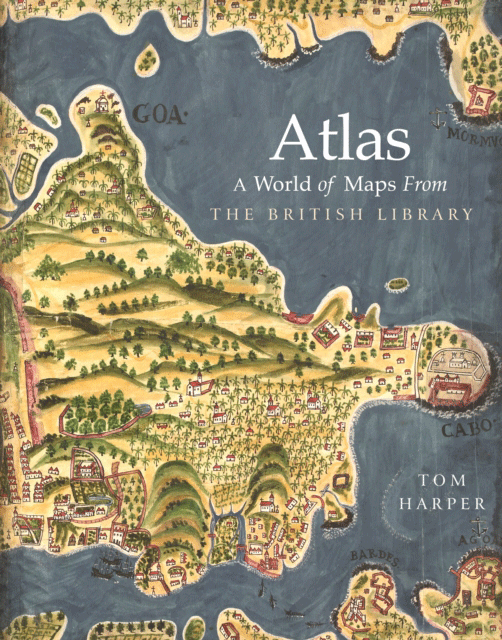
Review | Atlas: A World of Maps from the British Library
Tom Harper's Atlas: A World of Maps from is a ‘definitive showcase’ of the British Library, one of the world’s largest with over four million maps.

Review | The Consolation of Maps
Set in the world of the international trade in antique maps, this novel’s title seems most apt.

How Much Would You Need to be Paid to Give Up Digital Maps?
A trio of economists sought to figure out just how much money it would take users to give up digital services like Google Maps.

Visit Almost Four Hundred Years of Mapping Inner Earth With this Virtual Map Exhibit
This virtual exhibit shows different theories and maps that have been created postulating what Earth’s interior looks like throughout history and showed evolution of our ideas of what lies beneath our feet.

Online Accessibility Maps Should be Interactive
For a consistent experience across mobile devices, accessibility maps should be interactive instead of static images or PDFs.

Can High Tech Analysis of the Vinland Map Finally Answer Questions About its Authenticity?
Yale University is using high tech imagery analysis such as reflectance transformation imaging (RTI) to determine the authenticity of the Vinland Map, a purported 15th-century world map that has long been widely believed to be a 20th century forgery.

Review | The First Three Hundred Years of Historical Atlases
Though published a decade and a half ago, Walter Goffart's Historical Atlases: The First Three Hundred Years, remains the indispensable reference source for the appearance and development of historical atlases in the Western world.

St. Patrick’s Day Maps and Geography
Find maps about Irish surnames and the geography of St. Patrick's day from the US Census.

A Victorian Teenager Created These Comical Maps of Different European Countries
In the 1860s, a young girl decided to amuse her sick brother by creating maps of various European countries.

Visualizing Climate Change With Maps
The choice of labeling and color can have a pronounced influence in shaping opinions when visualizing climate change on maps.

Mappy New Year! Celebrate with Vintage Map Postcards
To celebrate the New Year, here are some vintage map themed postcards.

Holiday Season Gift Ideas Created by the GIS Community
Looking for a holiday gift idea for the geographers in your life and want to support the GIS community? Listed here are some great gift ideas produced by geographers.

Scientists are Improving How They Track Hurricanes with New Satellites
The Atlantic hurricane season in 2017 has given researchers the opportunity to perfect some of their previous methods and put into practice new instruments used to track hurricanes.

Tropical Forest Degradation Means More Carbon Dioxide is Released into the Atmosphere Than is Absorbed
Satellite images targeting areas of tropical Asia, Africa, and the Americas have shown that some tropical forests are dispelling more carbon than they are taking in.

The Brain Never Stops Making Maps
Researchers have found that even while they sleep, the internal maps of rats stay intact which enhances mental mapping.

How to Animate a Route on a Map Using Photoshop
Here is a step-by-step tutorial showing you how to animate a route on top of an image of a map using Photoshop.