
The impact of humans upon the planet’s ecosystems has long been a concern for scientists, and now the European Space Agency (ESA) is taking their assessment of natural resources to a new level with satellite technology. The emphasis of a new project from the ESA is on promoting sustainability and proper management techniques. All of this is with the help of earth-observing satellites and the data they provide from remote sensing technology for mapping and measuring.
The ESA has launched their Space for Ecosystem project in order to more accurately evaluate the benefits of a natural resource. The natural resources scientists are keeping a close eye on include forests as well as a whole host of other ecological assets like water, fuel, air filtration, nutrient retention, erosion control, fuel, and carbon sequestration. The ESA is looking to their Sentinel clan of satellites in order to assist with the program. The Sentinel-1A was launched in April of 2014 carrying advanced radar for mapping.
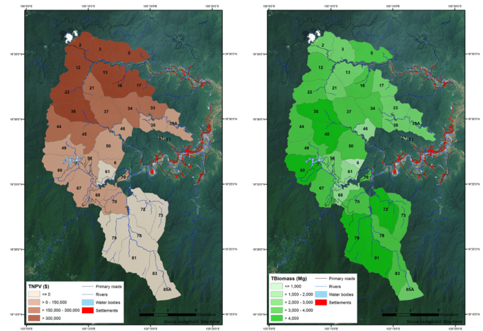
Using Satellite Data to Develop Forest Management Plans
Through satellites, vital areas on the planet for natural resources can be identified and assessed. The Huong Son is one such region in Vietnam. This tropical forest is logged for timber in order to support the local economy. However, unsustainable logging methods hurt the local economy even more by damaging the soil and water. Maps from the ESA have been used to inform forest management plans to help authorities there.
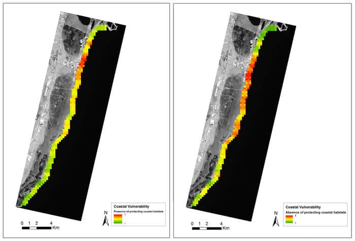
Using Satellite Data to Map Coral Reefs and Sea Grass Beds
Scientists have also used satellite data to assess coral reefs and sea grass beds on the coast of Mexico’s Yucatan peninsula. Maps were produced from this data in order to determine how to protect the reef while developing the coastline. Other trials in the Space of Ecosystem program have taken place in Indonesia, Peru, and Australia.
Satellites play a large role in the ESA’s programs because they can provide both the objective and repeated collection of data over the same area of the Earth. This makes it possible for scientists and researchers to follow how the landscape changes over time. Using remote sensing technology, they can distinguish between different land types (forest, grassland, marine) and track the degradation of them from both human and natural causes.
The European Space Agency is carrying out this work with the help of other international partners with the intention of developing other methods of ecosystem assessment. Overall, the hope is that the information provided from these satellites will enable scientists to more accurately evaluate the state of the Earth’s natural resources. This, in turn, can lead to better management techniques and the development of sustainable practices.
See More
Space for Nature – European Space Agency, May 29, 2014