
NASA’s Terra satellite and the European Space Agency’s Sentinel-2 satellites captured a large glacier flour storm over eastern Greenland on September 29, 2018. Related: What are glaciers?
What is Glacier Flour?
Glacier flour is a fine silt created as moving glaciers grind underlying rock into tiny particles. When winds in Greenland are strong enough, they can carry large plumes of glacier flour that have collected on the floor of dried out floodplains.
Glacier Flour in Greenland
The satellites captured events surrounding a braided stream valley located 130 kilometers (80 miles) northwest of Ittoqqortoomiit, a village at a latitude of 73 degrees North. Located along Greenland’s east coast, the winds generated a large silt plume from the floodplain that empties into Scoresby Sound.
The silt was produced by glaciers farther up the valley and carried downstream by meltwater streams. During the fall, the floodplains dried out, leaving behind glacier flour. A strong windstorm on September 29 scoured the floodplain floor, lifting the silt and spreading it along the coast.

Glacial Flour Turns These Lakes Turquoise
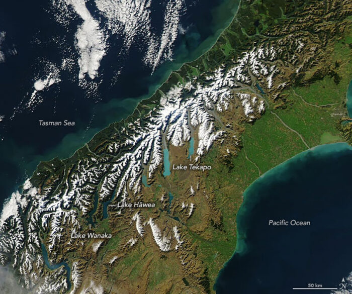
These lakes in New Zealand’s South Island appear turquoise as seen in this Landsat 8 satellite image. Lake Pukaki, Lake Tekapo, Lake Ohau, and Lake Benmore appear much lighter than nearby Lake Wanaka and Lake Hāwea because of suspended glacial flour.
Due to the fineness of the glacial flour sediment, it is easily transported and suspended in water. It is responsible for the hazy or milky look of glacier-fed streams, rivers, and lakes. Glacier lakes can exhibit a variety of stunning colors as a result of sunlight scattering as it strikes sediment particles in the water.
The fine silt that makes up glacial flour can be found in the water columns of these four lakes. The fine silt suspended in these lakes scatters blue and green wavelengths of sunlight, while the water absorbs more of the longer red wavelengths. Together, these processes give glacier-fed lakes their distinctive turquoise appearance.

References
Voiland, A. (2018, October 17). Glacier flour in Greenland skies. NASA Earth Observatory. https://earthobservatory.nasa.gov/images/92891/glacier-flour-in-greenland-skies
Voiland, A. (2019, May 20). How glaciers turn lakes turquoise. NASA Earth Observatory. https://earthobservatory.nasa.gov/images/145055/how-glaciers-turn-lakes-turquoise
Watch:

