
Jeff Oppong

Mapping Earthquakes with ArcGIS Pro
Jeff Oppong
This step-by-step tutorial shows you how to use USGS data and ArcGIS Pro to map earthquakes and geological faults.

Create a Bathymetric Map Using ArcGIS Pro
Jeff Oppong
This step-by-step GIS tutorial shows you how to create a bathymetry map using ocean data from GEBCO.

Mapping Buildings in 2.5D Using ArcGIS Pro
Jeff Oppong
Learn how to find and use building footprint data from OpenStreetMap to create a 2.5D map in ArcGIS Pro.
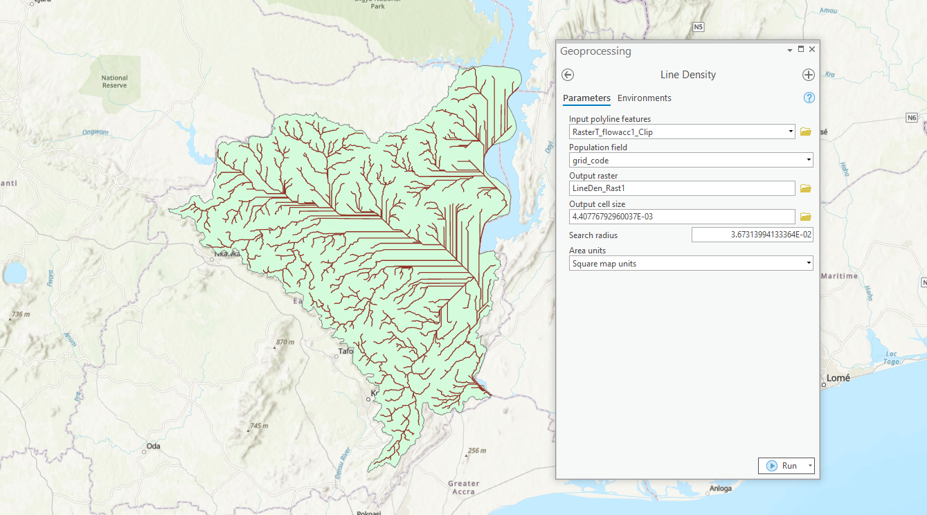
How to Map Watersheds Using ArcGIS Pro: A Step-by-Step Guide
Jeff Oppong
This tutorial shows you how to use ArcGIS Pro to delineate watersheds and drainage paths from elevation data.

Overview of Elevation Data
Jeff Oppong
This article reviews some of terminology and types of elevation based datasets available to GIS.