
Spatial Analysis
The spatial analysis category looks at data manipulation techniques in GIS.
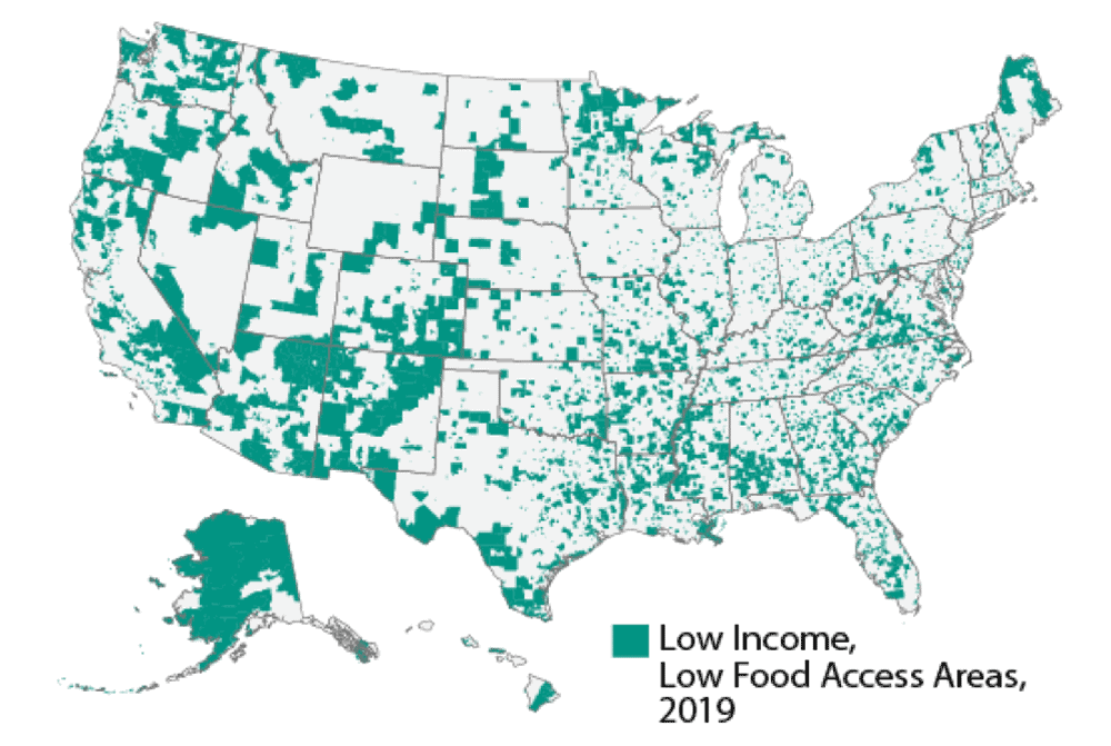
Using Local Knowledge to Better Map Food Deserts
Mapping and understanding food deserts is important if we are to understand how best to tackle the lack of healthy food options in the United States.
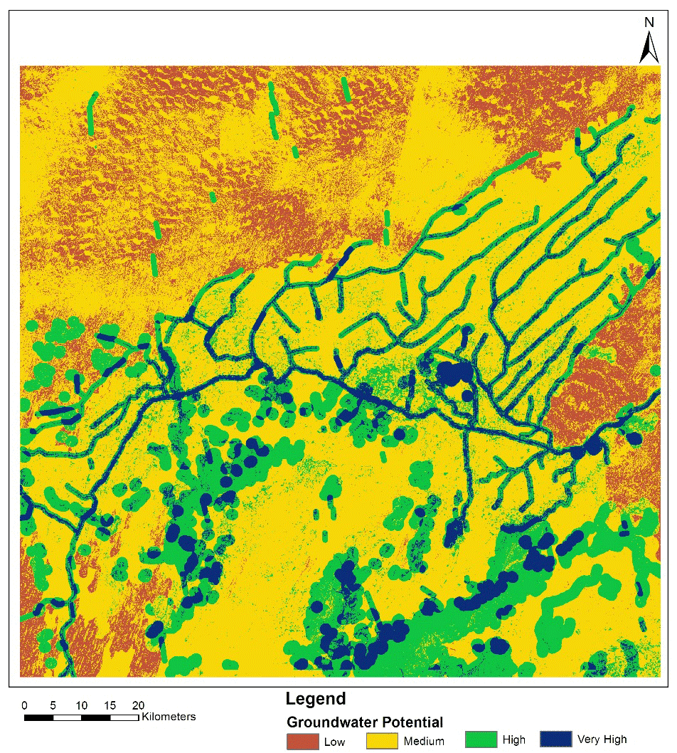
Mapping Groundwater Potential in a Desert using Geospatial Technology
Anindita Ghosh discusses her study that used GIS tools and analysis to map out areas with groundwater potential in a desert.
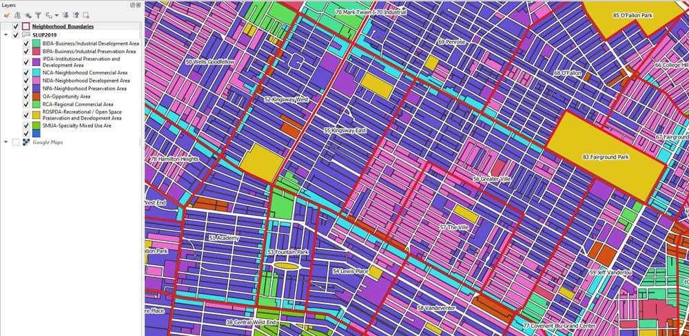
Calculating Land Use Mix with GIS
Alexandros Voukenas explains how to calculate land use mix indices (such as entropy) in a GIS environment.

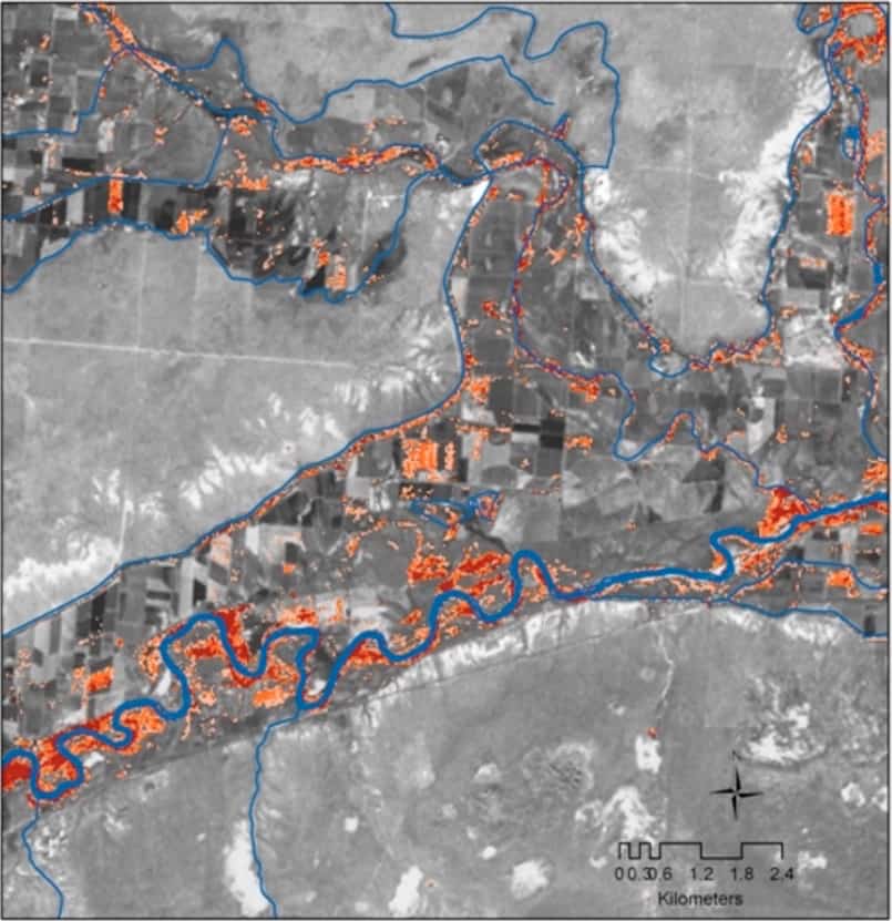
How to Use ArcGIS Pro to Map Flood Susceptibility
This tutorial makes use of spatial data science and remote sensing techniques to assess the susceptibility of floods using ArcGIS Pro.

GIS and Rewilding Efforts
GIS and geographical techniques help identify the best locations for successful rewilding and improve decisions on what to rewild.

Mapflow.ai — New Buildings Model and Kepler.gl Implementation
GeoAlert provides an overview of some of the features of its new Mapflow application.

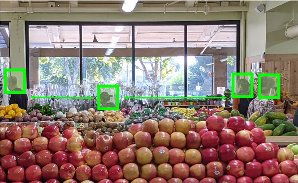
Using GIS to Map Election Results Based on Where People Live
Greg Bunce, from the State of Utah’s Automated Geographic Reference Center, presents an approach that uses GIS to create more representative election results maps.

Converting Historical Maps to Satellite-Like Imagery
Old maps and images can now be converted to make them similar to our modern satellite-base views, giving stylized views a more realistic appearance.
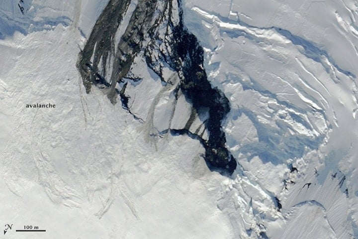
Forecasting and Mitigating Avalanches Using GIS
GIS and computational specialists have been developing models and methods to better forecast the likelihood of avalanches.
Recent Developments in Spatial Analysis and Computer Vision
Computer vision offers spatial analysts the possibility to conduct a variety of analyses without using traditional spatial tools.

GIS and SQL
One way to leverage the power of GIS as a data service and analytical tool is to better integrate relational database capabilities.

Using Spatial Methods to Combat Gerrymandering After the 2020 US Census
The challenge for GIS is to create methods that can better determine what less biased district maps look like that are acceptable to the judiciary.

Mapping Urban Heat
Lead by Portland State University professor Vivek Shandas, a network of citizen volunteers and local organizations are mapping urban heat islands in more detail than ever before.

Easily Create Interactive Flow Maps
Ilya Boyandin has developed an easy-to-use online tool that takes location data stored in Google Sheets to visualize interactive flow maps.
Using Remote Sensing to Map Invasive Species
Scientists and researchers are increasingly using remote sensing methods to map and track invasive species.

Analysis of Satellite Imagery and Search Data Suggests the Coronavirus Outbreak May Have Started Earlier in 2019
A study that analyzed traffic around hospitals using satellite imagery and Baidu search queries suggests that the coronavirus outbreak may have started earlier in China than in December of 2019.

Mapping the Amount of Snow on Arctic Sea Ice
Scientists are using satellite data to measure and map the amount of snow on Arctic sea ice.
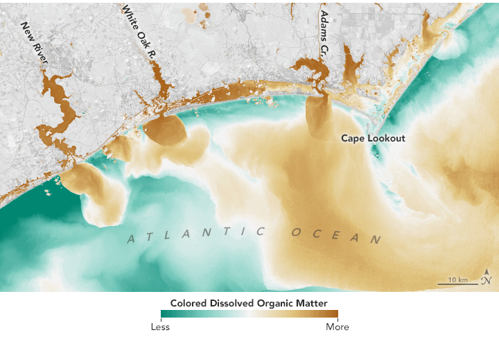
Monitoring Lakes Using Remote Sensing Data
Satellite-based remote sensing is proving to be a useful tool to allow effective monitoring of lakes around the world.
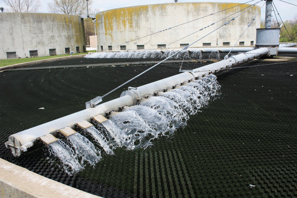
Tracking COVID-19 Through Sewage, Air, and Thermal Cameras
Given the limitations of testing, companies and researchers are using different proxies to better understand the extent of COVID-19.

Using Geospatial Technologies to Map Locust Swarms
Using a combination of satellite and UAV monitoring, the impact of locusts can be minimized by anticipating where swarms are likely to form next.

Computer Vision in the Time of the Coronavirus Outbreak
Computer vision is emerging as a promising set of techniques such as enabling rapid detection of COVID-19 and the better monitoring of social distancing practices among people.
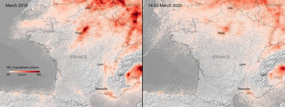
Mapping Changes in Air Pollution During the Coronavirus Pandemic
Satellite imagery also confirms many countries are seeing a strong downward trend in air pollution during the coronavirus outbreak.

Mapping the Universe
New satellite technology achieved in in the last decade are helping scientists to more accurately map the universe.
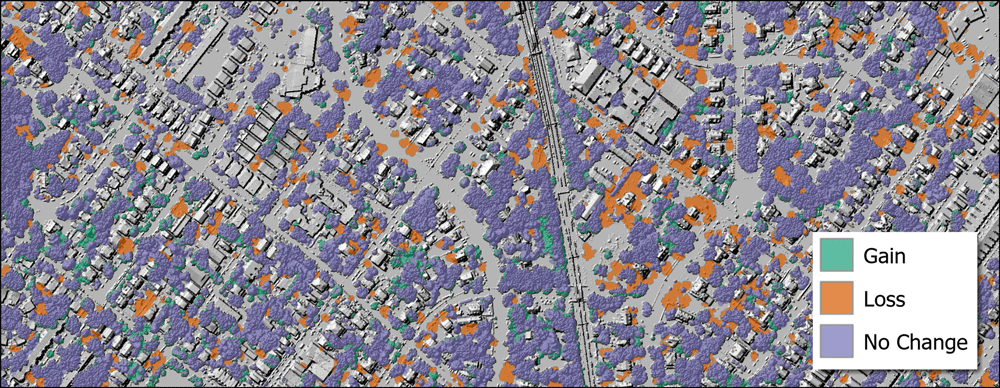
Using GIS to Assess Urban Tree Canopy
The University of Vermont Spatial Analysis Lab used spatial analysis to map out how the city of Philadelphia's tree canopy changed between 2008 and 2018.

Cloud-based Geospatial Analysis
We will see more migration of spatial and GIS work to cloud-based platforms in the near future.

Automated Remote Sensing of Underground Features
Below ground mapping can now better utilize remotely sensed data to create more accurate maps.