
Human Geography
Human geography is a branch of geography that focuses on the study of the human population and their cultural, economic, and social interactions with the environment. It examines the distribution of human populations across the globe, the impact of human activity on the natural environment, and the ways in which people use and manage natural resources.
Learn about the different areas of human geography including economic geography, population geography, cultural geography, and more.

Review | The Nocturnal City
Robert Shaw's newly published book, The Nocturnal City, is an effort to delve into the city at night which is a “very different time-space from day.”

Geography and Religion
Geographers study religions and their development based on the role that geography intersects with other important social components within a human geographic approach.

Geography of the Winter Olympic Games
Learn about the Olympic Winter Games' geography.
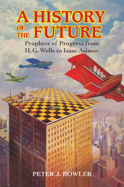
Review | A History of the Future
The History of Future presents a survey of the history of futuristic predictions from the nineteenth century on through the first two-thirds of the twentieth, in the English-speaking world

Mapping the 11 Lost Cities of the Bronze Age
New research methods have led to the narrowing of the search for 11 different Bronze Age cities that have been lost to the tides of time, thanks to new quantitative data analyses by some dedicated economists.

Noise Pollution and Geography
Noise pollution has long been seen to be particularly acute in regions where transportation and urban development are most pronounced; the disciplines of urban and environmental geography have focused on this topic.

Landlocked Countries
Learn about how many countries are landlocked, which is the largest landlocked country, and which two countries are double landlocked.

Knowing Geography Makes You More in Favor of Diplomacy
An increase in knowledge of global geography helps put into perspective greater events occurring around the world and makes the person more likely to favor diplomacy.

Model Predicts Economic Damage from Climate Change to be Greatest in the South in the US
A new model maps out the agriculture, crime, coastal storms, energy, human mortality, and labor costs of climate change in the United States.

Mapping Urban Vacancy
Nicholas de Monchaux, an urban design professor at UC Berkeley, has designed a project called Local Code that maps the underused sites in a city’s infrastructure and analyses how these spaces could be used to improve the local ecology.
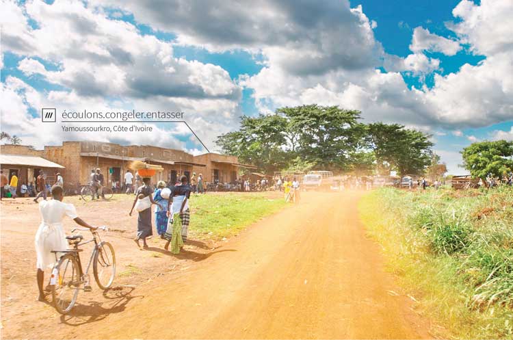
How Three Random Words are Helping with Global Mail Delivery
What3Words has come up with a way of accurately delivering mail even in locations where street addresses don't exist.

Geography of the Film Industry
Human geographers have studied how the film industry has developed in different countries and regions within countries.

Visualizing the Impact of Gentrification
Graphic designer Herwig Scherabon has developed a book visualizing the impacts of gentrification in a number of cities in the United States and United Kingdom. Combining public access data and research with crisp visuals, Scherabon illustrates the spatial distribution of gentrification and examines the different issues at play.

Medieval Irish and Colorful Winds
Medieval Ireland attributed a different color for each of the cardinal and ordinal directions of the wind.

How Geography is Used to Study Agriculture
From climate to key trade and shipping hubs, geography has shaped the fortunes of states and agricultural production.

Defining Urban Sprawl
The urban sprawl concept caused researchers to dive into figuring out what city in the world is the biggest based on the size of its urban sprawl.

Mapping Urban Trees and Income in Manhattan
This article analyzes tree and income data for the New York City borough of Manhattan.

Digital Hegemony: How Local Your Google Search Results are Depends on the Country
Researchers took at look at search results on Google for 188 capital cities to see the country of origin for the top results.

Review | Curbing Catastrophe: Natural Hazards and Risk Reduction in the Modern World
G.T Dempsey reviews Timothy H. Dixon's new book, 'Curbing Catastrophe: Natural Hazards and Risk Reduction in the Modern World.'
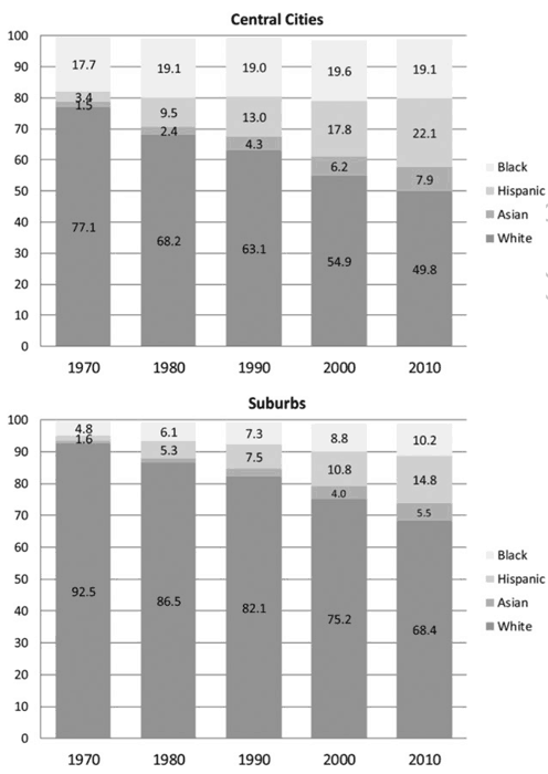
Racial Diversity Still Lacking in US Suburbs Per Study
A study out of Princeton University has found that United States suburbs are still mostly dominated by white residents.
Geography of Google Search
Explore Adventure analyzes where and when people in different countries search for locations in other countries.

Geography and Segregation
Socio-economic classes, ethnic groups, and race are some of the main factors that affect the geography of segregated populations.

World’s Longest Piers
Learn about the world's largest disembarkation pier, wooden pier, and pleasure pier.
Sports Geography
Sports, by nature, have location and spatial phenomena that are terrestrial, there are human-environment relationships, and regions have variations with how given sports are played.

Geography and Family Structure
Factors of geography, economics, and social trends have contributed to diverse ranges of household formation.

Geography and the Law
Law geographers have advanced the understanding that law also requires knowledge of geographic and other factors that may intersect in how law is developed and applied.