
Human Geography
Human geography is a branch of geography that focuses on the study of the human population and their cultural, economic, and social interactions with the environment. It examines the distribution of human populations across the globe, the impact of human activity on the natural environment, and the ways in which people use and manage natural resources.
Learn about the different areas of human geography including economic geography, population geography, cultural geography, and more.

Can Humans Sense Earth’s Geomagnetic Field?
A group of researchers wanted to test if humans have the ability to sense the Earth's geomagnetic field.

Spatial Income Inequality and Climate Change
The relationship between CO2and climate change emissions in general and wealth inequality is not a clear one.
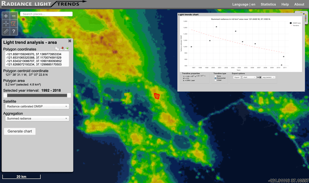
Interactive Map of How Nighttime Light Pollution Has Changed Around the World
The Radiance Light Trends website offers an interactive map where users can see how night light pollution has changed between 1992 to the present.

The Geography of Borrowing Size
Towns can 'borrow size' from nearby urban areas, enhancing their economic prospects and resilience by leveraging networks with larger towns.

Urbanization Makes the Surrounding Atmosphere Drier
Researchers in southern China have analyzed the impact of urbanization on local climates, known as the urban dry island (UDI) effects.
What is Necrotecture?
Necrotecture is an urban planning coined termed by Rowland Atkinson to describe the "dead residential space" created by a high density of mostly vacant residential dwellings.

Review | The Longest Line on the Map
This book tells the story of how and why the Pan-American Highway was conceived and, poignantly, the why of a stubborn gap that remains unconnected.

What is the Oldest Surviving Aerial Photograph?
The oldest surviving aerial photograph was taken on October 13, 1860 by James Wallace Black over the city of Boston.
Mapping Out Ammonia Hotspots With Satellite Data
Researchers recently used satellite data to create a high resolution map of ammonia hotspots around the world.

Changes in Countries and Capital
Listed here are more recently formed countries and capitals that have moved and well as some geography news items about some countries.

The 2018 Statistic of the Year is About Plastic Recycling
90.5% of all plastics that have ever been produced have never been recycled.

Interesting Geography Facts About the US-Canada Border
Here are some interesting geography facts about the Canada–United States border.
The Medieval Physician’s Almanac
During the Middle Ages, the belief that spiritual and cosmological forces affected the body and mind was commonly accepted (BBC, ...

2018 National Climate Assessment Warns of a Future with More Extreme Weather
The 2018 National Climate Assessment presents stark news for climate change and our environment.

Map and List of Fortune 1000 Companies for 2018
Map and list of Fortune 1000 companies for 2018, according to Fortune Magazine.

Geography of Fortune 1000 Companies in 2017
Explore the geographic distribution of Fortune 1000 companies for 2017.

Mapping Mediterranean UNESCO World Heritage Sea-level Rise Flood Risk
A Kiel University study has shown that some World Heritage Sites are at risk for damage in the face of changing sea level from climate change.

Review | Medieval Ireland
Medieval Ireland is Clare Downham's comprehensive synthesis of the current state-of-play of the history of medieval Ireland, 400-1500 A.D.

World’s Largest Water Bridge
The world's largest sea bridge/tunnel system, which took nine years to build, connects Hong Kong to Macau and the mainland Chinese city of Zhuhai.

What is the Environmental Insights Explorer (EIE) Tool?
Google has launched a new tool, Environmental Insights Explorer (EIE), with the main purpose of making new climate-relevant datasets easier for cities to access.

Mimicking the Geography of Distance with Letter Writing
Slowly is an interesting social network that reinstates the distance of geography when communicating with others when writing letters.

Extreme Fish Stocking: Repopulating Lakes by Air
To repopulate remote lakes, Utah's Division of Wildlife Resources (DWR) uses airplanes to drop fish into lakes.
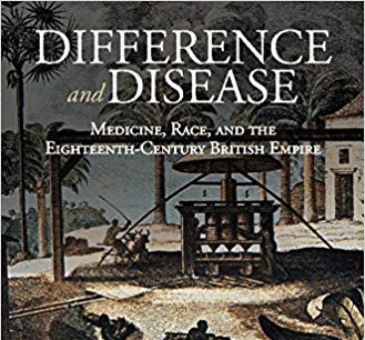
Review | Difference and Disease: Medicine, Race, and the Eighteenth-Century British Empire
The book, Difference and Disease: Medicine, Race, and the Eighteenth-Century British Empire, examines theories of medicine and science within a colonial, racially-mixed population.

Review | The Ape that Understood the Universe
The Ape that Understood the Universe: How the Mind and Culture Evolve is an engaging, intriguing, and ultimately most satisfying look into what the human mind can do and how it got that way.

Interviews with Geographers and Cartographers
Access interviews with prominent geographers from the 1970s to 1990s via the Library of Congress.

Will Self-Driving Cars Make Traffic Worse?
The World Economic Forum and Boston Consulting Group studied the possible effects of autonomous vehicles on Boston's future traffic.