The default projection for many geographic datasets, especially global or small scale ones, is some form of the Mercator map projection. You will commonly see this projection when viewing Google Maps, Mapbox, or many of the other web-based mapping applications.
These variants of the Mercator projection position the world so that the Prime Meridian (0° longitude) lies in the center of the map view. Among other criticisms of the projection, this particular world view can present a problem if you are trying to display data that is located in region of the Pacific Ocean.
This quick tutorial shows you how to recenter your map project in QGIS so that the center of the map view is on the Pacific Ocean.
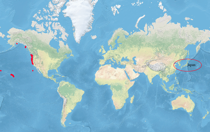
For this example, I am using collection points from a research project that looked at oceanic migration of debris as the result of the 2011 Japanese Tsunami (more: Debris From the 2011 Japanese Tsunami Carried Almost 300 Marine Species Across the Pacific Ocean). When the coordinates of this file are plotted in the map view, the collection points are plotted along the Hawaii Islands and the west coast of the United States. Japan, which is a central location in this research project, is found all the way over on the other side of the map view.

How to Change the Map Projection in QGIS
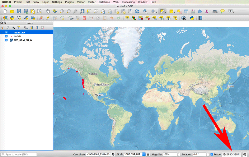
To create a map view centered over the Pacific Ocean, we will need to change the map projection. At the bottom of QGIS, there is a strip of information boxes. In the far right corner, you will see the current map projection information listed with the European Petroleum Survey Group or EPSG Geodetic Parameter Set code.

Hover your mouse over the area and you can see a tooltip with the name of the progression.

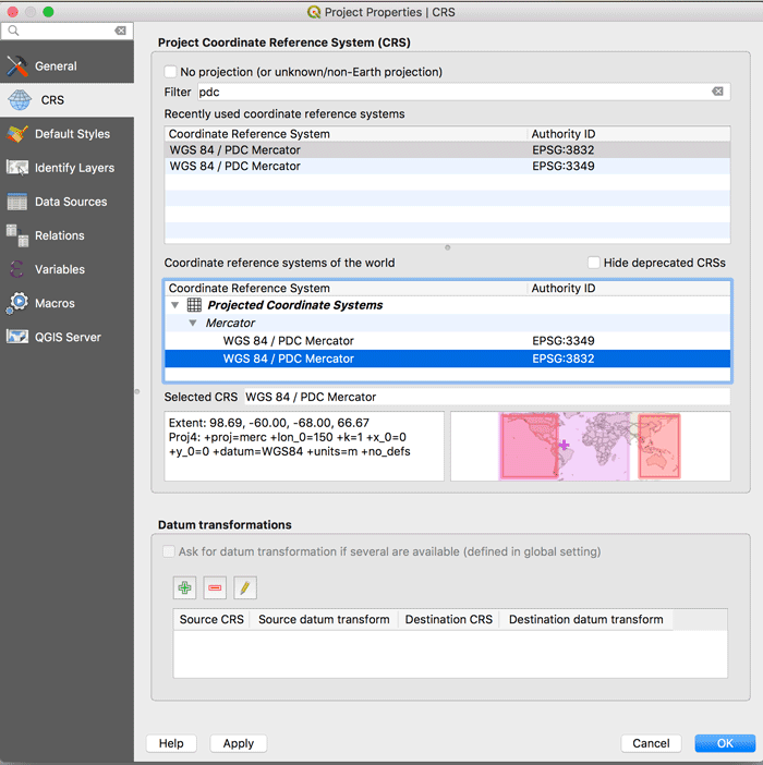
To change the projection of the current map project, click within the map projection information to pull up the CRS (Coordinator reference system) properties window. Using this window, we can search for and set a new projection or coordinate system for our map.
The coordinate system we are going to use is a modified Mercator from the Pacific Disaster Center in Hawaii known as PDC Mercator. In the filter box, type in PDC and you will notice there are two PDC Mercator entries. EPSG:3499 which is deprecated, and EPSG:3832.
Click on either one and in the preview window you will see a light purple shading indicating the zoom extent of your map project. The red shading shows you the extent of the projection bounds (the area that the projection is well defined for).
The overlap between the two lets you determine if the projection or coordinate system you want to select covers the geographic extent of your map project. As you can see for PDC Mercator, the red shade covers an area around the Pacific Ocean. You can also see coordinate information about the projection extent.

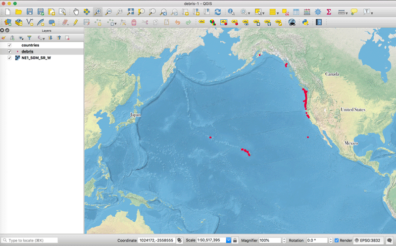
Select EPSG:3832 and click on the blue OK button. The CRS window will close and you will see that your map project has been reprojected to the selected projection. Now the countries surrounding the area of interest for the debris collection data are all shown in the same map view.
Likewise, the map projection information box now shows EPSG:3832 as the designated projection.


