
QGIS tutorial
Pan Sharpen Landsat Imagery in QGIS
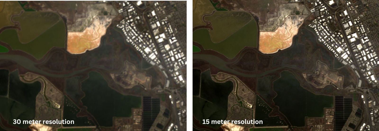
This QGIS tutorial guides you through pan sharpening Landsat imagery by combining the 15-meter panchromatic band with lower-resolution multispectral bands.
How to Find the URL to an ArcGIS Online Web Map and Add it to QGIS
Learn how to find URLs for older feature and map servers hosted on ArcGIS Online so they can be added to QGIS.

How to Use Esri File Geodatabases in QGIS
Learn how to load both Esri vector and raster file geodatabases in QGIS.

Collecting GIS Data in the Field Using QGIS and QField
This QGIS tutorial takes you through the steps to synchronize a map project with QField in order to collect GIS data using a mobile device.
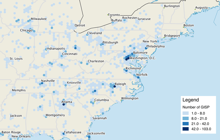
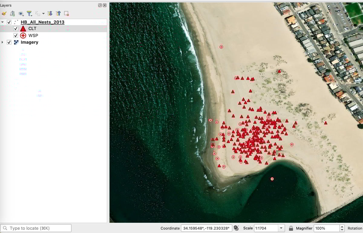
Using QGIS to Create a Hexbin Map
It is fairly easy to create a hexbin map using QGIS by following this GIS tutorial.
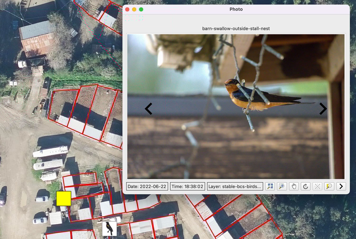
Mapping Geotagged Photos in QGIS
Geotagged photos can be easily mapped out in QGIS by following this GIS tutorial.

Learn How to Georeference a Map in QGIS Using GIS Data
Learn how to georeference scanned maps in QGIS using reference GIS data and control points when no coordinate grid is available.

Georeferencing Scanned Maps in QGIS Using Graticules
This GIS tutorial teaches you how to assign geographic coordinates to a scanned map in QGIS using a process known as georeferencing.

Using interpolation to create a surface layer with contours in QGIS
This GIS tutorial shows you how to find elevation data points and create a surface layer and contours using QGIS.
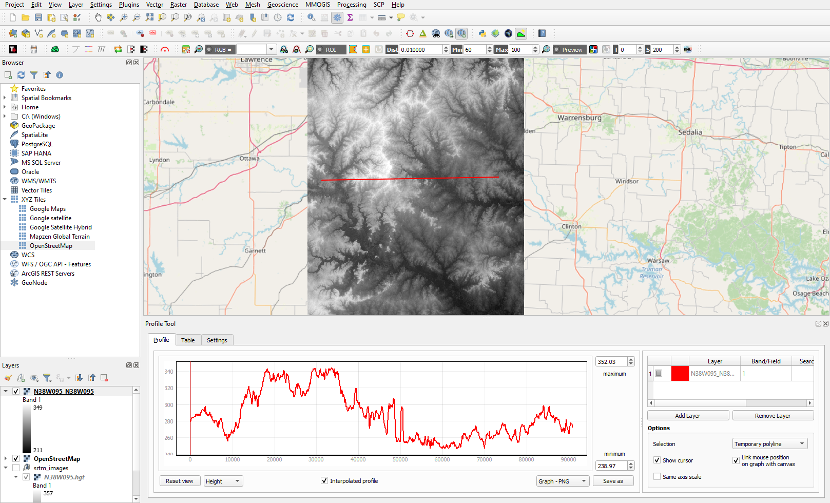
Creating Elevation Cross-Section Profiles with QGIS
Learn to create elevation cross-sections in QGIS with the Profile Tool plugin and SRTM elevation data.

How to Create Isochrone Maps in QGIS
Learn how to create isochrone maps in QGIS to visualize travel times, find the fastest and shortest routes, and analyze accessibility.
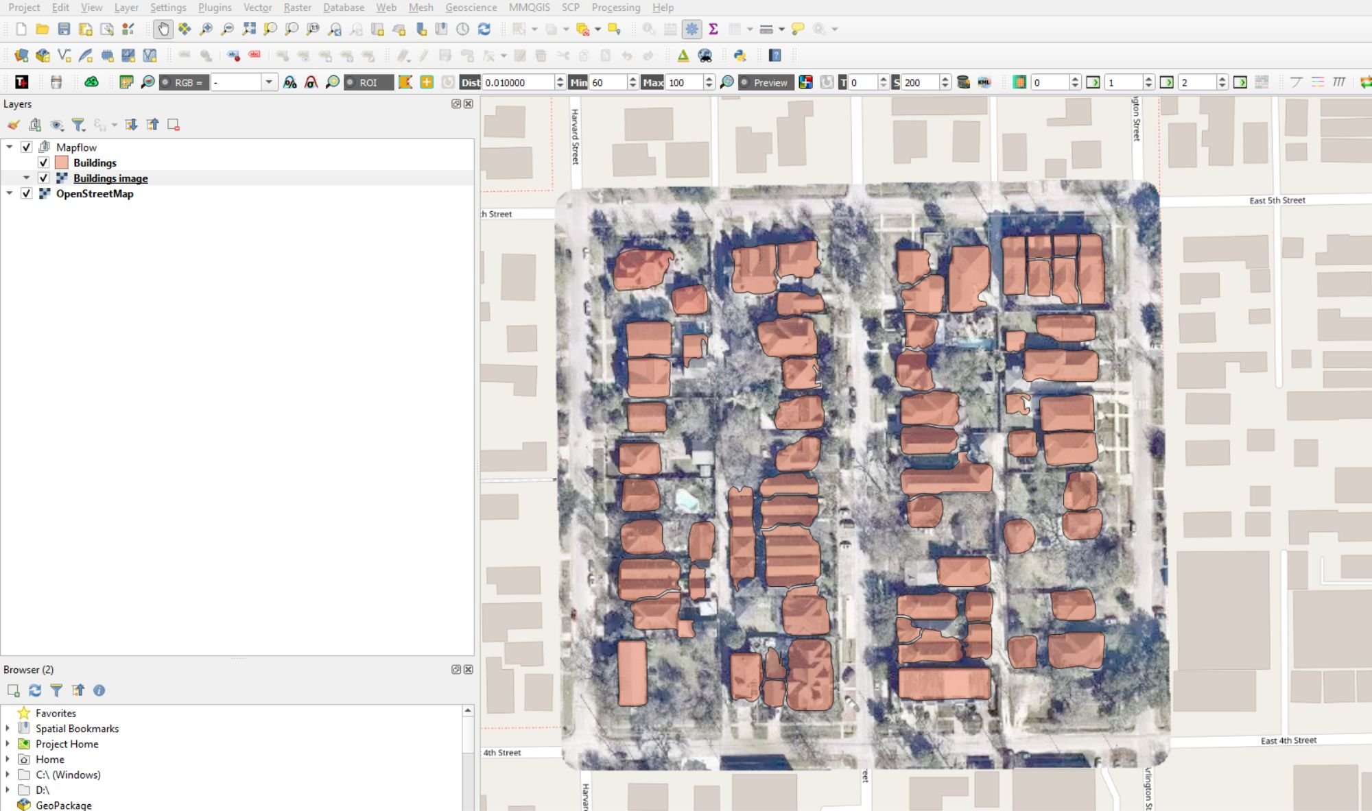
Automatic Digitizing of Imagery Using QGIS
This QGIS tutorial takes you step-by-step through the process of automatically digitizing building footprints using the Mapflow plugin and OpenStreetMap aerials.

How to Add Data from ArcGIS Online to QGIS
Adding data from an ArGIS Online Map Service or Feature Service into a QGIS map project is fairly easy and quick in most instances.
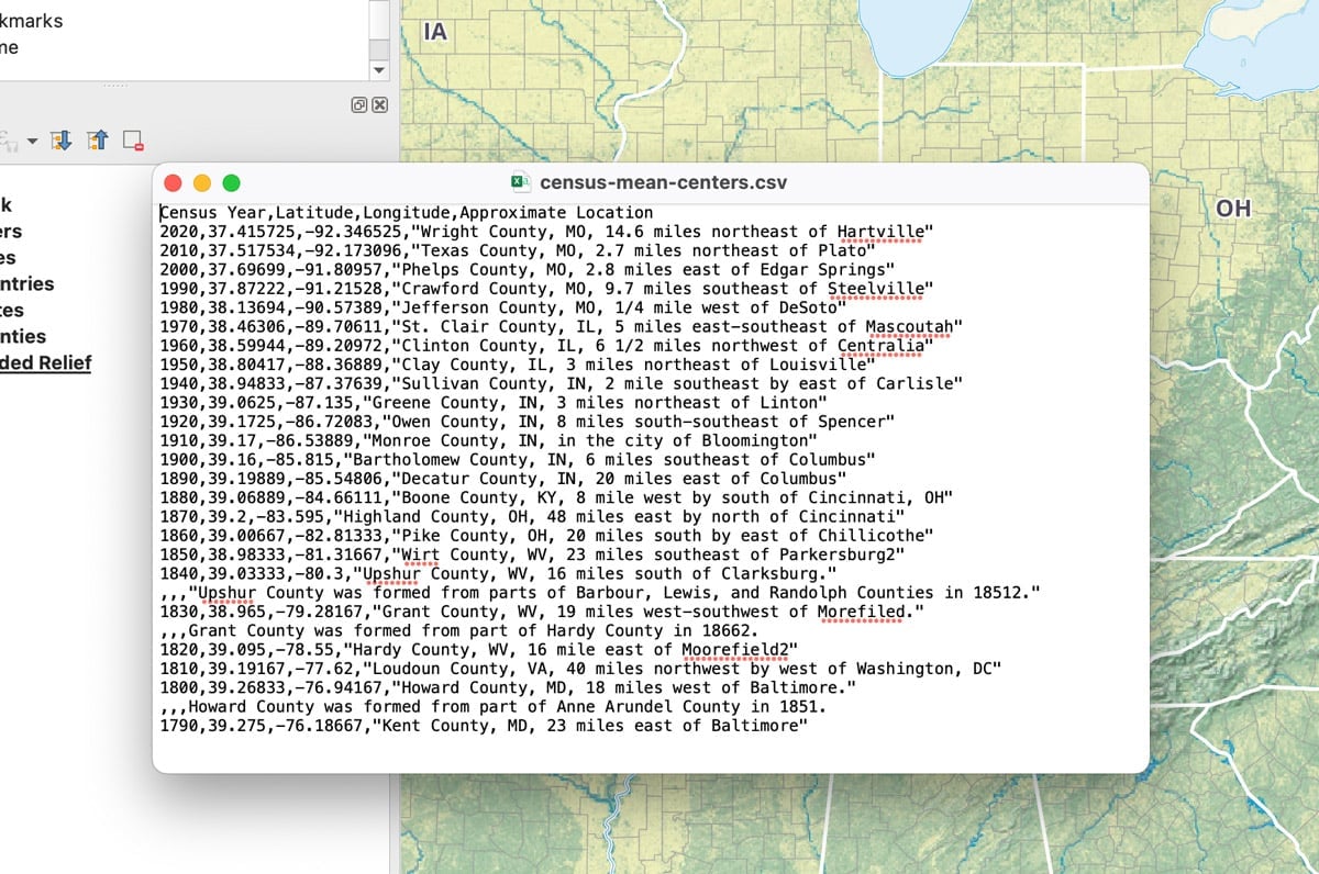
How to Add Latitude and Longitude as a CSV File in QGIS
This quick QGIS tutorial takes you through the steps of how to add a CSV file with latitude and longitude coordinates.
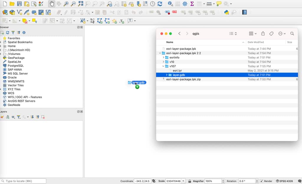
How to Import an Esri Layer Package in QGIS
While QGIS cannot directly read an Esri layer package, there is a simple technique to unpack the file and import it into this GIS software.

Self-Guided QGIS Courses
These six QGIS courses are available for free self-guided learning.

How to Add Leader Lines to Labels in QGIS
The release of QGIS version 3.10 brought with it the native capability to add leader lines to labels.
How to Change the Projection of a Shapefile Using QGIS
If you know your shapefile's beginning coordinate system or projection, you can export the data using QGIS.

How to Change the Label Language When Using Natural Earth’s Quick Start QGIS Files
One quirk with the version 3 of the Natural Earth quick start kit .qgs file is that when you load it in to a session of QGIS, it can display labels in a language you weren't expecting.

How to Get the Map View in QGIS to Resize Properly on a Mac
One Mac OS specific bug is the map view canvas doesn't fill the available space in QGIS 3.x versions. Learn how to fix this.
QGIS Tutorial: How to Change the Map Projection to be Centered Over the Pacific Ocean
This quick tutorial shows you how to recenter your map project in QGIS so that the center of the map view is on the Pacific Ocean.

How to Add a Map from Mapbox to QGIS
This tutorial will show you how to take a map style you have created in Mapbox and load it into a QGIS session.

How to Save a Selection as a New File Using QGIS
Learn how to save a selection from a GIS dataset to a new GIS file using QGIS with this quick video tutorial.

Dress Up Your QGIS Install With this Whimsical Plugin
The QGIS hats plugin is a bit of fun that accomplishes no other purpose than to add a hat to the QGIS icon.

How to Create a Non-contiguous Cartogram Using QGIS
This article presents a rough idea of how one might mimic a non-contiguous cartogram using QGIS.