
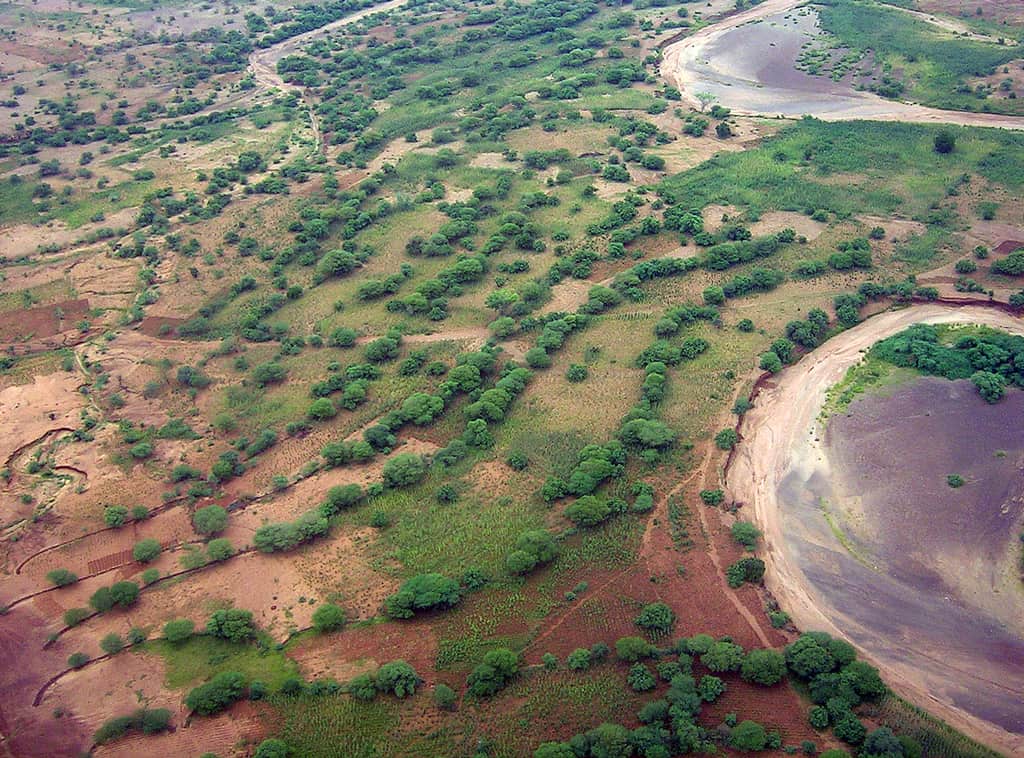
Agroforestry is essentially a way to imitate a natural ecosystem for agricultural production. In this case, farmers mix trees, shrubs, and potentially herbaceous plants within an agricultural area to create a more biodiverse and balanced ecosystem that can have productive value for the farmer and natural environment.
For instance, mixing trees that provide nuts with grain agriculture could be a simple form of agroforestry. In recent years, as conservation efforts have developed, agroforestry has gained greater interest.
GIS is being used to study and better develop land management practices within agroforestry while also assessing how effective these agroforestry practices are.
Agroforestry has been around for decades and farmers increasingly see its benefits relative to traditional monocropping. Agroforestry can allow farmers to diversify their holdings and production, while it helps the natural ecosystem to better conserve water, improve soil quality, and enhance wildlife habitat.
Increasingly, with climate threats, agroforestry could also help by diversifying the types of plants grown, including those more resistant to extremes in weather that is increasingly becoming common.
GIS, at a basic level, can be used to monitor and map the types of plants found in different farm holdings. It can be used as a database for water quality, soil quality, and the range and diversity of plants within given plots. This could not only be mapped spatially, but monitoring this over time enables farmers to better understand progress within their own farms and monitor how effective given agroforestry methods are.[1]
Today, methods are also being developed to aid farmers make decisions prior to developing a given area. In this case, what is called a multi-criteria decision analysis (MCDA) can be applied that outlines objectives, both ecological and farming-based, that are then inputted into a system that then evaluates the feasibility of those objectives given the environmental parameters.
Models that investigate land suitability, which determine how useful a given area is for desired crops and plants, and weighted objectives that investigate the feasibility of given goals for evaluated areas are applied in decision frameworks. An analytical hierarchy process (AHP) is used to identify the importance of different outcomes and their overall potential for farmers and the environment.
Recent approaches have also developed more precise metrics for assessing suitability and outcome measures, whereas previous methods used a more relative determinant for suitability of land areas for given agroforestry practices.[2]
Using Remote Sensing to Map Agroforestry
Remote sensing has also been used to assess how successful or prevalent agroforestry has been in different regions.
Globally, the average percentage of farmers using agroforestry has increased to nearly 43% in recent years. However, countries are also lagging in many regions, including some of the most populous states. For instance, India only has 17% of its lands using agroforestry.
Remote sensing can also reveal the suitability of different regions for agroforestry, with results showing that India alone can increase its agroforestry by 2.7 times current levels.[3]
In another study, 69% of suitable land for agroforestry show 55% or more suitability, indicating that the majority of the land potentially used for agroforestry is highly suitable for different methods mixing trees and shrubs. The study was able to combine land, soil, climate, and topography data along with using the Food and Agriculture Organization (FAO) suitability criteria to measure land that can be used for agroforestry.[4]
Agroforestry in Africa
While a lot of recent work has focused on South Asia, parts of Africa that have seen devastating droughts and land degradation offer hope for agroforestry benefiting local communities there.
Remote sensing data from Ethiopia has revealed that regions that have been severely degraded due to past land use practices and drought have successfully applied agroforestry methods to reclaim large areas and improve soil quality and agricultural output. In this case, combining local community efforts, with government incentives, and monitoring using imagery, have all worked together to measure and create conditions to benefit farmers and improve environmental quality.[5]
GIS and Spatial Analysis Can Help Assess Land Suitability for Agroforestry
Agroforestry can be seen as a critical strategy to help farmers and conservation efforts in the decades to come. It is also seen as potentially adaptive against climate change, both for farmers and local wildlife.
Spatial analysis and GIS play a critical role in decision-making, evaluation on the quality and types of landscapes suitable for different types of vegetation that could be grown, and remote sensing data provide information on the progress of given practices and how effective they are. What this shows is that spatial data and GIS will be vital in efforts related to agroforestry, including for farmers, societies, and ecosystems.
References
[1] For a general use and introduction of GIS for agroforestry, see: https://www.fs.usda.gov/nac/assets/documents/research/publications/2002agroforestrygis.pdf.
[2] For more on a recent approach using MCDA for agroforestry, see: Wotlolan, D.L.; Lowry, J.H.; Wales, N.A.; Glencross, K. Land Suitability Evaluation for Multiple Crop Agroforestry Planning Using GIS and Multi-Criteria Decision Analysis: A Case Study in Fiji. Agroforest Syst 2021, doi:10.1007/s10457-021-00661-3.
[3] For more on India’s agroforestry potential and areas, see: Ahmad, F.; Uddin, M.M.; Goparaju, L.; Talukdar, N.R.; Rizvi, J. Agroforestry Environment, Potentiality and Risk in India: A Remote Sensing and GIS Understanding. Environ Dev Sustain 2021, doi:10.1007/s10668-021-01292-5.
[4] For more on the use of FAO criteria to measure agroforestry potential, see: Ahmad, F.; Uddin, Md.M.; Goparaju, L.; Rizvi, J.; Biradar, C. Quantification of the Land Potential for Scaling Agroforestry in South Asia. KN J. Cartogr. Geogr. Inf. 2020, 70, 71–89, doi:10.1007/s42489-020-00045-0.
[5] For more on agroforestry methods in Ethiopia and imagery used to observe progress, see: Chiemela, S.N.; Noulekoun, F.; Zenebe, A.; Abadi, N.; Birhane, E. Transformation of Degraded Farmlands to Agroforestry in Zongi Village, Ethiopia. Agroforest Syst 2018, 92, 1317–1328, doi:10.1007/s10457-017-0076-7.