
GIS Data
This category contains introductory text about GIS data such as types of error in GIS datasets, types of GIS data (raster and vector), and metadata.

How the Satellite Imagery Industry is Re-inventing Itself
Joe Morrison discusses how new businesses are developing tools that use satellite imagery and SAR to quantify climate-related disasters.
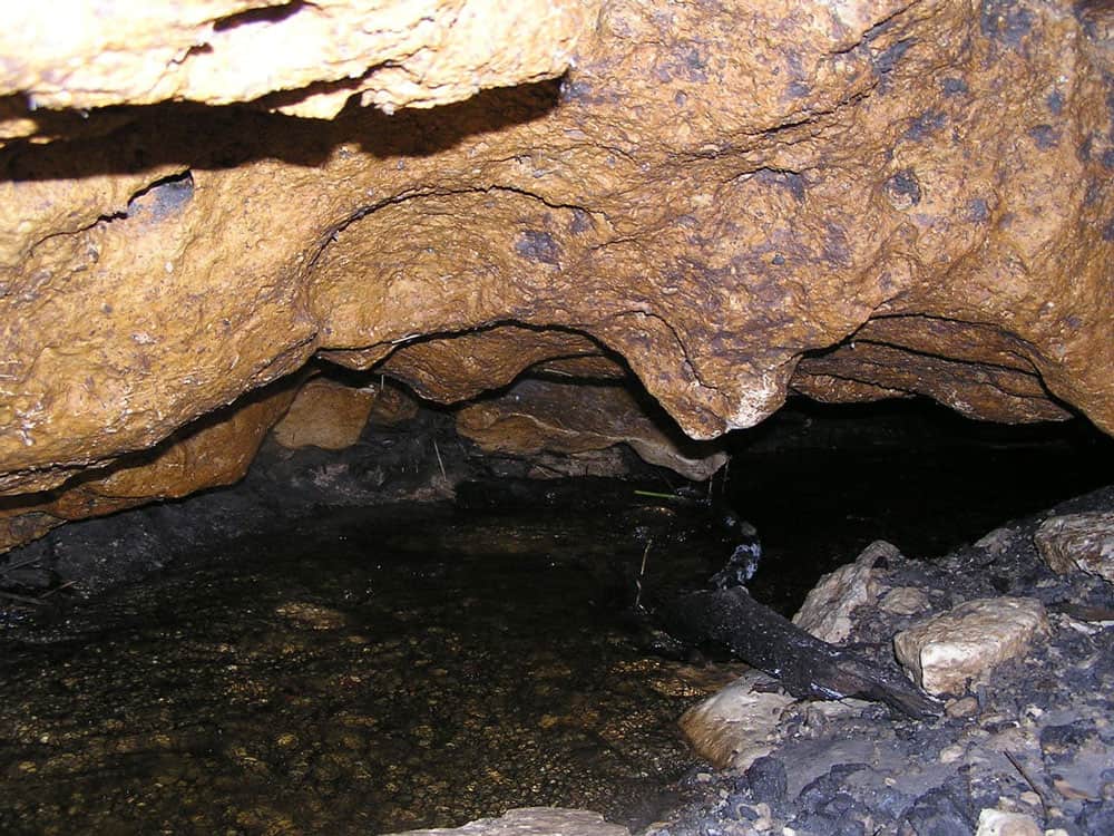
Mapping Underground Features
In recent decades, mapping underground features, such as physical structures or even sounds, has substantially improved.

USGS Releases Two Decades of Land Cover Change for the Contiguous United States
The USGS has updated land cover maps for the conterminous United States, which show how the country's landscapes have changed over the last 18 years.

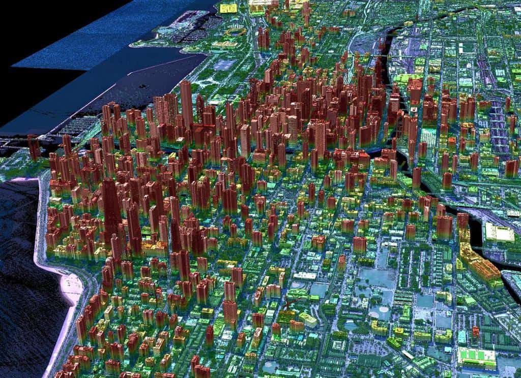
Next-generation Lidar: Seeing the Forest Through the Trees
Next-generation Geiger-mode lidar’s high density and multi-angle looks offer a better chance of seeing through tree foliage to map what's underneath.

2020 Global Land Use Data
A GIS dataset of land cover for the entire world was recently released.

Efforts to Combat Map Vandalism in OpenStreetMap Data
Map vandalism is the deliberate wrong change or update to map data, such as adding an incorrect name for a street or place.

Super-resolution Imaging
Super-resolution is a technique derived from computer vision approaches that tries to increase the quality of an image by employing algorithms and upsampling to improve image sampling.

Mapping Our World, Saving Lives with Humanitarian OpenStreetMap Team
The “Mapping our World: Saving Lives” episode of the AfricaGeoConvo Podcast, examines the world of mapping and volunteering, with Geoffrey Kateregga.
Geiger-mode Lidar and Geospatial Data Acquisition
Paul Nash discuses Geiger-mode lidar and its use in geospatial data acquisition.

Terrestrial Ecoregions GIS Data
The terrestrial ecoregions dataset is available both in shapefile format and as a Google Engine dataset.

Open Geospatial Standards
The creation of geospatial standards is critical for sharing data among different technologies and industries.

Last-Mile Problem: Achieve Pinpoint Accuracy With Hyperlocal Maps
Curated points-of-interest of a hyperlocal mapping and routing solution enable enterprises to lower cancellations and achieve higher map accuracy.

OpenStreetMap: One of the World’s Largest Collaborative Geospatial Projects
OpenStreetMap is a community project with the goal of mapping the world using a crowdsourcing, collaborative method.

Synthetic-Aperture Radar (SAR), Earth Observation, and Mapping
Synthetic-Aperture Radar (SAR) is becoming more widely available and increasingly part of Earth observation satellites.

GIS Data for California Public Schools
California School Campus Database (CSCD) offers a GIS dataset that contains all of the public school locations from K-12 grades for California.

Using GIS to Explore Mars
Esri’s Explore Mars site allows you to explore the surface of Mars and make some basic geospatial measurements.

Monitoring Vegetation Regrowth After Fire With Remote Sensing
Synthetic-aperture radar (SAR) is being used to map post-fire vegetation recovery.

New GIS Dataset on the Interconnection Between Urban Centers and Rural Areas
A freely downloadable GIS dataset – the Urban–Rural Catchment Areas (URCAs) – shows the diversity of urban-rural systems worldwide.
The “Bystander Effect” With Crowdsourcing GIS Data
A recent research article found that users are less inclined to contribute to crowdsourced geospatial sites like OpenStreetMap and Waze if they know others are already contributing.

Atlas of the Human Planet: Free GIS Data and Tools
The Atlas of the Human Planet 2020 provides GIS Data for research, policy, and action that can be used to document the presence of humanity on Earth.
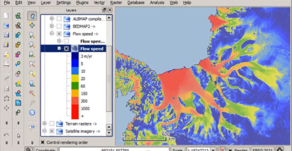
Quantarctica – Free GIS Data for QGIS
Quantarctica is a collection of freely downloadable GIS data for Antartica.

Mapping the Ocean Floor by 2030
A MapScaping podcast episode with NOAA's Samuel Greenaway discusses how mapping the seafloor will be a major challenge this decade.

Google Launches AI powered Tree Canopy Lab
Google is using artificial intelligence to develop maps of tree canopy from its aerial imagery.

The Use of Gravimetry Satellites for Measuring Ice and Sea Level Change
Satellites now allow researchers to make more accurate mass measurements to large areas covered by ice and understand the effects of snow and ice melt on sea level change.

Understanding and mapping ZIP Codes
Resources for accessing ZIP code data. Ben Fry has created zipdecode that shows the location of all the ZIP codes in the United States.

Machine Learning and Object Detection in Spatial Analysis
Picterra offers a relatively easy to use interface that allows users train AI on satellite and aerial imagery to detect features.