
GIS Data
This category contains introductory text about GIS data such as types of error in GIS datasets, types of GIS data (raster and vector), and metadata.

GIS Data of the Moon’s Geology
The USGS has released GIS data from its new Unified Geologic Map of the Moon.

GIS and Migrant Deaths in the United States
Spatial analysis and GIS is being used in the study of migrant deaths to not only better track routes taken but also use results from research to limit deaths and danger to migrants.

What is Snapping in GIS?
Snapping involves connecting a geometric vertex or edges of one feature to another when editing a GIS dataset.

Null Island: Where Geocoding Errors Go to Live
Null Island, a fictional location at the confluence of the Equator and the Prime Meridian, is used for troubleshooting purposes as a way to flag geocoding failures.
Open Repository for Geospatial Training Data Released
Radiant Earth has launched Radiant MLHub, a cloud-based open library for training geospatial data used by machine learning algorithms.

There are Four Trillion Measurements in this Global Sea Surface Temperature Dataset
Researchers have compiled an enormous global dataset with over four trillion satellite-based measurements of sea surface temperature.
MERIT Hydro: A High-Resolution Global Hydrography GIS Dataset
Researchers have developed a high-resolution GIS dataset of river systems using remotely sensed data and OpenStreetMap data.

Creating a Spatial View of the Brain
Mapping small scale but complex organs such as the human brain is requiring new technologies and spatial modeling to be developed.

New Report Values Economic Benefits of Landsat Archive at $3.45 billion
A newly released report from the USGS has estimated the 2017 domestic and international economic benefits of Landsat imagery to be $3.45 billion.
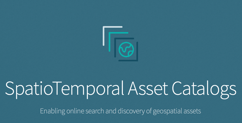
Making Finding Geographic Information Easier: SpatioTemporal Assets Catalogs
SpatioTemporal Assets Catalogs (STAC) provides a common set of search terms so that geospatial information can be found and indexed easily.

Online Landslide Inventory Mapping Tool
The USGS has launched an online web map that compiles existing United States landslide data into a searchable tool called the U.S. Landslide Inventory Map.

Geospatial Data and Sustainable Development Goals
The new initiative, called Data for Now, will see the linkage of Google Earth satellite data and other GIS data with UN data.

Community Involvement in OpenStreetMap
While we often assume that the OpenStreetMap (OSM) community is primarily made up of individuals, large corporations are increasingly active in the development of OSM.

World Bank and Geospatial Data
The World Bank in August 2018 launched the Integrated Geospatial Information Framework, which is seen as a way for GIS data to be provided for governments, NGOs, and companies to make more informed decisions that not only benefit their economies but also enable sustainable development.

New Map Shows How Fast Ice is Leaving Antarctica
Researchers used synthetic-aperture radar (SAR) data to look at how the ice is moving and shifting on Antarctica.

Version 3 of the ASTER Global Digital Elevation Model Released
2.3 million scenes from the ASTER archive were processed to create the latest version of the ASTER Global Digital Elevation Model (GDEM).

3 Ways Geospatial Data is Changing the Way We Manage the Environment Around Us
Dr. Michael Flaxman, director of Geodesign Technologies and Geospatial Community Advocate for OmniSci, presents three example of how newly available geospatial data is being leveraged.

NASA is Expanding its Worldwide Landslide Data Catalog Using Volunteers
NASA has developed Landslide Reporter as a way to collect as much information as possible about landslides from citizen scientists from around the world.

New GIS Dataset: Forest Carbon Stocks for the Western United States
Covering 11 states, this GIS dataset contains annual estimates of carbon stocks, fluxes, and productivity for Arizona, California, Colorado, Idaho, Montana, Nevada, New Mexico, Oregon, Utah, Washington, and Wyoming.

Changes to the National Land Cover Database
The National Land Cover Database is a GIS dataset that is seen as critical for monitoring the impact of fires, particularly increased wildfires in the West, general health of ecosystems, biodiversity monitoring, and increasing effects of climate change on land cover.

GIS and the US 2020 Census
The 2020 Census promises to be the most technically advanced census undertaken, where data, for the first time, will be mostly collected online.

First Data from NASA’s GEDI Program to 3D Map Forests
The first set of data that have returned have demonstrated GEDI is able to measure density of forests far better than previous satellite missions.

2018 NAIP Imagery
Aerial imagery covering 20 states has been added to the USDA's direct access site for NAIP imagery.

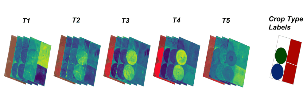
Mapping Land Cover by Stacking Landsat Imagery
Landsat 8 is offered as free, open data, which has led to new innovation in methods to better utilize such data for time series and complex scenes that are sometimes obstructed by clouds or dust.

36,500 Satellite Images from RADARSAT-1 Now Available to the Public
The Canadian Space Agency and the Canada Centre for Mapping and Earth Observation have released RADARSAT-1's archive of 36,500 satellite images to the public.

UK Satellite Data Now Available to Those Working in the Public Sector
The UK Space Agency has announced that its radar and satellite imagery data will be made available to those working in the UK public sector.