
Spatial Analysis
The spatial analysis category looks at data manipulation techniques in GIS.

GOCE Gravity Mapping Mission Has Ended
GOCE, which stands The Gravity field and steady-state Ocean Circulation Explorer was launched with the purpose of mapping the Earth's gravity field at a high level of detail.
Using Remote Sensing to Combat Poverty
Remote sensing, the practice of gathering information about objects without being physically near them, has had many practical uses for ...

Landsat 8
NASA has continued its long running earth observation data collection with the launch of Landsat 8.

Analyzing Bike Sharing Demand with GIS
To study the best citing of bike stations in New York City for a bike sharing program, the NYC DOT used GIS data and geospatial analysis.
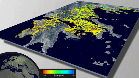
Using Remote Sensing to Measure Land Deformation
The European Space Agency has developed a new land data processor to create maps of land deformation. Called Wide Area Processor ...

Line of Sight in GIS
Line of sight is a GIS analysis that shows the line of visibility from one point across a terrain.
Spatial Analysis in GIS
Geographic information systems uses spatial analysis in order to understand geographic questions. Listed here are geographic analysis commonly performed in GIS.

Statistical Surfaces in GIS
This looks at some statistical analysis in GIS. A statistical surface is any geographic entity that can be thought of as containing a Z value for each X,Y location.

Tracking Global Vegetation with Micro-Satellite Proba-V
The ESA, also known as the European Space Agency, has managed to do a lot of amazing feats in the ...
Change Detection in GIS
Change detection in GIS is a method of understanding how a given area has changed between two or more time ...
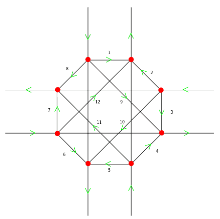
Turn Restrictions Simplified
Tim Hirrel takes a look at a new method for implementing turn restrictions in GIS street data.
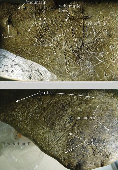
Geoarchaeology
Geoarchaeology uses geospatial technologies such as GIS in combination with human, physical, and environmental concepts pulled from Geography and Geology.

Using GIS to Showcase College Acceptance
Every June, my local paper is filled with the local private school announcements containing lists and lists and lists of ...

Distance Decay and Its Use in GIS
Distance decay is a phenomenon observed between locations or ethnic groups- the further apart they are, the less likely it is that they will interact very much. Distance decay theory in GIS can be used for other purposes such as the effects of time and distance on public transportation ridership, crime analysis, and health care.

Analysis Finds Three Times More Farmers’ Markets in Areas with the Lowest Obesity Rates
An independent analysis conducted by mapping analytics firm PetersonGIS shows that locations with the highest obesity rates contain the fewest farmers’ markets.

Ice Mapping App for Smartphones
The European Space Agency has released a new iOS app for accessing ice data from the ESA's CryoSat mission.

Using Unmanned Aerial Systems (UAS) for Remote Sensing of Archaeological Sites
Unmanned vehicles are becoming more widely available both in the military and civilian sectors for their usefulness for remotely acquiring ...

Understanding the Earth’s Gravity with ESA’s Swarm Satellites
The European Space Agency will be launching three satellites next year with the objective of studying the earth's gravity.
Urban Heat Island Analysis
Remote sensing methods are being used to monitor thermal radiation in European cities. Hardscape surfaces such as roof tops and ...
Finding Lost Pyramids with Satellite Imagery
An Egyptologist analyzed satellite imagery to identify over 17 pyramids, 1,000 tombs, and 3,000 ancient settlements previously unknown.

Using GIS to Pinpoint Osama bin Laden
A UCLA report revealed the results of a GIS study on emphasizing the likely location of Osama bin Laden.

2010 Mean Center of Population for the United States
The official mean population center for the United States as of April 1, 2010 is a location near the town of Plato in Missouri.

Geographic Profiling
The geographic profiling concept proposes that criminals tend to commit acts of crimes within a comfort zone located near but not too close to their residence.

The World in 2050
Dr. Laurence Smith, a professor with the Department of Geography at UCLA, has a new book out called "The World in 2050: Four Forces Shaping Civilization's Northern Future."
Geostatistics Resources
Geostatistics is a brand of statistics that deals specifically with spatial relationships. Find information about this branch of mathematics, software ...
Remote Sensing Principles
Online tutorials and articles on what remote sensing is, digital imagery analysis and applications.