
Caitlin Dempsey

Uses of GIS/GPS in the Space Shuttle Columbia Debris Recovery
On February 1st 2003, the Space Shuttle Columbia was destroyed upon re-entry to the earth’s atmosphere. During its re-entry into ...

How to Get Rid of that Pesky “missing (jsForm.htm)” Message in ArcIMS
Here's a quick solution to remove the "missing (jsForm.htm" message from ArcIMS.
Basic Guide to ArcXML
With the release of ArcIMS, ESRI’s map server software, GIS users were also introduced to ArcXML. ArcXML is ESRI’s flavor ...

Basics of ArcView 3.x Customization
There are some simple concepts that you can learn to do basic modifications of ArcView 3.x.
Crime Mapping: GIS Goes Mainstream
“I can cut crime in half in any city in this country.” So uttered are the first words of Police ...
Jason-1 – Measuring Ocean Topography From Space
Jason-1 is a satellite to be jointly operated by NASA and CNES (Centre National d’Etudes Spatiales), the French space agency. ...
Learning Java – A GIS Perspective
If you examine the GIS industry you will find a great diversity of applications of the technology, from business geographics ...

Using GPS to Monitor the Earth’s Movement
A network of research stations located across Southern California and Baja California was created in 2011 in order to detect minute movements of the earth.

Notes from the Conference – ESRI’s 21st Annual User Conference
The 21st annual ESRI User Conference is being held this week in San Diego, California with over 11,000 GISers representing 110 countries in attendance.

The World in a Box
This is an excellent video to show people who want to understand what GIS can do and how it affects them.
U.S. Census 2000 – Population Trends Mapped
As the numbers are released from the 2000 United States Census, mapping the data helps clarify the nationwide trends in ...
GIS 2000: A Brief Look Backwards
While anticipating the events of 2001, this article takes a brief look at some of the notable GIS and geospatial events of 2000.

Campaign 2000 – the Recount
A spatial look at the nail biting vote recount in Florida that will decide the winner of the 2000 U.S. presidential election.

Campaign 2000 – A Cartographic Perspective
A look at the 2000 US Presidential election through campaign maps.

Gateway into Bali
Gateway into Bali is an interactive, guided tour of GIS using this colorful Indonesian island as the backdrop.
How to Create a Password Login For ArcView 3x
If you want to require users to login with a password before being able to use ArcView here's a simple way.
Creating Html Pages on the Fly Using Avenue
You can use Avenue to write html code in order to create html pages on the fly. In the Avenue ...
National Map Accuracy Standards (NMAS)
Definition: Standards established in 1941 by the U.S. Bureau of the Budget to set accuracy standards for all federally produced ...
Linking MS Access With ArcView 3.x Using Avenue
The two sections of code in this article focus on using Avenue to interact with MS Access to extract and use data with ArcView.

The Geography Network
Esri launched the Geography Network as a collaborative system for sharing digital geographic information on the internet.
How to Add a Custom Symbol to Arcview 3x
This article will show you in easy to follow steps how to add your own image file to ArcView 3x in order to create a custom symbol.

Geography of Fortune 1000 Companies
Data gathered from two thousand year Fortune 1000 Company ranking was mapped in order to look at any spatial patterns in their locations.
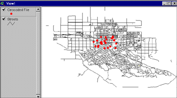
Geocoding Primer
This tutorial explains how to geocode using Esri's ArcView 3.x GIS software.
Number of Year 2000 Fortune 1000 Companies by State
Number of Fortune 1000 companies categorized by state for the year 2000. The list of total count of Fortune 1000 ...
Fortune 1000 Companies By State for the Year 2000
Listed below are the Fortune 1000 companies listed by state for the year 2000. Each records lists the company name, ...
How to Change Default Directories in ArcView 3x
After using ArcView 3x you’ve probably noticed the directory defaults. You can easily change the default temp directory, the first directory ...