
ArcGIS Pro

Create a Bathymetric Map Using ArcGIS Pro
This step-by-step GIS tutorial shows you how to create a bathymetry map using ocean data from GEBCO.

Mapping Buildings in 2.5D Using ArcGIS Pro
Learn how to find and use building footprint data from OpenStreetMap to create a 2.5D map in ArcGIS Pro.
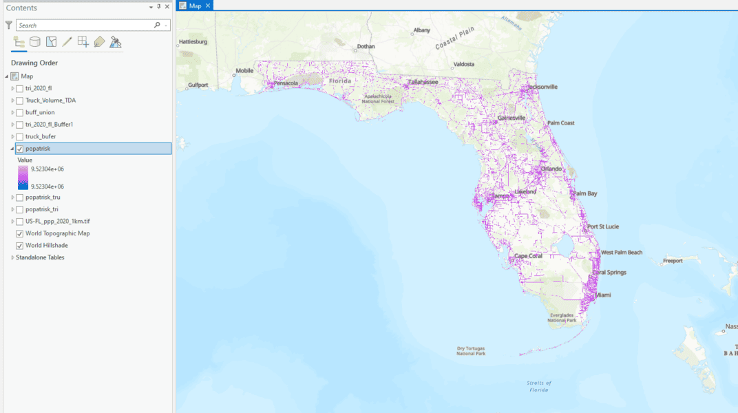
How to Use ArcGIS Pro to Determine the Population Impacted by Air Pollution
Learn to estimate air pollution's impact on people with geospatial methods using ArcGIS Pro and data from Toxic Release Inventory, Worldpop, and ArcGIS Hub.
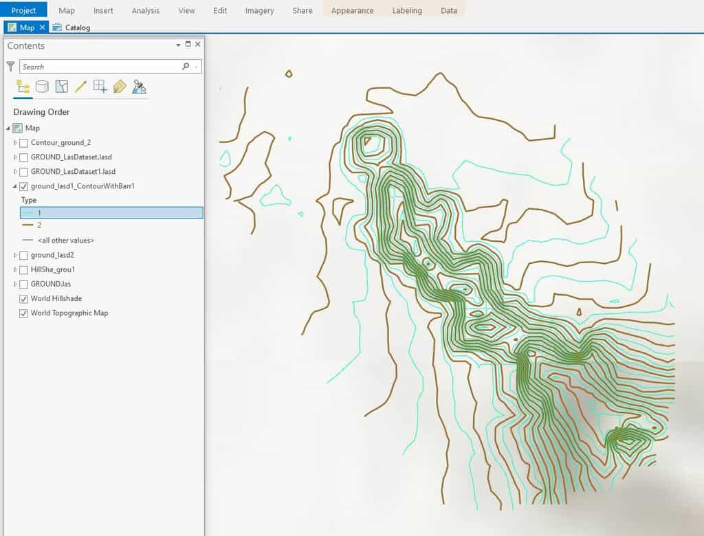
How To Create Contours in ArcGIS Pro from LIDAR Data
This ArcGIS Pro tutorial shows how to add LIDAR data from the National Map to ArcGIS Pro and create topography contours.
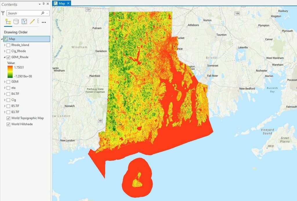
How to use ArcGIS Pro and Landsat 8 Imagery to Calculate Chlorophyll Index and Global Environmental Monitoring Index
Learn to create a chlorophyll index using Landsat 8 imagery in ArcGIS Pro with this step-by-step GIS tutorial.

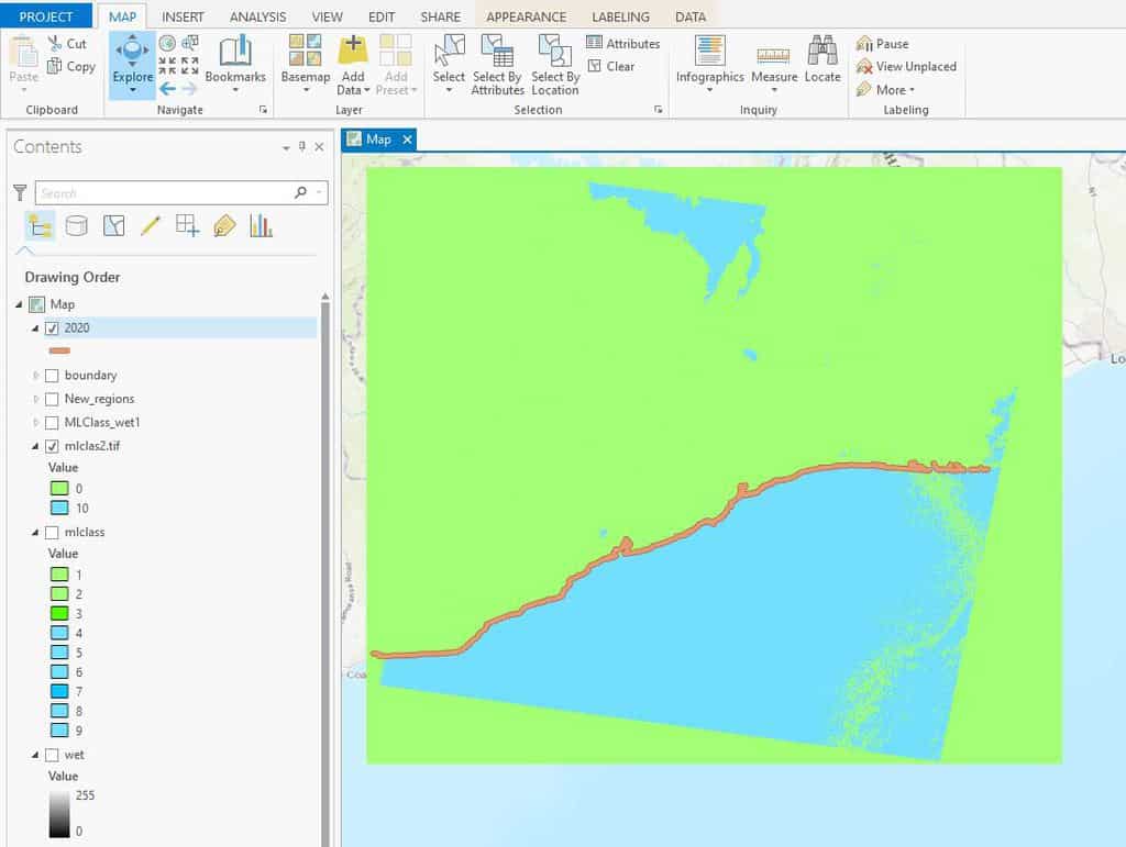
How to Use ArcGIS Pro for Supervised Classification
This ArcGIS Pro tutorial provides a step-by-step guide for performing supervised classification on Landsat 8 imagery using remote sensing and GIS techniques.

How to Use ArcGIS Pro to Estimate Soil Erosion from a Catchment Basin
This lesson shows how to use spatial data science and remote sensing techniques in ArcGIS Pro to predict soil erosion in a catchment area using the Universal Soil Loss Equation (USLE).

How to Use ArcGIS Pro for Fire Risk Mapping
Tutorial showing how to map fire risk for a region with slope, elevation, aspect, and land use data in ArcGIS Pro.
How to Use ArcGIS Pro for Automatic Shoreline Delineation from Landsat Imagery
Learn how to extract shorelines in ArcGIS Pro using the Tasseled Cap and NDVI indices with the Landsat toolkit for automatic shoreline delineation.

How to Perform a Site Selection Analysis in ArcGIS Pro
Using this tutorial, ArcGIS Pro users will learn how to do a site selection analysis, which includes analyzing travel times and accessibility to a location via various modes of transportation.

How to Use ArcGIS Pro to Map Flood Susceptibility
This tutorial makes use of spatial data science and remote sensing techniques to assess the susceptibility of floods using ArcGIS Pro.
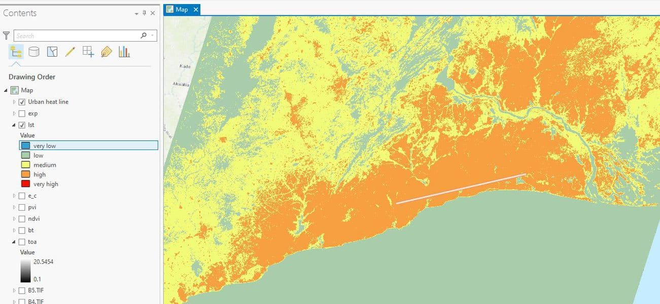
How to Use ArcGIS Pro to Map Urban Heat Islands
This ArcGIS Pro tutorial demonstrates how to assess urban heat in a region.

How to Use ArcGIS Pro to Estimate Areas Prone to Malaria
This tutorial uses Spatial Data Science and Remote Sensing techniques (ArcGIS Pro) to estimate areas that are prone to malaria using ArcGIS Pro.
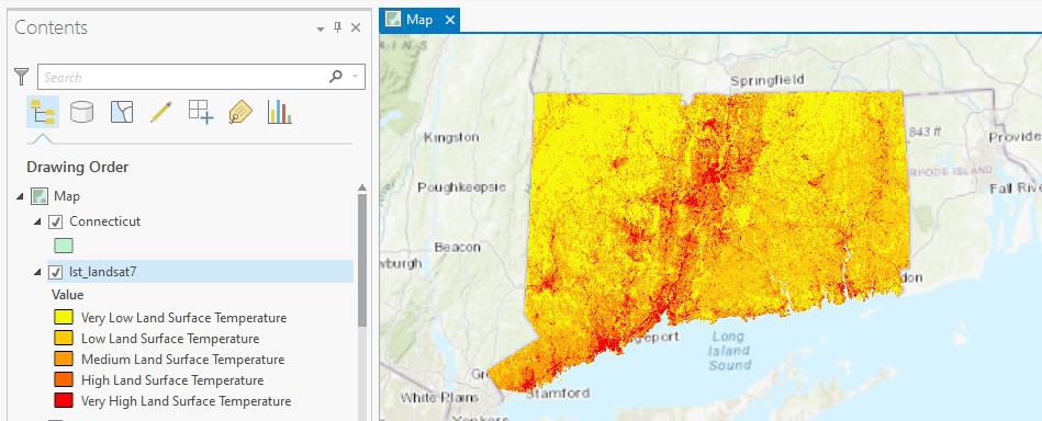
How to Use ArcGIS Pro to Calculate Land Surface Temperature (LST) from Landsat Imagery
This ArcGIS Pro tutorial utilizes spatial data science and remote sensing techniques to calculate land surface temperatures using Landsat imagery.

How to Use ArcGIS Pro to Assess Landslide Susceptibility
This tutorial explains how landslide susceptibility can be assessed using ArcGIS Pro.