
Esri
Learning GIS Programming
Having some competence in programming has become a critical requirement for many geospatial positions. So which languages should you learn for GIS programming?
GIS Tutorials
Online GIS tutorials from Geography Realm for mapping and data analysis.

Create a Bathymetric Map Using ArcGIS Pro
This step-by-step GIS tutorial shows you how to create a bathymetry map using ocean data from GEBCO.
Free GIS Books
Most of these free GIS books are available in downloadable PDF format and can be read from a computer or on an eBook reader.
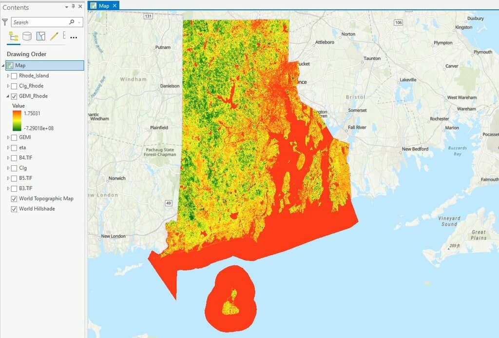
How to use ArcGIS Pro and Landsat 8 Imagery to Calculate Chlorophyll Index and Global Environmental Monitoring Index
Learn to create a chlorophyll index using Landsat 8 imagery in ArcGIS Pro with this step-by-step GIS tutorial.

GIS in Land Use Planning and Surveying
Michael Parks explains how he used GIS data and imagery to develop geospatial analysis and maps to recommend potential base camp sites.

Using ArcGIS Online to Manage Content
With the Item Report Dashboard from GEOACE, you can use out-of-the-box tools in ArcGIS Online to manage content within an organization.

Using GIS to Explore Mars
Esri’s Explore Mars site allows you to explore the surface of Mars and make some basic geospatial measurements.

Halloween GIS Fun
Looking to add a little geo to your Halloween beyond the proliferation of Halloween Trick or Treater online maps? Halloween ...

Building a Model with ArcGIS ModelBuilder Saves Time
Emmanuel Jolaiya shows users how to use ArcGIS ModelBuilder to develop a model for for analyzing and manipulating GIS Data.

An Introduction to ArcGIS ModelBuilder
In this overview, Emmanuel Jolaiya introduces readers to ModelBuilder in ArcGIS which can be used to build models for analyzing and manipulating GIS Data.
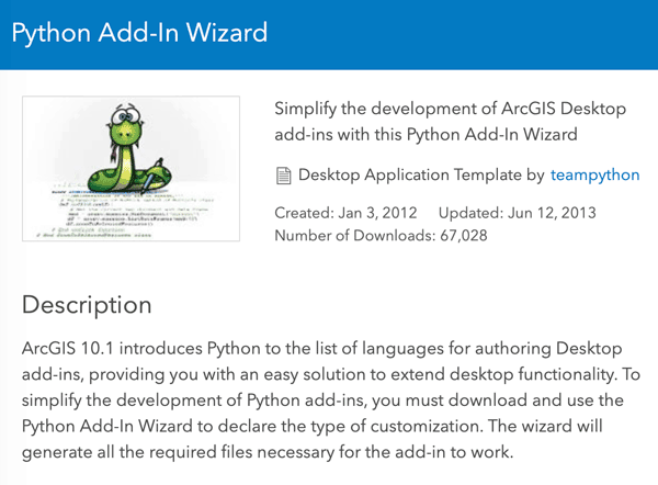
Customize ArcMap with Python Add-Ins
Daniel Fourquet walks users through the process of using Python to create Add-Ins for ArcMap.

How Advances in Computer Mapping Shaped the Early Days of GIS
Greg Bunce, from the State of Utah’s Automated Geographic Reference Center, presents a walk through the history of mapping and geospatial advances that led to the early days of GIS.

Latest Release of ArcGIS Online Introduces New Features and Enhanced Capabilities
Bernard Szukalski, Esri tech evangelist and product strategist, introduces new features and enhancements to the latest release of ArcGIS Online.

Guardacostas Pro: Tracking Illegal Vessels
Argentina’s coast guard, or the Prefectura Naval Argentina will utilize Esri’s platform to create a new, real-time tracking system, aptly titled “Guardacoastas Pro.”

What is a MXD File?
Files with the extension .mxd are ArcMap document files and stands for Map Exchange Document.

St. Patrick’s Day Maps and Geography
Find maps about Irish surnames and the geography of St. Patrick's day from the US Census.

Understanding What Six GIS/Map Software Providers Offer
Matt Sheehan from WebMapSolutions is posing a series of six questions to six GIS/map software companies (Pitney Bowes, Esri, Mapbox, Carto, GIS Cloud, and Boundless) to understand their similarities and differences in product offerings.

How GIS Helps Drive Hydrography Data
There are more high resolution maps of the Moon and Mars, than the seafloor.

Secure Geocoding
World Geocoder for ArcGIS allows users the ability to secure map out addresses and locations from behind a firewall.

Free Trial of Drone2Map: Turn Drone Imagery into GIS Ready Data
Esri has released its beta version of Drone2Map will enables user to quickly develop GIS ready data from drone imagery.

WalMap: The App By Walgreens That Maps Out Community Trends in Real Time
Walgreens uses GIS to power its Flu Index Map, visually tracking flu spread for better healthcare decisions and increased public awareness.

A Brief History of GIS
From the early days in Canada to the high tech world of internet mapping, the field of GIS is older than you may think.

Keys to Successfully Managing GIS Data Health and Quality
Jennifer Kennedy, a GIS Analyst at Timmons Group discusses the importance of managing GIS data quality and some GIS solutions for managing GIS data and ensuring its integrity.

Geodesign to Create Smarter Cities and Adaptable Landscapes
Nadia Amoroso writes about geodesign and the geodesign technology platform offered by Esri as it pertains to Smart Cities.

Esri Launches Site to Find Open Data
Esri has launched ArcGIS Open Data as a portal for users to search, download, and visualize open data: Since July 2014, ...