
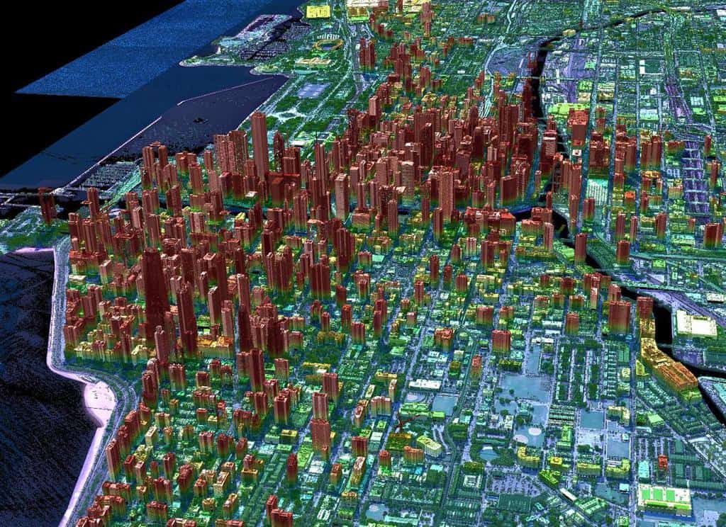
LiDAR

Overview of Elevation Data
This article reviews some of terminology and types of elevation based datasets available to GIS.
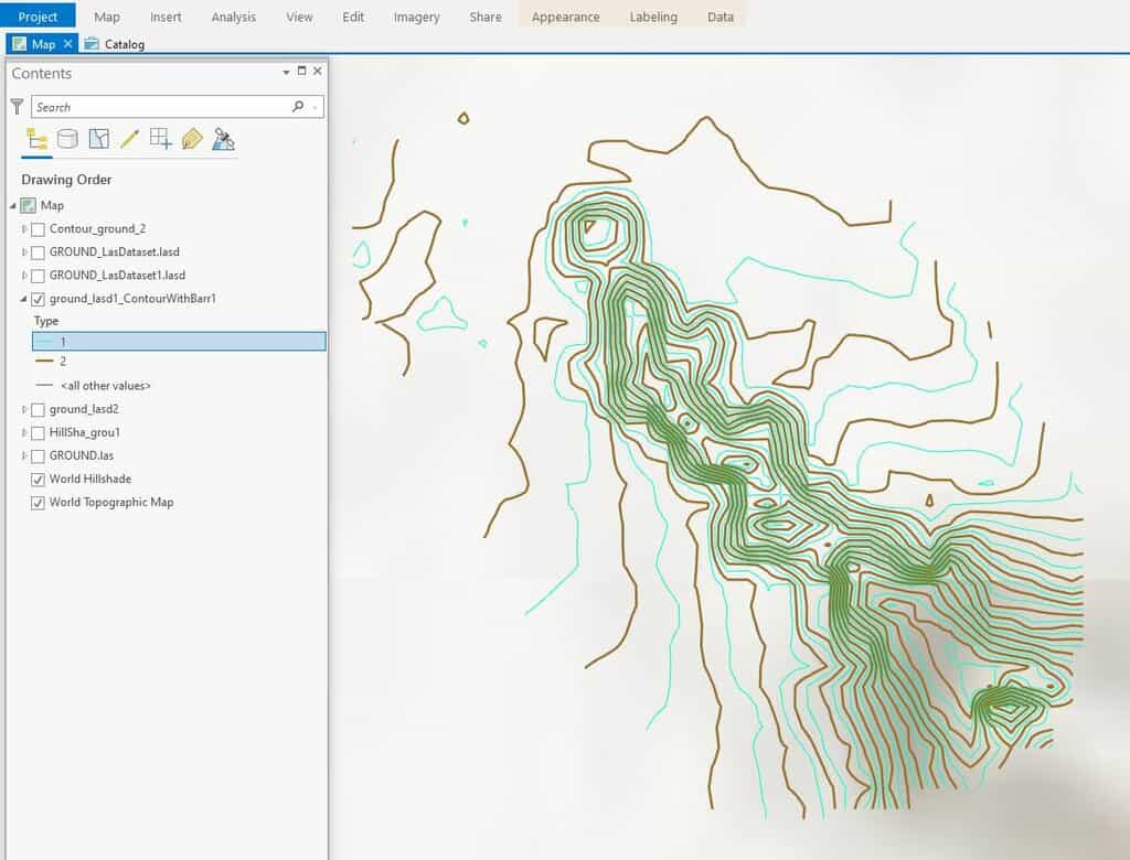
How To Create Contours in ArcGIS Pro from LIDAR Data
This ArcGIS Pro tutorial shows how to add LIDAR data from the National Map to ArcGIS Pro and create topography contours.

Lidar Explained
Lidar is a technology developed to map the elevation of features on and below the surface of the Earth.

Next-generation Lidar: Seeing the Forest Through the Trees
Next-generation Geiger-mode lidar’s high density and multi-angle looks offer a better chance of seeing through tree foliage to map what's underneath.
Geiger-mode Lidar and Geospatial Data Acquisition
Paul Nash discuses Geiger-mode lidar and its use in geospatial data acquisition.

The Earth Archive Project and 3D Mapping the Earth
The Earth Archive Project, launched in 2019, is a project that will provide a detailed 3D map of the entire Earth.

Mapping the Entire Surface of the Earth with LiDAR
A project called the Earth Archive plans to use Light Detection And Ranging (LiDAR) to map the entire surface of the Earth.

Understanding LiDAR Technologies
This article presents insights from the new IDTechEx report titled “Lidar 2020-2030” IDTechEx report.

3 Ways Geospatial Data is Changing the Way We Manage the Environment Around Us
Dr. Michael Flaxman, director of Geodesign Technologies and Geospatial Community Advocate for OmniSci, presents three example of how newly available geospatial data is being leveraged.

First Data from NASA’s GEDI Program to 3D Map Forests
The first set of data that have returned have demonstrated GEDI is able to measure density of forests far better than previous satellite missions.

3D Map of Puerto Rico’s Forest Shows How Hurricane Maria Reduced Tree Height
Researchers who compared before and after LiDAR measurements of Puerto Rico's tropical forests found that Hurricane Maria damaged or uprooted 40-60% of the tallest trees.

How Collecting LiDAR is Being Supported by the USGS 3D Elevation Program
Quantum Spatial (QSI) is currently working on more than two dozen LiDAR collection projects in support of the 3DEP. Here’s a look at three of the projects QSI has worked on in 2018.

Seeing the World with Data: 3D LiDAR with MapD and Uber’s deck.gl
Dipti Kothari, an intern with MapD, has developed an open source project that uses LiDAR to create a 3D visualization of tree coverage around buildings and the impact of rising sea levels on buildings on Jekyll Island, GA.

Spatial Challenges of Navigating Rural Roads for Self-Driving Cars
Researchers from MIT are testing the use of GPS and LiDAR to enable autonomous navigation in rural areas lacking detailed 3D maps.

LiDAR: Light Detection And Ranging
LiDAR systems are used to collect high resolution topographic and bathymetric data.

When Predictions Match Reality: The Power of LiDAR for Flood Warnings
LiDAR data is being used to develop highly accurate elevation-enabled flood inundation mapping in advance of major storms in North Carolina.

How LiDAR is Being Used to Help With Natural Disaster Mapping and Management
Michael Shillenn, vice president and program manager with Quantum Spatial outlines three projects where LiDAR data from the USGS 3D Elevation Program (3DEP) has been used to assist in planning, disaster response and recovery, and emergency preparedness.

Using GIS in Landscape Archaeology
Landscape archaeology is a discipline where space is critical to understanding ancient settlements and human use of ancient space. The use of GIS is steadily growing as a tool in this field.

How GIS Helps Drive Hydrography Data
There are more high resolution maps of the Moon and Mars, than the seafloor.

Using LiDAR to Show How Native American Depopulation Impacted Forests in the United States
Researchers have used LiDAR to understand the impacts of Native American population decline on forest fires in the United States.

Cartography of an Oregon River
Dan Coe used a geospatial technology called LiDAR to map changes in the flow of the Willamette River in Oregon.

Extracting 3D GIS Data
This piece by Anil Narendran Pillai, Vice President of Geomatics at SBL, takes a look at 3D GIS data creation using feature extraction methods.

LiDAR and Rail Utility Mapping and Digital Asset Preparation
Venugopalan Nair, Senior Manager, SBL, discussed why LiDAR is an efficient and quick technology for mapping rail utilities.

Smart Tree Logging with Remote Sensing
Treemetrics is using satellite imagery, UAV, and LiDAR to help forestry managers to map out forests in order to better assess the quality and value of their forests and to cut down on waste.
LiDAR and the Archaeology Revolution
Through the use of LiDAR, archaeologists are now able to uncover more of the ‘lost’ New England of subsistence farming from the 1700s.

Wearable Cartography – Portable Mapping System
Researchers from MIT’s Computer Science and Artificial Intelligence Laboratory have developed a portal mapping system that transmits remotely a digital map ...