
Articles

Plaid Avenger’s World Geography Book
John Boyer created a comic-book style geography book.

OneGeology Project: Mapping the Planet
The "OneGeology Project," a global consortium of scientists and organizations, aims to map the entire planet's geology in an ambitious endeavor.

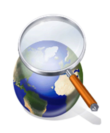
Neogeography
Neogeography means “new geography” and consists of a set of techniques and tools that fall outside the realm of traditional GIS, Geographic Information Systems.
New Perspectives on Urban Land Use Change
As Population Grows, So Do Urban Areas New Perspectives on Urban Land Use Change Over 300 million Americans have to live ...
Methods for Creating Spatial Databases
There are several ways in which to bring spatial data into a GIS. This article provides a brief overview of some of the more common methods for creating vector GIS data.
Fixing Segmentation Violations in ArcView 3.x
If you’ve tried to open an ArcView 3.x project (.apr) and gotten the “segmentation violation” error, it can be very ...

The Components of GIS Evolve
This article discusses the proposed six components of GIS.

How to Label More Than One Field in ArcMap
You can easily label more than one field of a layer in ArcMap with Visual Basic script.
Orthophotos and GIS
Aerial photographs play an important role in GIS data acquisition and visualization. First, they help provide a solid visual effect. ...
Spatial Data Mining
Data mining is the automated process of discovering patterns in data in order to find correlation among different datasets that are unexpected.

Uses of GIS/GPS in the Space Shuttle Columbia Debris Recovery
On February 1st 2003, the Space Shuttle Columbia was destroyed upon re-entry to the earth’s atmosphere. During its re-entry into ...

How to Get Rid of that Pesky “missing (jsForm.htm)” Message in ArcIMS
Here's a quick solution to remove the "missing (jsForm.htm" message from ArcIMS.

Military Applications of GIS
Military forces use GIS in a variety of applications including cartography, intelligence, battle field management, terrain analysis, and remote sensing.

Java For Newbies – A GIS Perspective
Learn about what Java is and how to use it in GIS.
Impressions of a GIS Intern
Anthony Calderon, a GIS intern with the City of Santa Clarita and a Geography student at California State University, Northridge, shares his experiences.
Basic Guide to ArcXML
With the release of ArcIMS, ESRI’s map server software, GIS users were also introduced to ArcXML. ArcXML is ESRI’s flavor ...

Basics of ArcView 3.x Customization
There are some simple concepts that you can learn to do basic modifications of ArcView 3.x.
Crime Mapping: GIS Goes Mainstream
“I can cut crime in half in any city in this country.” So uttered are the first words of Police ...
Geography Markup Language (GML) 2.0 – Enabling the Geospatial Web
Ron Lake is the President of Galdos Systems Inc., a company that provides advanced software tools to enable the delivery ...
Jason-1 – Measuring Ocean Topography From Space
Jason-1 is a satellite to be jointly operated by NASA and CNES (Centre National d’Etudes Spatiales), the French space agency. ...
Learning Java – A GIS Perspective
If you examine the GIS industry you will find a great diversity of applications of the technology, from business geographics ...

Using GPS to Monitor the Earth’s Movement
A network of research stations located across Southern California and Baja California was created in 2011 in order to detect minute movements of the earth.

Notes from the Conference – ESRI’s 21st Annual User Conference
The 21st annual ESRI User Conference is being held this week in San Diego, California with over 11,000 GISers representing 110 countries in attendance.
Java Map Servers and GIS Toolkits – Reporting from JavaOne
This article comments on some of the Internet map servers and GIS toolkits offered by GIS companies at JavaOne.

The World in a Box
This is an excellent video to show people who want to understand what GIS can do and how it affects them.
U.S. Census 2000 – Population Trends Mapped
As the numbers are released from the 2000 United States Census, mapping the data helps clarify the nationwide trends in ...