
Articles
Mapping via Cell Phone in Brazil
A Brazilian non-profit by the name of Rede Jovem (meaning roughly “Youth Net”) is helping to map the slums or ...

First American Spatial Solutions and Parcels
FASS has promoted their ParcelPoint® GIS database and associated technologies, featuring a nationwide parcel database with over 120 million parcels, now approaching 122 million, as highlighted by their vice president and general manager, Scott Little.
To What End, GIS?
Don Meltz blogs his thoughts on the myth of the GIS professional in his post, “GIS is Dead – Long ...
Walk Score To Go Open Source
Walk Score is preparing to go open source which they announced on their blog and in a press release.. At ...
Digitizing Using ArcGIS
This tutorial reviews basic digitizing using the editor toolbar in ArcGIS desktop.
American Red Cross Uses Trimble Technology and RDMS to Speed Hurricane Disaster Relief
Since 1881, the American Red Cross has been the United State’s premier emergency response organization. In addition to offering neutral ...
NASA Drone Mapping Earthquake Faults
Wired has a pictorial on the latest effort by NASA to map California’s earthquake faults: In hopes of understanding California’s ...
Preserving Geospatial Data
Digital Preservation Coalition has released a new publication in its series of Technology Watch Reports: Preserving Geospatial Data by Guy ...
LiDAR Resources
Find resources, tutorials and tools for working with LIDAR (Light Detection and Ranging) elevation data, particularly within the GIS environment.
Congressional Report on GIS
In June 2009, the CRS published a report, "Geospatial Information and GIS: Current Issues and Future Challenges," providing an overview and analysis of GIS-related subjects.

Topographic Map of the Earth Released
NASA has release of the most complete topographic data of the earth with 99% of the surface mapped.
Remote Sensing Principles
Online tutorials and articles on what remote sensing is, digital imagery analysis and applications.
Five Themes of Geography Explained
The Five Themes of Geography started out as a framework for making geography accessible to kids from kindergarten to high ...

Relief Shading
There are different methods for achieving a shaded relief map and resources for understanding this cartographic technique are listed here.

This Satellite Image of Algae Bloom Looks Like a Painting
Satellite imagery can show us fantastic and beautiful views of Earth. This image captured on November 22, 2008 shows vibrate ...

Implementing GIS
Implementing GIS is intricate. Factors like user base, funds, accuracy, and area of interest must be assessed before adopting GIS software. #GIS #Implementation

Heidelberg-3D – Interactive 3D City Mapping Based on OGC Standards
The inaugural version of the interactive 3D city information system, Heidelberg-3D.de, was launched online, offering free access to anyone.

Online Mapping is Not the Death Knell for Maps
Despite fretting by some, the rise of online mapping is not end of cartography and map making as we know it.
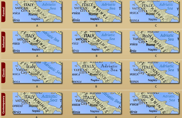
TypeBrewer – Font Tool for Cartography
TypeBrewer is a Flash application that “offers a quick and easy way to explore typographic alternatives and see the impact ...
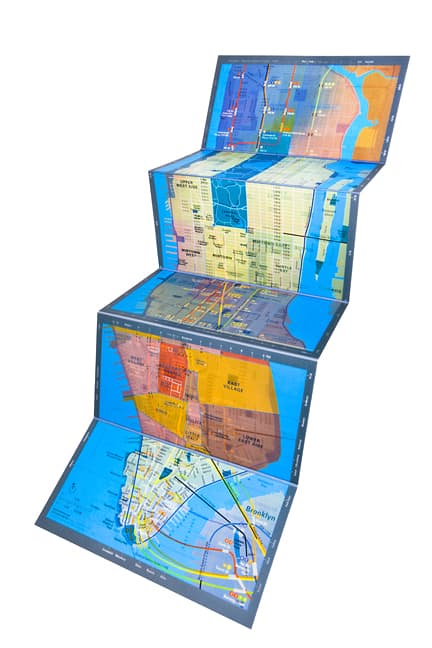
As Dynamic as Paper Maps Get
Panamap is a physical map that uses layered plastic sheets to display three distinct map views on a single page.

Fighting snowmelt with a windshield
Geographer Hans-Joachim Fuchs is convinced that the use of windscreens to funnel katabatic winds (cold winds that blow downhill) in ...
XML – eXtensible Markup Language
XML is a web-based language used to interact data behind the scenes. With projects like GML by the Open GIS ...

Early Tidbits from the 2008 ESRI User Conference
Updates from the 2008 annual Esri User Conference
Using Location Intelligence, Office Max Grows Business and Improves Operations
Mapinfo has provided a case study on location intelligence in the retail sector with this article on OfficeMax’s use of ...
The Many Names of Crowdsourcing GIS
The advent of tools that invite and encourage even non-GIS trained users to provide geographic data and mapping in a ...