
Physical Geography
Physical geography focuses on geography as an Earth science (and is sometimes called Earth System Science).
Physical geography is a branch of geography that focuses on the study of the natural features and processes of the Earth’s surface. It includes the examination of landforms, climate, vegetation, soils, and water resources. Physical geographers use a range of scientific methods and tools to analyze and understand the complex interactions between the Earth’s physical systems.
Learn about the different branches of geography that fall under the physical geography category: climatology, geomorphology, biogeography, and more.

Using Ancient DNA to Reconstruct Past Ecosystems
Two-million-year-old DNA from Greenland's permafrost reveals a rich ancient ecosystem, including mastodons, showing past climate impacts and adaptation.
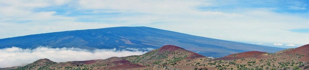
Geography Facts About the World’s Largest Active Volcano
Hawaii's Mauna Loa is the world's largest subaerial volcano as well as the world's largest active volcano.

Lake Effect Snow
Lake effect snow can occur when dry, cold air moves across a vast lake with warm waters, resulting in a snowfall event.

History of Artificial Coral Reefs
Researchers have found success in using submerged ships and other artificial structures to help build coral reefs.

Geography of Kansas
Flat expanses, badlands, rolling hills, cuestas, and canyons shape Kansas' geography.

Geography of Coral Reefs
Learn about how coral reefs are formed, their growth, distribution, and the looming threats they face from environmental changes.

Geography Definitions Related to Water
Listed here are geography terms related to water bodies such as lakes, rivers, and oceans.

Mapping Bee Populations: Understanding Distribution and Conservation
Scientists use spatial science to monitor bee populations and address declines caused by insecticides, habitat loss, and climate change.

Mapping Caves
Mapping caves has proved difficult, especially vast, complicated caves that can span for kilometers underground.

How Reintroducing Wolves Changed Yellowstone National Park
Scientists have documented the trophic cascade effect of reintroducing wolves to Yellowstone National Park.

Mapping Small Bird Migrations
Our understanding of bird migrations is changing as a result of tracking devices on birds, especially for small bird species.

Earth at Night
Nighttime lighting is when the effect of humans on the environment is especially pronounced.

Visual Geography: the Shape of Land Near the Oceans
A visual dictionary of geography words that describe the shapes of land near ocean water.

The Global Evaporation of Lakes
Researchers used satellite imagery and modeling to calculate the evaporation volume across over 1.42 million natural and artificial lakes.

Tallgrass Prairie
The American Tallgrass prairie was once one of the largest and most diverse continuous ecosystems on the planet.

Biogeography Definitions
Here are some common terms in biogeography, a field of geography that studies the distribution of species.

The Largest Delta in the Arctic
The Lena Delta is a significant wildlife refuge and the largest delta in the Arctic.

Waterfalls That Flow Into the Open Ocean
Waterfalls that flow directly into the ocean are known as tidefalls, a rare natural phenomenon where freshwater meets the sea.

Triple Dip La Niña Event
Current predictions have given La Niña a strong probability of persisting into 2023, making it a triple dip event.

Where are Wild Turkeys in California From?
The wild turkeys that roam California were originally introduced from Texas.

Synanthropes at a Horse Stable in Northern California
Synanthropes are wildlife that benefit from living near humans.

Canada Geese Migrate Less from Urban Areas
With the expansion of urbanization, more Canada geese are becoming year round residents instead of migratory.

How Many Tree Species are There in the World?
A team of scientists from the UK's Botanic Gardens Conservation International has compiled the first comprehensive list of all the world's tree species.

Geography of Wild Horses in the United States
Wild horses continue to roam the Western United States as well as parts of the East Coast.

How Ships Create Clouds Over the Oceans
Ships can create a trail of clouds as they travel over the world's oceans.

Circumhorizontal Arc: Rainbow in the Clouds
When conditions are just right, clouds can act like prisms, turning the rays of the sun into a brilliant color show.