
open source GIS

5 Ways GIS Users Can Broaden Their Geospatial Skills
From programming and remote sensing to volunteering and networking, there are many ways to build new geospatial skills.

What is PostGIS?
PostGIS is an Open Geospatial Consortium (OGC)-compliant software that serves as an extension for PostgreSQL, an object-relational database.

Five Reasons to Start Using QGIS
Here are five compelling reasons to start using the open-source GIS platform QGIS, a free and open source software.
Free Ways to Learn QGIS
If you want to start learning how to use QGIS, a free and open source GIS software package, there are some excellent free resources out there.

Learn GIS for Free
There are a few online options to learn GIS for free. Take advantage of resources that provide you access to free courses from some of the world's best universities and institutions.

Open Source GIS and Freeware GIS Applications
There are many open source GIS and web mapping applications to choose from.

Using GIS to Map Fly Fishing Destinations
William Bakemeyer describes how he used QGIS and open source data to create a fly fishing map.

QGIS from a Graduate Student’s Perspective
Kent Campbell writes about how he has come to view the benefits of using QGIS as a graduate student.

Efforts to Combat Map Vandalism in OpenStreetMap Data
Map vandalism is the deliberate wrong change or update to map data, such as adding an incorrect name for a street or place.

WebGIS Section 3: Architecture
Emmanuel Jolaiya explains the architectural workflow of a WebGIS.

Openlayers: Geospatial JavaScript Library
One of the most under-utilized programming languages in geospatial analysis and processing is JavaScript.

Businesses Using Open Source GIS
Businesses are using open source GIS software, finding that there are a lot of benefits along the way.

Why GRASS Delivers Powerful GIS Capabilities
A recent MapScaping podcast with Markus Neteler, chairman on the GRASS GIS Project Steering Committee, makes it is clear that GRASS will continue to be a powerful GIS open source effort for years to come.

Series: WebGIS Using Open Source Tools
Emmanuel Jolaiya's series on WebGIS using open source geospatial tools and technologies.

Self-Guided QGIS Courses
These six QGIS courses are available for free self-guided learning.

H3: Open Source Geospatial Indexing System
H3, developed by Uber, divides the Earth into hexagons.

QGIS and Free Mobile Applications
The capabilities of QGIS can be extended with plugins and mobile GIS apps.

EarthPy: Python Package for Plotting and Working with Spatial Data
A Python language spatial package, called EarthPy, has been released for free download for working with GIS data.

Portable GIS
Portable GIS is a collection of open source GIS software applications and tools that can be run from a portable drive.

Platforms for Making Deep Learning Easier for GIS
New tools have been developed to facilitate the integration of deep learning tools within GIS applications.
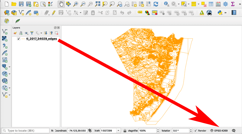
How to Change the Projection of a Shapefile Using QGIS
If you know your shapefile's beginning coordinate system or projection, you can export the data using QGIS.

A Case Study on Converting a Geodatabase From ArcGIS for Use in QGIS
In this article Charles Altendorf outlines a method he developed to convert GIS data located in a geodatabase created in ArcGIS into open source data that can be used in QGIS.
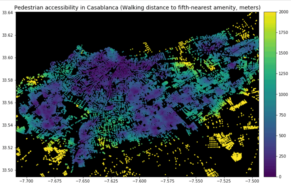
Using GIS to Analyze Pedestrian Accessibility
GIS tools to compute pedestrian accessibility are not just available to governments, academics, or companies, but are also free and open source.

Free Urban Planning GIS Book and Exercises
An open access book focusing on the use of GIS in sustainable urban planning and management includes six chapters containing exercises and GIS data.

QGIS Map Design, 2nd Edition
Updated to be used with QGIS 3.4, the second edition of QGIS Map Design is now available in its final version.

How to Get the Map View in QGIS to Resize Properly on a Mac
One Mac OS specific bug is the map view canvas doesn't fill the available space in QGIS 3.x versions. Learn how to fix this.