
Articles
GIS and Blockchain
For Earth observation and GIS technologies, researchers have only recently begun contemplating what might be useful in applying blockchain technologies.

Hurricane Michael is the Fourth Category 5 Storm to Hit the United States
Hurricane Michael was determined to be the fourth Category 5 storm to make landfall in the United States.

Review | Horizon
Horizon by Barry Lopez can, perhaps, be best described as an intellectual autobiography by means of geography and the abiding truths of the natural world.

Next Generation Asset Management with iSTAR Pulsar
Danny Sullivan writes about how 360 imaging company NCTech's vehicle-mounted iSTAR Pulsar camera is being used by Icon Spatial as part of an asset management project for a major highway operator Australia.
Geography of International Travel by U.S. Presidents
So where have U.S. presidents traveled? This article explores the geography of international travel by sitting U.S. presidents.

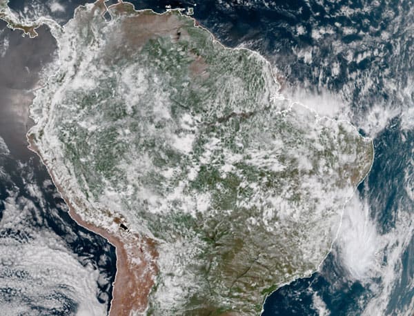
Mapping Land Cover by Stacking Landsat Imagery
Landsat 8 is offered as free, open data, which has led to new innovation in methods to better utilize such data for time series and complex scenes that are sometimes obstructed by clouds or dust.

The Oldest Continuously Occupied Human Settlement
Erbil Citadel, located in the center of Erbil, Iraq, is the oldest continuously occupied human settlement.

Stokes Drift Is Pushing Microplastics Towards the Arctic
A recent publication in JGR Oceans took a look at how the physical processes of oceans affect the distribution of micro plastics around the world.

Climate Change is Intensifying Drought in Southern California
Researchers from UCLA and Columbia University discovered that the 2012–16 drought impacted Southern California more severely than northern regions.

Teaching Geography Through Map Samplers
These map samplers, made by schoolgirls over 200 years ago, demonstrated how such craftwork was utilized to aid in the teaching of geography.

What Is The Difference Between Afforestation and Reforestation?
Both reforestation and afforestation represent a conversion of non-forested areas into new forests. So what's the difference between the two terms?

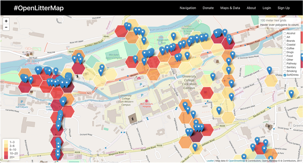
Using GIS to Analyze People’s Attitudes
GIS can help researchers analyze spatial data within social media posts in order to understand how people react to different features in their environment.

Latest Release of ArcGIS Online Introduces New Features and Enhanced Capabilities
Bernard Szukalski, Esri tech evangelist and product strategist, introduces new features and enhancements to the latest release of ArcGIS Online.

Iceland’s Long Road to Reforestation
Reforestation and afforestation have a long tradition in Iceland, but the results are barely noticeable - only a tiny fraction of the land is now covered in forests.

Review | Who Owns England?
The concentration of wealth – in England, particularly landed wealth – is a most serious issue.

The Arctic Permafrost is Thawing and It’s Causing Thousands of Landslides
Using Banks Island, Canada as a study area, researchers analyzed trends in permafrost thaw and associated landslides.

36,500 Satellite Images from RADARSAT-1 Now Available to the Public
The Canadian Space Agency and the Canada Centre for Mapping and Earth Observation have released RADARSAT-1's archive of 36,500 satellite images to the public.

Mapping School Performance and Inequality With GIS
With GIS, researchers can look at how effective schools are relative to spatial measures.

Can Using a Waterless Barrier Prevent the Expansion of Invasive Species?
In western Australia, researchers have proposed a waterless barrier method to halt the spread of cane toads.

Help Map Out Australia’s Dead Trees
By using a GPS-enabled smartphone, volunteers can capture imagery of tree health around Australia to help researchers map out where trees are dying in Australia.

UK Satellite Data Now Available to Those Working in the Public Sector
The UK Space Agency has announced that its radar and satellite imagery data will be made available to those working in the UK public sector.

Microsoft Releases Canada Building Footprint Database to OpenStreetMap
Microsoft recently announced that it had released 12 million building footprints in Canada to the OpenStreetMap community.

Fire Danger Reanalysis Dataset
Researchers have made 38-years worth of global fire danger reanalysis available as an open dataset.

How the Last 160 Years Have Changed the Earth’s Climate
Since the Industrial Revolution, this level has been rising continuously, reaching 410 ppm in 2018.
The First South Atlantic Tropical Storm Since 2010
Iba is the first tropical storm to form in the South Atlantic since 2010.

NASA Satellite Captures Image of Meteor Over the Bering Sea
On December 18, 2018, the Multi-angle Imaging SpectroRadiometer (MISR) instrument on NASA's Terra satellite detected the aftermath of an explosion of a fireball (a very bright meteor) 16 miles (26 kilometers) over the Bering Sea.