
Elizabeth Borneman

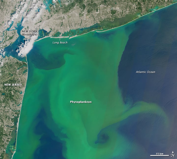
Agricultural Patterns Visible from Space
Satellite images reveal distinctive agricultural patterns shaped by history, geography, irrigation, and farming practices around the world.

Geography of Giant Sequoias
Giant sequoias are one of the longest lived tree species, with the oldest giant sequoia living an estimated 3,400 years.

Finding Penguin Colonies from Space
Satellite observations help researchers track penguin populations in some of the most remote regions of Antarctica.

The Highest 11 Mountains in the United States
Learn about the highest 11 mountains in the United States.

Types of Map Projections
Map projections are used to transform the Earth's three-dimensional surface into a two-dimensional representation.

Geography of Wild Horses in the United States
Wild horses continue to roam the Western United States as well as parts of the East Coast.

Geography of the United States
Extreme temperatures, topography, wind, and other powerful natural forces have shaped the geography of the United States.
Geography of Sewage Contamination in the Ocean
80% of the sewage produced by the global population makes its way into the world’s oceans untreated.

What are Desire Paths?
Desire paths (also known as social trails) form when people or animals consistently take direct routes instead of using designated paths.

What are Actinoform Clouds?
Actinoform clouds are typically found along large Western landmasses over the ocean and were first seen on satellite imagery in the 1960s.

Introduction to Wildlife Corridors
Wildlife corridors are overpasses and underpasses that connect natural regions and provide safe transit for migratory animals through human infrastructure.

Geography of U.S. Lakes
Within its borders, the United States is home to a vast wealth of lakes.

Tracking Plastic in the Air
Approximately 1,100 tons of microplastics are thought to be floating in the air above the Western United States

Climate Change and the Expansion of Ghost Forests
Along the geography of the East Coast of the United States, large swathes of forest are declining at increasing rates.

North American Continental Divide
The North American Continental Divide separates the watersheds that flow into the Pacific Ocean and those that flow into the Gulf of Mexico and the Atlantic, Caribbean, and Arctic Oceans.

How Oxbow Lakes Form
An oxbow lake is a uniquely shaped lake resulting from the path of a meandering river.

The Continent of Africa Might Eventually Split
Rifts could split Africa into pieces and create a new ocean that would form in the rift valleys.

What are the Branches of Geography?
Geography is divided into two main branches: human geography and physical geography.

Flooding Can Help Protect Wetlands From Climate Change
Targeted flooding may be one tool that conservationists and wetland restoration specialists have to make wetland areas more resilient in the face of climate change.

Geography of Time Zones
A time zone is a region of the Earth that uses the same standard time, which is commonly referred to as the local time.

What are 15-Minute Cities?
What if you could get from home to your job to the grocery store to the park, all in 15 minutes?

Sub-branches of Physical Geography
Physical geography is one of the two primary branches of geography.

Study Forecasts World Population to Peak in 2064
A report recently published by the University of Washington has estimated that the global population would peak in 2064 at 9.7 billion before declining to 8.8 billion in 2100.

Smoke from Australian Wildfires Reaches Atmospheric Highs
Smoke from the 2019 wildfires not only impacted Australian population centers but drifted far into the atmosphere as well.

Mapping Urban Heat
Lead by Portland State University professor Vivek Shandas, a network of citizen volunteers and local organizations are mapping urban heat islands in more detail than ever before.
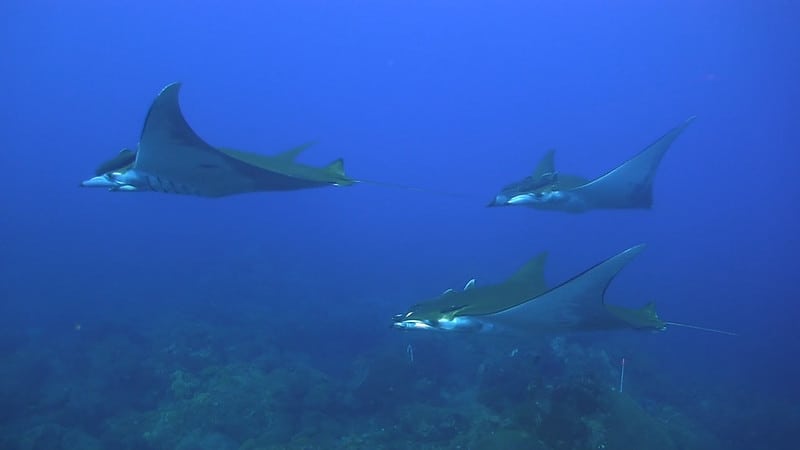
Marine Species are Shifting Towards the Poles
A review of research found that marine species were shifting their habitats toward Earth’s poles on an average of six kilometers (3.7 miles) per year.