
GIS and Geospatial Technologies
Articles focusing on the application of geographic information systems (GIS), geospatial technologies, remote sensing, LiDAR, and Global Positioning System (GPS). These technologies serve as critical tools for understanding and interacting with our physical environment. GIS allows for the mapping and analysis of spatial data Geospatial technologies refer to the various tools used to measure and analyze Earth’s lands and resources. Remote sensing provides a way to collect data from a distance, often via satellites or high-flying aircraft, and is commonly used for environmental monitoring and military applications.
GIS subcategories :
GIS Career | GIS Data | GIS Industry | GIS Learning | GIS Software | GPS | Remote Sensing | Spatial Analysis

Using GIS to Evaluate Parking Availability
GPS and GIS can be used to analyze parking space usage in a college town.

Mapping County Demographic Data in R
Learn how to map US County demographic data in R in this article by Ari Lamstein.

Abstracts from a Day at the 2015 Esri User Conference
Kristina Jacob, a professional photographer and GIS professional, captured some moments from the 2015 Esri User Conference. The annual conference ...

Processing UAV Imagery and its Applications
This article highlights the steps for processing Unmanned Aerial Vehicles (UAV) imagery and GIS data acquisition and discusses areas of applications.

River Width GIS Data Created from 1,756 Landsat Images
Researchers used 1,756 Landsat images to develop a GIS database of river widths for the entire North American continent.
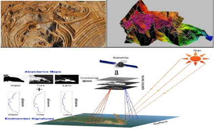
A Brief Introduction to Photogrammetry and Remote Sensing
The following is a brief introduction to photogrammetry and remote sensing for those who are new with the technology, written by Anil Narendran Pillai, Vice President – Geomatics at SBL.

Neocartography Can Be Beautiful, Cartography Can Be Fast
Nicolas Regnauld, Product Manager at 1Spatial discuss the debate about neocartography versus traditional cartography and the evolution towards creating more intelligent automation tools for creating maps.

First Satellite Images from Sentinel-2 Delivered
Four days after its launch, the first images from Sentinel-2 have been delivered. Covering an area from central Europe and the ...

Landsat 8 Data Users Handbook
Launched in 2013 by NASA, Landsat 8 is the latest satellite in the series. The mission of the orbiting satellite is ...

Using Drones to Protect Indigenous Lands
Indigenous Dayaks in Setulang, Indonesia are using drones to quickly and cheaply map their territories for defending against trespassers.

BIM – Information and Management
Building information modeling (BIM) is a managed approach to the collection, creation, collation and exchange of shared intelligent and structured ...

Black Holes No More: The Emergence of Volunteer Geographic Information
This essay by Ron Mahabir takes a look at how crowdsourced mapping efforts are helping to fill in much needed geographic information about impoverished areas around the world.

Keys to Successfully Managing GIS Data Health and Quality
Jennifer Kennedy, a GIS Analyst at Timmons Group discusses the importance of managing GIS data quality and some GIS solutions for managing GIS data and ensuring its integrity.

Geodesign to Create Smarter Cities and Adaptable Landscapes
Nadia Amoroso writes about geodesign and the geodesign technology platform offered by Esri as it pertains to Smart Cities.

Creating Dynamic Maps in QGIS Using Python: QGIS Python Programming CookBook
Learn how to use Python to create dynamic maps in QGIS with this free preview chapter of QGIS Python Programming CookBook. With ...

Tools: QGIS Python Programming CookBook
Learn how to work with map tools in QGIS using Python from this section as part of this preview chapter, Creating Dynamic Maps from QGIS Python Programming CookBook.
Labeling and Map Transparency: QGIS Python Programming CookBook
Learn how to label features and set map transparency in QGIS using Python from this section as part of this preview chapter, Creating Dynamic Maps from QGIS Python Programming CookBook.

Adding Real-Time Weather Data from OpenWeatherMap: QGIS Python Programming CookBook
Learn how to add real-time weather data from OpenWeatherMap in QGIS using Python from this section as part of this preview chapter, Creating Dynamic Maps from QGIS Python Programming CookBook.
Bing Aerial Image Service: QGIS Python Programming CookBook
Learn how to use the Bing Aerial Image Service in QGIS using Python from this section as part of this preview chapter, Creating Dynamic Maps from QGIS Python Programming CookBook.
Using the OpenStreetMap Service: QGIS Python Programming CookBook
Learn how to use the OpenStreetMap Service in QGIS using Python from this section as part of this preview chapter, Creating Dynamic Maps from QGIS Python Programming CookBook.

Layer Symbols: QGIS Python Programming CookBook
Learn how to symbolize layers using SVG and pie charts in QGIS using Python from this section as part of this preview chapter, Creating Dynamic Maps from QGIS Python Programming CookBook.
Scale and Layer Visibility: QGIS Python Programming Cookbook
Learn how to set up scale-dependent layer visibility in QGIS using programming from this section as part of this preview chapter, Creating Dynamic Maps from QGIS Python Programming CookBook.
Map Bookmarks: QGIS Python Programming CookBook
Learn how to create and navigate to map bookmarks using python in QGIS as part of this preview chapter, Creating Dynamic Maps from QGIS Python Programming CookBook.

Symbolizing Vector and Raster Layers: QGIS Python Programming CookBook
Learn how to symbolize vector and raster layers in QGIS using programming from this section of the preview chapter, Creating Dynamic Maps from QGIS Python Programming CookBook.
Accessing the Map Canvas, Changing Map Units, and Iterating over Layers
Learn how how to control an object through the Map Canvas, change map units, and how to loop through map layers in QGIS using Python. From: Creating Dynamic Maps from QGIS Python Programming CookBook takes a look at

Free Preview of Mastering QGIS
Mastering QGIS is designed to bring users who want to go beyond the basics of QGIS to an advanced level ...