
Articles

Using Twitter to Map Nuisance Flooding
To get a better understanding of localized flooding, the researchers mined Twitter data for geolocated tweets to fill in the gaps in data about flooding.

Most Tourists Don’t Stray Far From the Road When Taking Photos in National Parks
Cartography students mapped out 800,000 geotagged photos posted to Flickr to analyze how far those pictures were taken from a road.

Using GIS to Assess the Impact of Electric Cars
GIS and spatial analysis may help find some practical solutions for electric vehicle charging.

Mumbai Police Fighting Noise Pollution With Enforced Patience
In an effort to lower noise levels, the Mumbai Police have set up noise meters at select traffic signals around the city called "Punishing Signals".
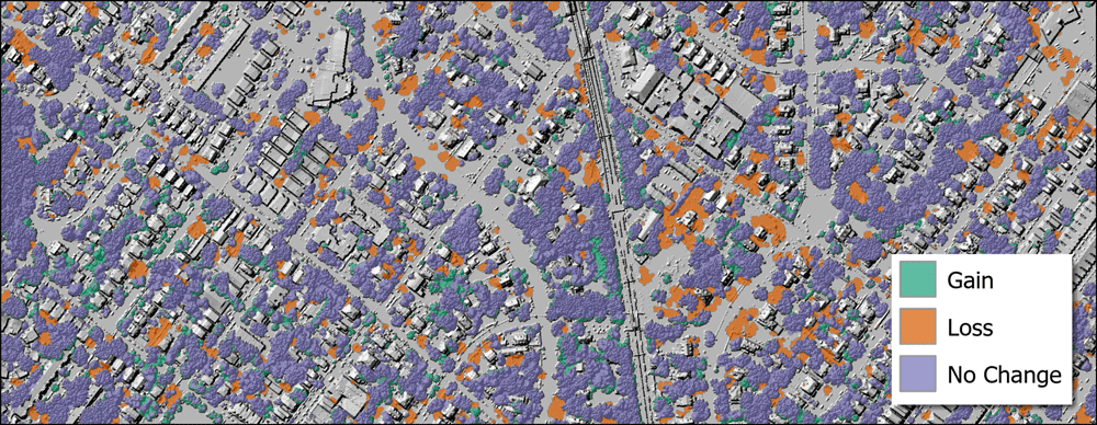
Using GIS to Assess Urban Tree Canopy
The University of Vermont Spatial Analysis Lab used spatial analysis to map out how the city of Philadelphia's tree canopy changed between 2008 and 2018.

Satellites Give Detailed Insights into Climate Sciences
The European Space Agency has recently released a report entitled ‘10 New Insights in Climate Science’.

How to Add Leader Lines to Labels in QGIS
The release of QGIS version 3.10 brought with it the native capability to add leader lines to labels.

Why Do Groundhogs Really Emerge on February 2?
Why do groundhogs emerge around February 2? Hint: it's more to do with Valentine's Day.

Cloud-based Geospatial Analysis
We will see more migration of spatial and GIS work to cloud-based platforms in the near future.
What is a Snow Devil?
Miniature vortexes of wind can stir up snow in a formation known as a snow devil.

GIS Data of the Moon’s Geology
The USGS has released GIS data from its new Unified Geologic Map of the Moon.

An Incredibly Detailed Map of the Moon’s Geology
Entitled, "Unified Geologic Map of the Moon" the newly created map summarizes the current state of lunar geologic knowledge.

GIS and Migrant Deaths in the United States
Spatial analysis and GIS is being used in the study of migrant deaths to not only better track routes taken but also use results from research to limit deaths and danger to migrants.

Geography Facts About the Pacific Ocean
Learn some geography facts about the world's largest ocean.

Soil Community in Atacama Desert Survives on Fog
Scientists have discovered new methods that allow certain plants and animals to survive in Chile’s Atacama Desert.
Driest Non-polar Desert in the World
Situated in northern Chile, the Atacama Desert is one of the driest places on Earth.

Is Climate Change Bringing Back Prehistoric Redwood Trees?
Because of global warming, the Dawn redwood might unexpectedly make it back to the wilderness of its ancient habitats in North America.

European Wolves Could Be Replaced by Wolf-Dog Hybrids
Scientists are now worried that the future of the 17,000 wolves known to live in Europe is in jeopardy due to crossbreeding with dogs.

Voyant: Online Text Analysis Tool
Voyant is an online text analysis tool that allows users to enter one or more URLs, a block of text, or a set of text documents, and see the results of terminology used.

Mapping the Transportation Network of the Roman World
ORBIS is a mapping project developed by researchers at Stanford that reconstructs the financial and spatial challenges of transporting goods and people during Roman times about 200 CE.

Why Do Iguanas Drop From Trees When It’s Cold in Florida?
Occasionally, the temperature in southern Florida approaches freezing, leading to falling iguanas.
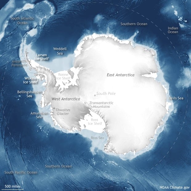
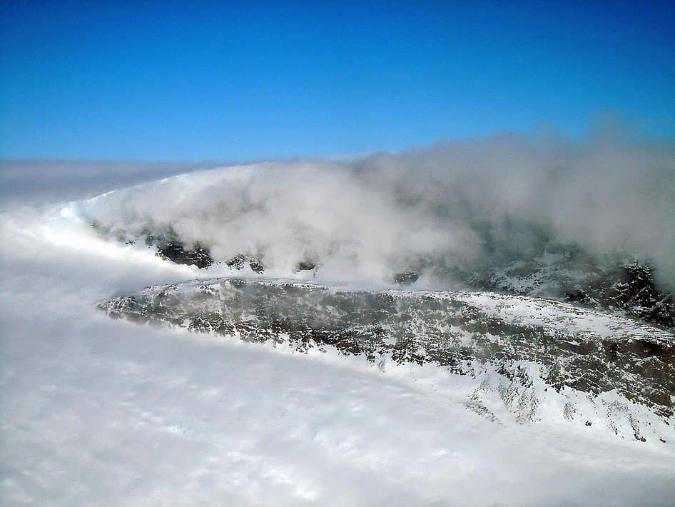
Geography Facts About Antarctica
Learn interesting geography facts about the continent of Antarctica, the driest, coldest, highest continent on Earth.

Mapping Epidemics
Forecasting the spread of viruses and mapping potential epidemics is gaining important attention in the medical community.

How Many Countries Are There?
The answer to the question of how many countries there are in the world remains a question with many different possible answers.

Review | Phantom Islands: In Search of Mythical Lands
In this book, Dirk Liesener provides the life-stories of islands, some thirty of them, which though thought to exist in some cases for many centuries turned out to either not be an island or to have never existed to start with.

Mapping Australia’s Bushfires
Tools based on near-real time data from satellites, such as those used by Australia or developed by NASA, have great utility in monitoring existing fires while giving the public near real-time monitoring.