
Articles

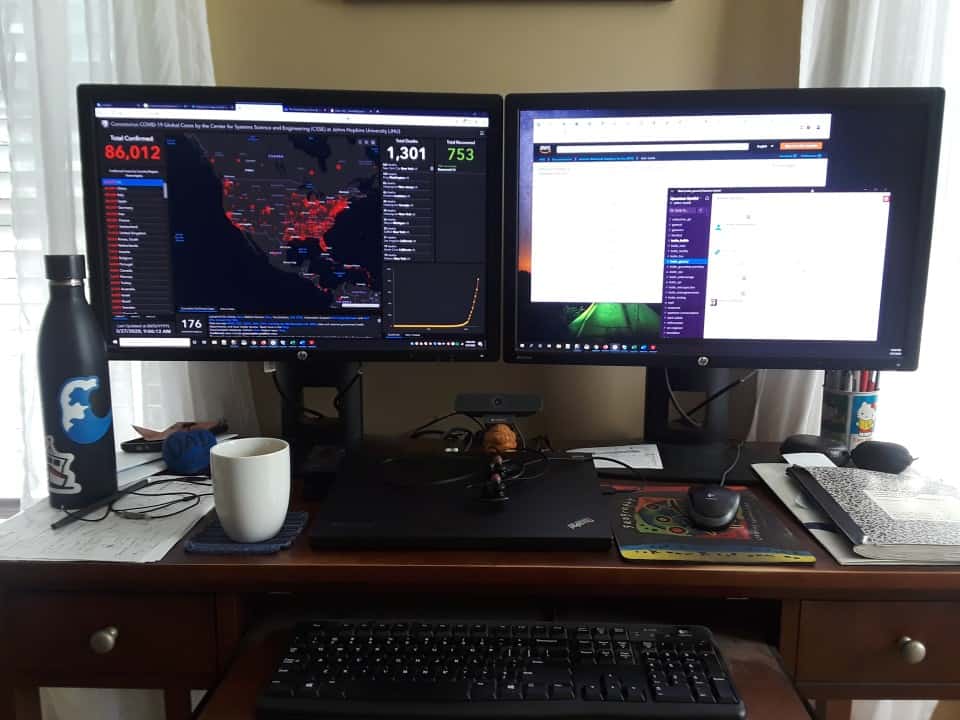
This Map is Tracking the Coronavirus (COVID-19) in Near-Realtime
An interactive GIS dashboard developed by Johns Hopkins University is mapping COVID-19 cases with near real-time tracking.

Free GIS, Analytical, and Programming eBooks from Springer
If you're looking for free digital books covering GIS, analysis, and programing to improve your geospatial skills, Springer has eBooks you can download.

2020 Hurricane Season is Likely to be More Active Than Usual
A newly released hurricane outlook from the Weather Channel expects the upcoming 2020 hurricane season to be more active than normal.

New Satellite Technologies to Monitor Volcanoes and Earthquakes
One relatively new satellite is a small satellite system called the CubeSat Imaging Radar for Earth Sciences (CIRES).
Review | A Field Guide to Climate Anxiety
This is a self-help book about how each of us, both personally and together, can deal with the angst of confronting this seemingly intractable problem of climate change.

2020 Earth Day Marks the 50th Anniversary
On April 22, 2020, a big environmental jubilee is taking place - the 50th anniversary of Earth Day.

These Maps Show How Early Spring Arrived in Parts of the United States
Spring arrived up to three to four weeks early in parts of the contiguous United States in 2020.

Defining the Degree of Urbanization
The Degree of Urbanization model classifies urban, semi-urban, and rural areas based on data from open satellite imagery and GIS data.

Using Location Data to Map People’s Movements, Social Distancing Efforts, and the Spread of COVID-19
As the COVID-19 pandemic continues, mobility data is being used to track and map out social distancing compliance and track the spread of the coronavirus.

This Newly Identified Strain of Bacteria Eats Rarely Recycled Plastic
Scientists have identified a strain of bacterium that is able to break down plastic and use that plastic as its food source.
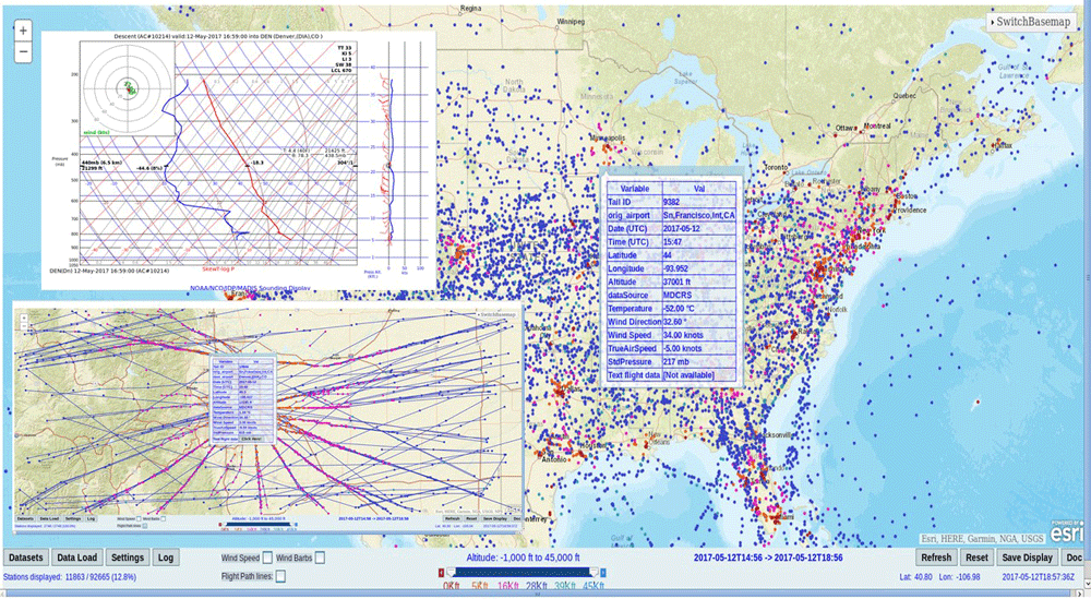
How Weather Forecasting is Affected by Coronavirus-Related Flight Cancellations
Grounded flights due to the coronavirus pandemic is resulting in far fewer aircraft weather observations and less access to repair remote weather stations.

Physical and Chemical Weathering of Rocks
Weathering is the breaking down of rock material by physical or chemical processes.

Nature Emerges as People Shelter-in-Place During the Coronavirus Outbreak
As people shelter-in-place during the coronavirus outbreak, animals come out to roam and skies are clearer in some places.

Urban Fish Get Less Sleep
Researchers looked at the effect of different nighttime light levels on the production of melatonin in European perch.
Review | Rivers of Power
Rivers shape the surface of our planet and play a role in human history. Review of Rivers of Power by G.T. Dempsey.

Urban Farming Increases Food Resources for Local Populations
Researchers from the University of Sheffield mapped out urban spaces that could be used to grow fruits and vegetables in Sheffield, a city in England.

Computer Vision in the Time of the Coronavirus Outbreak
Computer vision is emerging as a promising set of techniques such as enabling rapid detection of COVID-19 and the better monitoring of social distancing practices among people.
Tips for Leading a Remote Team during Covid-19
Jeffrey Skahill with Quantum Spatial shares some strategies he uses to successfully lead a remote team.
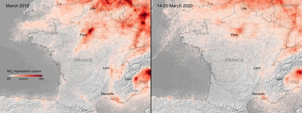
Mapping Changes in Air Pollution During the Coronavirus Pandemic
Satellite imagery also confirms many countries are seeing a strong downward trend in air pollution during the coronavirus outbreak.

Gerrymandering Map Font
Designers Ben Doessel and James Lee created a free font that forms the letters of the alphabet using congressional district shapes.

Can GPS Work on the Moon?
NASA researchers found that existing GPS satellites can provide navigational signals to the moon, aiding astronauts in future lunar missions.

What is the Difference Between Elevation and Altitude?
The geography terms altitude and elevation have slightly different meanings.

As the Ozone Layer Recovers it is Changing Wind Patterns
Researchers from the University of Montreal used satellite data and climate modeling to understand how the recovery of the ozone layer has affected the Earth's atmosphere.

Geolocation Data, Geofencing Warrants, and Crime
With most adults carrying mobile devices that have GPS tracking capabilities, mapping our movements has never been easier.

The Politics of Defining Central New Jersey
In the state of New Jersey, one of the most contentious arguments its citizens have is the existence of the region ‘central Jersey.’
Review | Dangerous Earth
G.T. Dempsey reviews Ellen Prager's Dangerous Earth: What We Wish We Knew about Volcanoes, Hurricanes, Climate Change, Earthquakes, and More.