
GIS and Geospatial Technologies
Articles focusing on the application of geographic information systems (GIS), geospatial technologies, remote sensing, LiDAR, and Global Positioning System (GPS). These technologies serve as critical tools for understanding and interacting with our physical environment. GIS allows for the mapping and analysis of spatial data Geospatial technologies refer to the various tools used to measure and analyze Earth’s lands and resources. Remote sensing provides a way to collect data from a distance, often via satellites or high-flying aircraft, and is commonly used for environmental monitoring and military applications.
GIS subcategories :
GIS Career | GIS Data | GIS Industry | GIS Learning | GIS Software | GPS | Remote Sensing | Spatial Analysis
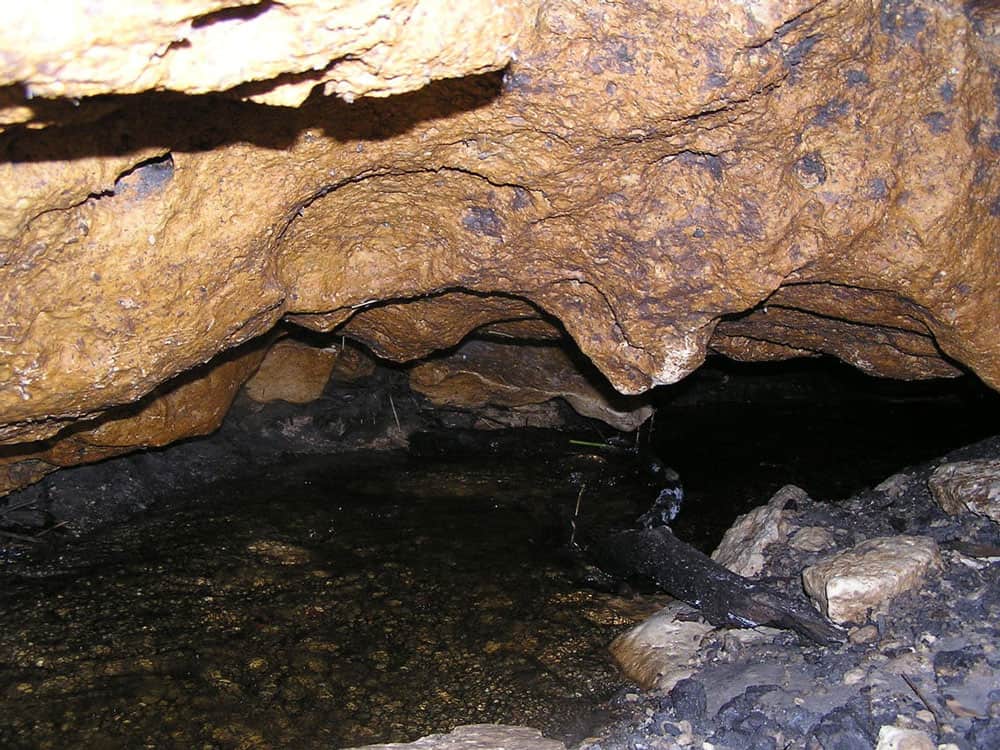
GIS and Karstic Cave Monitoring
GIS and remote sensing have been used to predict likely regions where caves can be found.

Using GIS to Conserve the Greater Sage-Grouse
GIS has emerged as an essential analysis and communication tool for the Oregon BLM in general, and its sage-grouse conservation efforts.

Monitoring Livestock Using GIS
GIS and other geospatial technologies are being used to monitor livestock, understand the role that cattle play in climate change, and estimate biofuel.

Understanding What Six GIS/Map Software Providers Offer
Matt Sheehan from WebMapSolutions is posing a series of six questions to six GIS/map software companies (Pitney Bowes, Esri, Mapbox, Carto, GIS Cloud, and Boundless) to understand their similarities and differences in product offerings.

Create Custom Map Projections
Flex Projector is a free and open source, platform agnostic software application that lets users upload GIS data and create customized small scale global map projections.

A Global Landslide Potential Map That Updates Every 30 Minutes
Researchers from NASA have developed a global landslide susceptibility model that maps out areas in danger of potential landslides every thirty minutes.

How This Remote Island Inhabited by Polar Bears Became Known as Landsat Island
A few unusual pixels in Landsat imagery led to the discovery of a previously unmapped island off the coast of Labrador, Canada.

Navigation, GIS, and Voice Command
Progress has been made on developing GIS and GPS technology capable of interpreting natural language and voice commands.

Understanding Ocean Wave Patterns from Satellite Imagery of Sun Glitter
Researchers have developed a method by which to translate satellite imagery of sun glitter on the water into data about the direction, height and movement of waves.

ESA’s Swarm Satellites Reveal Detailed Variations in the Earth’s Magnetic Field
Three years of data collection the European Space Agency's (ESA) Swarm satellites has resulted in the highest resolution map of Earth’s lithospheric magnetic field.

Data Driven: GIS Guiding the Future
Mapping has always been data driven, and the more data we gather, the more important practical visualization of that data becomes.

How 1Spatial is Helping the Arizona Department of Transportation Automate Validation of State-Wide Road Network
Sheila Steffenson discusses how the Arizona Department of Transport will be able to validate and integrate its own road network information with regular updates from multiple contributing government bodies within the state using 1Spatial technology.

Using Terra and Aqua Layers with Open Satellite Map
Georgy Potapov of OpenWeatherMap introduces the availability of low resolution MODIS imagery from Aqua and Terra satellites via the VANE platform.
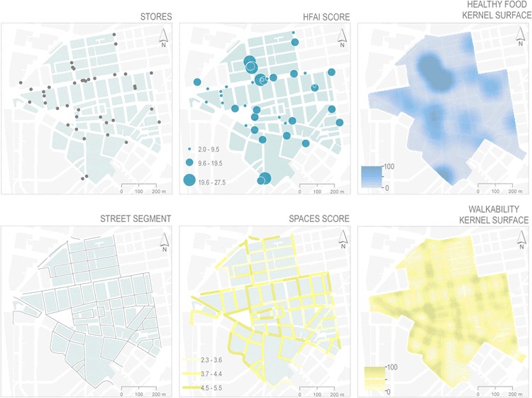
GIS and Obesity
GIS has been used to measure the built environment and its relationship to obesity.

GIS and the Geography of Religion
GIS has become an important historical and contemporary analytical tool used to explain past and current social trends shaping and being shaped by religions.
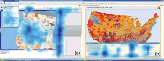
Analyzing Eye Movement For Better Map Design
With new and growing areas where eye monitoring and GIS can be utilized together, big data techniques will be a leading way in which visual and analytical understanding of spatial cognition will be understood in coming years.

Using Visual Search to Find Geographically Similar Features on Satellite Imagery
Descartes Labs recently unveiled its GeoVisual Search application which uses machine learning to visually search satellite imagery for similar geographic features.

Tracking Deforestation by Measuring the Distance to the Nearest Forest
Using satellite images, researchers established a method of calculating the distance between any point in the continental United States and the nearest forested area.

The Need For Ethics in GIS
The consideration of a code of ethics in GIS has mostly been overlooked as a critical component in geospatial education and certification.

3.1-Trillion Pixel Landsat 8 Mosaic of the World
Descartes Labs has compiled some of the massive amount of data sent back from the satellites orbiting Earth into a 3.1-trillion pixel composite image of Earth’s surface.
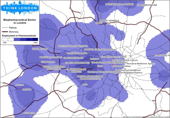
GIS and Entrepreneurs
GIS aids in investment decision-making by unveiling spatial patterns key to entrepreneurial success like labor concentration, knowledge, and opportunities.
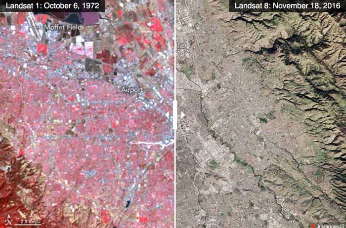
Advances in Landsat Sensors
Since those first images in 1972, multiple Landsat satellites have been launched with the ability to take increasingly detailed pictures of our world.

How GIS Can Help With Football Game Analysis
Football, or Soccer, is a spatial strategy game involving tactical player movements, which can be analyzed effectively using Geographic Information Systems (GIS).

How to Create a Non-contiguous Cartogram Using QGIS
This article presents a rough idea of how one might mimic a non-contiguous cartogram using QGIS.

Creating Non-contiguous Cartograms
Non-contiguous cartograms are a type of area cartogram. In a non-contiguous cartogram, the features are not connected and enlarge or shrink based on a quantified value.

Celebrating Valentine’s Day, Geographer Style
What better way for geographers to say "Happy Valentine's Day" than with geography? Nature supplies us with plenty of heart shape topography found around the world. Heart shaped islands, vegetation, and lakes make up this love themed geography article.