
GIS and Geospatial Technologies
Articles focusing on the application of geographic information systems (GIS), geospatial technologies, remote sensing, LiDAR, and Global Positioning System (GPS). These technologies serve as critical tools for understanding and interacting with our physical environment. GIS allows for the mapping and analysis of spatial data Geospatial technologies refer to the various tools used to measure and analyze Earth’s lands and resources. Remote sensing provides a way to collect data from a distance, often via satellites or high-flying aircraft, and is commonly used for environmental monitoring and military applications.
GIS subcategories :
GIS Career | GIS Data | GIS Industry | GIS Learning | GIS Software | GPS | Remote Sensing | Spatial Analysis

Information Services and the User Experience in the Geographic Information Community
Members of the geographic information community can be considered heavy users of information services. Geographic information (GI) users are “super-encounterers” ...
Information Needs and Information Seeking Behavior Within the Geographic Information Community
As part of the Professional and Occupational information community category (Hansen 2014), members of the geographic information community can be ...

The Geographic Information Community
At its broadest definition, the geographic information community (GIC) is a community of users who are connected by the common interest in visualizing and analyzing spatial (or geographic) information.

Dress Up Your QGIS Install With this Whimsical Plugin
The QGIS hats plugin is a bit of fun that accomplishes no other purpose than to add a hat to the QGIS icon.

These Two ArcGIS Books are Free from Esri
Esri offers two free ArcGIS books: '10 Big Ideas about Applying The Science of Where' & 'Instructional Guide for The ArcGIS Imagery Book'.

How to Make a Map in Excel Using the 3D Map Add-in
This tutorial by Nick Williams provides an overview of how to create a map in Excel using 3D Map for Excel 2016 (or Power Map for Excel 2013).

Teaching Math with GIS
GIS has enormous potential to be used for teaching mathematics to students.

The Role of GIS in Wildlife Research and Conservation
Monitoring and studying wildlife habitats has long been a key focus within GIS.

GIS and Advertising
Advertisers are becoming more sophisticated with the use of GIS as a way to better target their audiences.

Automated Generalization Sped Up Cartographic Output by 40% for This German Mapping Agency
Working with 1Spatial, AdV’s ATKIS-Gen Project Group's cartographic output is 40% faster with automated generalization.

Be Aware of the Proposed Geospatial Data Act (GDA) of 2017
The Geospatial Data Act (GDA) of 2017 is being reintroduced in Congress. Passage of this bill would have a severe impact on the GIS industry.

Using Free and Open Source GIS to Support Natural Resource Management in the Developing World
Rohan Fisher describes his GIS work for decentralized, evidence-based resource management in developing nations.

Mapping Rainforest Chemistry
Researchers mapped 23 chemicals that are released by the rainforests in Peru with laser-guided imaging spectroscopy.

WMS Map Viewer
WMS Map Viewer, developed by Pantelis Rodis, is a http/JavaScript application for visualizing, combining and indexing web maps.

GIS and Flight Training
The future of aviation technology looks to continue to utilize GIS in ways that allow better training and smarter aircraft.

The Use of Python in GIS
Python today is by far the most widely used language by GIS users and programmers.

Streamline GIS Project Workflow with Online Recordkeeping
For efficient collaboration on a GIS project, document and catalog all work in an easily accessible location to overcome common challenges with diverse skill sets.

A New Algorithm to Find Wildfires When It’s Cloudy
New technology called the Firelight Detection Algorithm, or FILDA, can help detect wildfires at night even when the skies are cloudy.

GIS and Spatial Autocorrelation
Spatial autocorrelation statistics have become incorporated into commonly used packages such as ArcGIS as well as open source software such as GRASS and QGIS.
Sub-surface Mapping and Subterranean Data Representation
ArcGIS Online advances sub-surface mapping with 3D options, enhancing design, accessibility, and customization for urban planning and transportation.

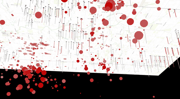
Detecting Spatial Patterns in Drug Abuse With GIS
Drug abuse has been shown to have clear spatial patterns that GIS has helped to demonstrate.

How Agencies Can Harness Geosharing to Improve Infrastructure
How can communities become more engaged with reporting issues with infrastructure? Olivia Harne discusses how an investment in geographical data sharing could be a potential solution.

Creating and Editing Features with MapInfo
This tutorial by Nick Williams, a MapInfo trainer at Acuity Training, provides an overview of how to create, edit, and convert features within MapInfo.

GIS RoadMap and Mobile Strategy for Engaging Missouri Constituents
Douglas Fees, the Information Technology Services Chief with the Missouri Department of Conservation (MDC) discusses how his agency collaborated with Timmons Group to develop a GIS roadmap and mobile strategy that resulted in a suite of applications to better serve citizens, visitors and internal MDC staff.
GIS and Topic Modeling
Topic modeling is a thriving field in humanities and social sciences, with GIS being use to identify trends in social media.

How the ‘Quirky Geography’ of ZIP Codes Obscured Flint’s Lead Problem
Richard Casey Sadler, an assistant professor at Michigan State University discusses how the Michigan Department of Health and Human Services' reliance on using ZIP Code level data obscured the link between Flint residents and lead exposure.