
GIS and Geospatial Technologies
Articles focusing on the application of geographic information systems (GIS), geospatial technologies, remote sensing, LiDAR, and Global Positioning System (GPS). These technologies serve as critical tools for understanding and interacting with our physical environment. GIS allows for the mapping and analysis of spatial data Geospatial technologies refer to the various tools used to measure and analyze Earth’s lands and resources. Remote sensing provides a way to collect data from a distance, often via satellites or high-flying aircraft, and is commonly used for environmental monitoring and military applications.
GIS subcategories :
GIS Career | GIS Data | GIS Industry | GIS Learning | GIS Software | GPS | Remote Sensing | Spatial Analysis

Analyzing Bike Sharing Demand with GIS
To study the best citing of bike stations in New York City for a bike sharing program, the NYC DOT used GIS data and geospatial analysis.
Smartphone Maps Illegal While Driving but Paper Maps are Okay in California
In recent years, some states have been putting harsher laws in place to curb drivers talking on their cellphones or ...
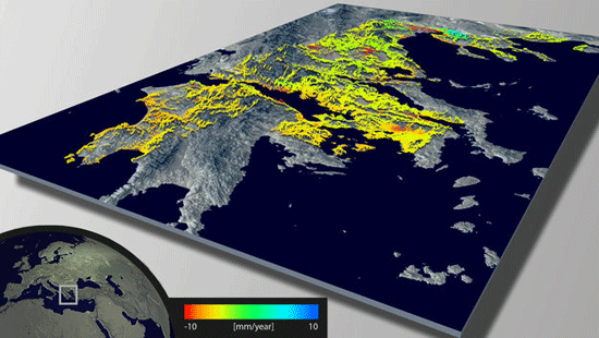
Using Remote Sensing to Measure Land Deformation
The European Space Agency has developed a new land data processor to create maps of land deformation. Called Wide Area Processor ...

Map of Every Photo Taken of the Earth by the International Space Station
The Gateway to Astronaut Photography of Earth houses a collection of over a million archived photos taken by the International ...

Line of Sight in GIS
Line of sight is a GIS analysis that shows the line of visibility from one point across a terrain.

Developing Auditory Maps for the Blind
Human beings navigate through their environment by developing a mental understanding of spatial relationships known as a spatial cognitive maps. ...
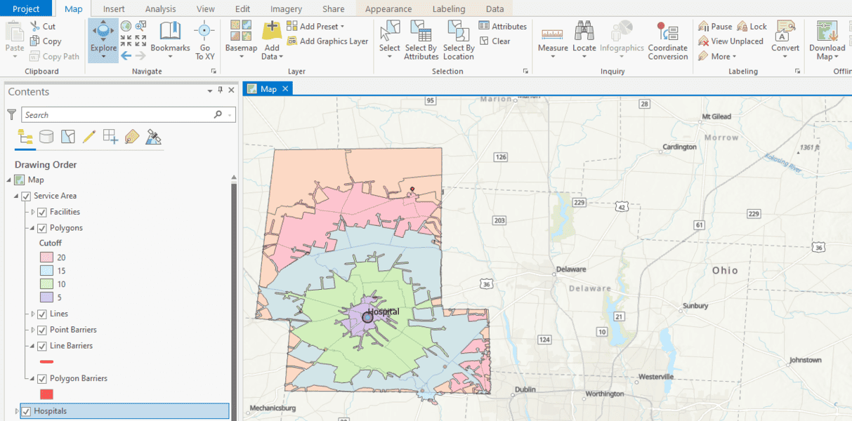
Spatial Analysis in GIS
Geographic information systems uses spatial analysis in order to understand geographic questions. Listed here are geographic analysis commonly performed in GIS.

Statistical Surfaces in GIS
This looks at some statistical analysis in GIS. A statistical surface is any geographic entity that can be thought of as containing a Z value for each X,Y location.

How to Translate GIS into Different Languages: GIS Around the World
How is "geographic information systems" translated into different languages?
Typefaces for National Geographic Maps
The National Geographic Society is renowned in part for its stunning maps, each labeled in incredible detail. The distinctive lettering ...
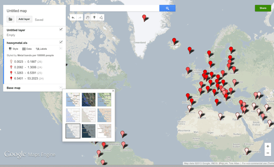
Make Your Own Maps with Google Maps Engine Lite
Google Maps Engine Lite is a simpler version of the Google Maps Engine that allows users to create and share their own maps.

Mapping Social Vulnerability
Oxfam America has released new maps about the geography and the people of the US Southeast, specifically Louisiana and Mississippi. This project ...

Measuring Earthquakes from Space
Up until recently, seismometers have been a strictly Earth-bound devices, diligently tracking each and every change in the Earth’s surface ...

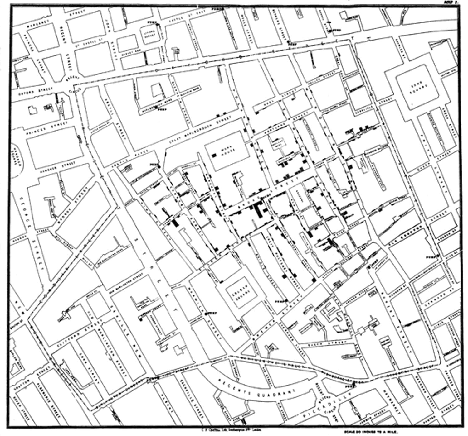
Explore John Snow’s Cholera Map using GIS Data
Explore the GIS data behind John Snow's famous cholera map and discover how spatial analysis helped transform public health.

Grassroots Aerial Mapping
Aerial imagery has evolved into a more complex and sophisticated enterprise with most aerial imagery today being captured by aircraft ...

Spatial Orientation and the Brain: The Effects of Map Reading and Navigation
Map reading and orienteering are becoming lost arts in the world of global positioning systems (GPS) and other geospatial technologies. What are the effects of navigation and map reading on the brain?
Introduction to GIS
The fundamentals of GIS involve an understanding about data types, projections, data quality (accuracy and precision), how to collect data ...

Converting Shapefiles to Google Fusion Tables
Learn how to import shapefile GIS data directly into Google Fusion tables.
GIS Organizations
Joining a GIS organization is a great way to network and to exchange ideas. There is a growing number of non-profit and industry specific groups to choose from.

Mark Greninger | Profiles from the Geospatial Community
Mark Greninger, the GIO for Los Angeles County since 2006, shares his views on the GIS field in the latest Profiles from the Geospatial Community.

Attribute Data Types for GIS
There are two components to GIS data: spatial information (coordinate and projection information for spatial features) and attribute data. Attribute ...

Robotic Mapping: Simultaneous Localization and Mapping (SLAM)
Simultaneous localization and mapping, or SLAM for short, is the process of creating a map using a robot or unmanned vehicle that navigates that environment while using the map it generates

Tracking Global Vegetation with Micro-Satellite Proba-V
The ESA, also known as the European Space Agency, has managed to do a lot of amazing feats in the ...

Making Maps with D3
D3 is a JavaScript data visualization library using HTML, SVG and CSS. D3 stands for Data Driven Documents and was developed by Mike Bostock, ...

Wearable Cartography – Portable Mapping System
Researchers from MIT’s Computer Science and Artificial Intelligence Laboratory have developed a portal mapping system that transmits remotely a digital map ...